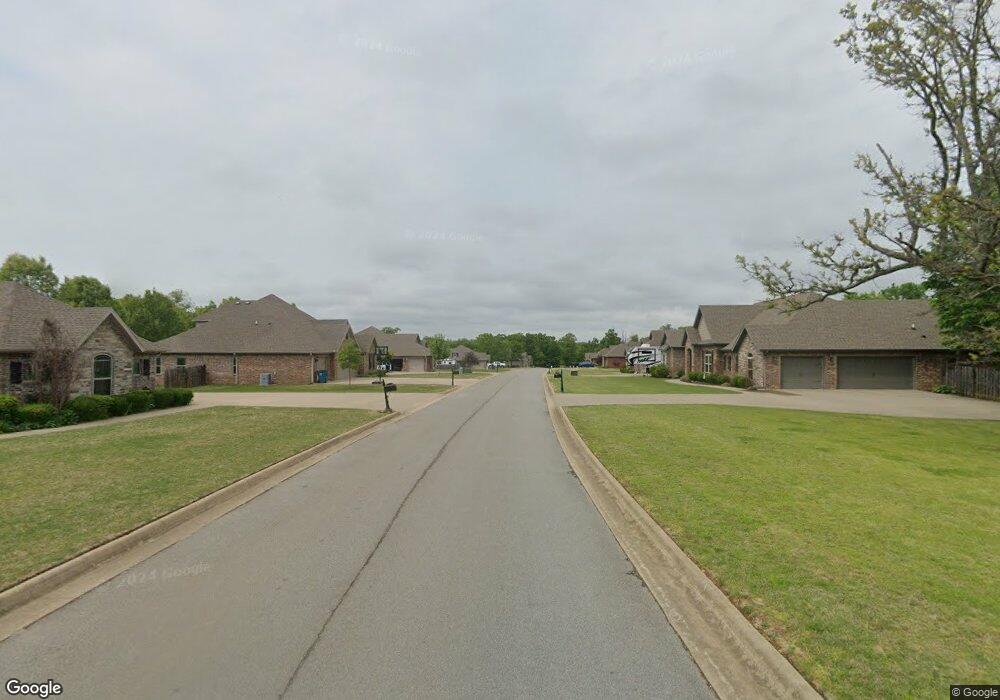
Lot 18 Greenstone Dr Bentonville, AR 72712
Estimated Value: $651,000 - $740,228
--
Bed
--
Bath
1,788
Sq Ft
$382/Sq Ft
Est. Value
About This Home
This home is located at Lot 18 Greenstone Dr, Bentonville, AR 72712 and is currently estimated at $683,807, approximately $382 per square foot. Lot 18 Greenstone Dr is a home located in Benton County with nearby schools including Thomas Jefferson Elementary School, Ardis Ann Middle School, and Lincoln Junior High School.
Ownership History
Date
Name
Owned For
Owner Type
Purchase Details
Closed on
Feb 2, 2024
Sold by
Melancon Kenneth W and Melancon Linda L
Bought by
Wagner Seth and Wagner Emily
Current Estimated Value
Home Financials for this Owner
Home Financials are based on the most recent Mortgage that was taken out on this home.
Original Mortgage
$529,625
Outstanding Balance
$519,745
Interest Rate
6.61%
Mortgage Type
New Conventional
Estimated Equity
$164,062
Purchase Details
Closed on
Oct 4, 2017
Sold by
Hec Development Llc
Bought by
Melancon Kenneth W and Melancon Linda L
Home Financials for this Owner
Home Financials are based on the most recent Mortgage that was taken out on this home.
Original Mortgage
$246,500
Interest Rate
3.78%
Mortgage Type
Construction
Create a Home Valuation Report for This Property
The Home Valuation Report is an in-depth analysis detailing your home's value as well as a comparison with similar homes in the area
Home Values in the Area
Average Home Value in this Area
Purchase History
| Date | Buyer | Sale Price | Title Company |
|---|---|---|---|
| Wagner Seth | $557,500 | Realty Title | |
| Melancon Kenneth W | $73,000 | Waco Title Company |
Source: Public Records
Mortgage History
| Date | Status | Borrower | Loan Amount |
|---|---|---|---|
| Open | Wagner Seth | $529,625 | |
| Previous Owner | Melancon Kenneth W | $246,500 |
Source: Public Records
Tax History Compared to Growth
Tax History
| Year | Tax Paid | Tax Assessment Tax Assessment Total Assessment is a certain percentage of the fair market value that is determined by local assessors to be the total taxable value of land and additions on the property. | Land | Improvement |
|---|---|---|---|---|
| 2025 | $6,295 | $112,019 | $14,600 | $97,419 |
| 2024 | $4,504 | $112,019 | $14,600 | $97,419 |
| 2023 | $4,094 | $72,723 | $12,000 | $60,723 |
| 2022 | $486 | $12,000 | $12,000 | $0 |
| 2021 | $444 | $12,000 | $12,000 | $0 |
| 2020 | $407 | $7,000 | $7,000 | $0 |
| 2019 | $407 | $7,000 | $7,000 | $0 |
| 2018 | $407 | $7,000 | $7,000 | $0 |
| 2017 | $394 | $7,000 | $7,000 | $0 |
| 2016 | $394 | $7,000 | $7,000 | $0 |
| 2015 | $225 | $4,000 | $4,000 | $0 |
| 2014 | $225 | $4,000 | $4,000 | $0 |
Source: Public Records
Map
Nearby Homes
- 12188 Bedrock Ln
- 12136 Bedrock Ln
- 11982 Arkansas 72
- 3760 Bitterroot St
- 3760 Whitefish St
- 3750 Whitefish St
- 3731 Bitterroot St
- 3711 Bitterroot St
- 3611 Bitterroot Cove
- 3620 Bearpaw Path
- 3621 Bearpaw Path
- 800 Greenhorn St
- 810 Greenhorn St
- 3601 Beaverhead Way
- 811 Greenhorn St
- 3560 Bridger Ln
- 0 Midhurst Ln Unit 1326303
- 7 Rearsby Ln
- 12382 Arkansas 72
- 12610 Bullock Rd
- 12278 Greenstone Dr
- Lot 17 Greenstone Dr
- 12286 Greenstone Dr
- 12262 Greenstone Dr
- Lot 20 Greenstone Dr
- 12254 Greenstone Dr
- 12263 Greenstone Dr
- 12246 Greenstone Dr
- 12247 Greenstone Dr
- 12238 Greenstone Dr
- 12230 Greenstone Dr
- 12231 Greenstone Dr
- 12226 Greenstone Dr
- 12227 Greenstone Dr
- 12222 Lost Oak Dr
- 12221 Greenstone Dr
- 0 Greenstone Dr
- 12203 Bedrock Ln
- 12214 Greenstone Dr
- 12210 Lost Oak Dr
