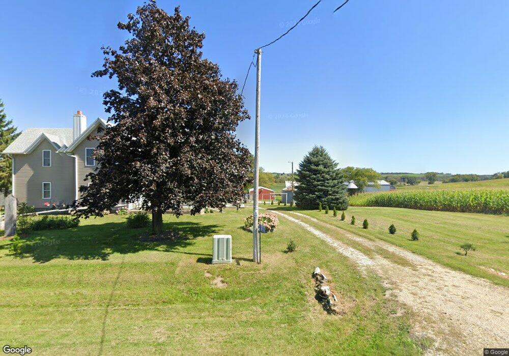
N4766 Garfield Rd Iron Ridge, WI 53035
Estimated Value: $377,000 - $612,607
--
Bed
--
Bath
--
Sq Ft
40.52
Acres
About This Home
This home is located at N4766 Garfield Rd, Iron Ridge, WI 53035 and is currently estimated at $514,536. N4766 Garfield Rd is a home with nearby schools including John Hustis Elementary School, Hustisford High School, and St. Matthew Lutheran School.
Ownership History
Date
Name
Owned For
Owner Type
Purchase Details
Closed on
Jan 23, 2024
Sold by
Roeseler Debra A
Bought by
Roeseler Robert E and Roeseler Debra A
Current Estimated Value
Purchase Details
Closed on
Sep 6, 2022
Sold by
Westphal Dale R
Bought by
Westphal Duane A and Roeseler Debra A
Purchase Details
Closed on
Mar 21, 2013
Sold by
Westphal Herber E and Westphal Delores A
Bought by
Firari Diane M and Roeseler Debra A
Create a Home Valuation Report for This Property
The Home Valuation Report is an in-depth analysis detailing your home's value as well as a comparison with similar homes in the area
Home Values in the Area
Average Home Value in this Area
Purchase History
| Date | Buyer | Sale Price | Title Company |
|---|---|---|---|
| Roeseler Robert E | -- | None Listed On Document | |
| Westphal Duane A | $472,500 | -- | |
| Firari Diane M | -- | None Available |
Source: Public Records
Tax History Compared to Growth
Tax History
| Year | Tax Paid | Tax Assessment Tax Assessment Total Assessment is a certain percentage of the fair market value that is determined by local assessors to be the total taxable value of land and additions on the property. | Land | Improvement |
|---|---|---|---|---|
| 2024 | $3,071 | $177,500 | $61,100 | $116,400 |
| 2023 | $3,040 | $176,900 | $60,500 | $116,400 |
| 2022 | $3,216 | $177,700 | $61,300 | $116,400 |
| 2021 | $2,617 | $177,300 | $60,900 | $116,400 |
| 2020 | $2,836 | $177,700 | $61,300 | $116,400 |
| 2019 | $2,811 | $177,700 | $61,300 | $116,400 |
| 2018 | $2,693 | $167,300 | $61,000 | $106,300 |
| 2017 | $2,742 | $167,000 | $60,700 | $106,300 |
| 2016 | $2,795 | $166,900 | $60,600 | $106,300 |
| 2015 | $2,781 | $166,900 | $60,600 | $106,300 |
| 2014 | $2,994 | $166,900 | $60,600 | $106,300 |
Source: Public Records
Map
Nearby Homes
- N5413 County Rd S
- 0 Burkwald Ave
- N4569 Hazelwood Rd
- N4690 Lake Dr
- 202 East Ave
- N4973 Lake Dr
- N4510 & N4504 Anthony Island
- N4510 Anthony Island -
- 234 Watertower Cir
- .68 Acre Parcel Anthony Island
- 244 S Ridge St
- 252 S Hustis St
- Lt0 E Neda Rd
- 441 Sandy Ln
- 727 E Lakeview Rd Unit 8
- Lt1 Lilly Rd
- Lt0 Lilly Rd
- Lt2 Lilly Rd
- W4436 E Lakeview Rd
- 827 E Lakeview Rd
- N4810 Garfield Rd
- N4809 Brown Rd
- N4847 Brown Rd
- W2853 State Road 67
- N4867 Brown Rd
- Lt2 Brown Rd
- W2818 State Road 67
- W2854 State Road 67
- Lt1 Brown Rd
- 2854 Wisconsin 67
- W2823 Hwy 67
- W2823 State Road 67
- N4730 S Cedar Ln
- W2753 N Hwy 67
- N4747 S Cedar Ln
- W2700 State Road 67
- N4771 Moss Rd
- N4797 Moss Rd
- N4765 Moss Rd
- N4755 Moss Rd