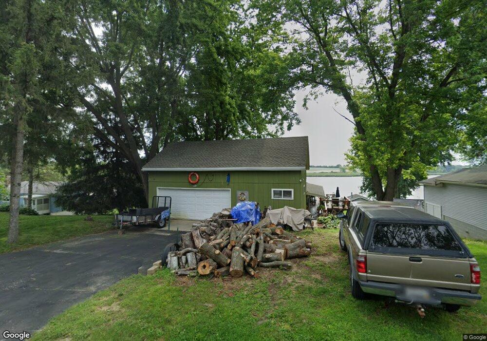
N5236 Wildcat Rd Iron Ridge, WI 53035
Estimated Value: $383,000 - $455,000
--
Bed
--
Bath
--
Sq Ft
0.33
Acres
About This Home
This home is located at N5236 Wildcat Rd, Iron Ridge, WI 53035 and is currently estimated at $419,848. N5236 Wildcat Rd is a home located in Dodge County with nearby schools including John Hustis Elementary School, Hustisford High School, and Bethany Lutheran School.
Ownership History
Date
Name
Owned For
Owner Type
Purchase Details
Closed on
Jul 1, 2021
Sold by
Kendhammer Douglas and Kendhammer Debra
Bought by
Kendhammer Douglas and Kendhammer Debra
Current Estimated Value
Purchase Details
Closed on
Aug 24, 2012
Sold by
Hempleman and James D
Bought by
Kendhammer Douglas and Kendhammer Debra
Purchase Details
Closed on
Jun 9, 2006
Sold by
Greifenhagen Susan M and Greifenhagen Susan M
Bought by
Hempleman James D and Hempleman Larsen
Home Financials for this Owner
Home Financials are based on the most recent Mortgage that was taken out on this home.
Original Mortgage
$145,200
Interest Rate
6.72%
Mortgage Type
New Conventional
Create a Home Valuation Report for This Property
The Home Valuation Report is an in-depth analysis detailing your home's value as well as a comparison with similar homes in the area
Home Values in the Area
Average Home Value in this Area
Purchase History
| Date | Buyer | Sale Price | Title Company |
|---|---|---|---|
| Kendhammer Douglas | -- | None Listed On Document | |
| Kendhammer Douglas | $182,000 | -- | |
| Hempleman James D | $181,500 | -- |
Source: Public Records
Mortgage History
| Date | Status | Borrower | Loan Amount |
|---|---|---|---|
| Previous Owner | Hempleman James D | $145,200 |
Source: Public Records
Tax History Compared to Growth
Tax History
| Year | Tax Paid | Tax Assessment Tax Assessment Total Assessment is a certain percentage of the fair market value that is determined by local assessors to be the total taxable value of land and additions on the property. | Land | Improvement |
|---|---|---|---|---|
| 2024 | $3,005 | $199,100 | $61,200 | $137,900 |
| 2023 | $2,799 | $199,100 | $61,200 | $137,900 |
| 2022 | $2,709 | $199,100 | $61,200 | $137,900 |
| 2021 | $2,967 | $199,100 | $61,200 | $137,900 |
| 2020 | $3,202 | $199,100 | $61,200 | $137,900 |
| 2019 | $2,908 | $199,100 | $61,200 | $137,900 |
| 2018 | $2,838 | $199,100 | $61,200 | $137,900 |
| 2017 | $3,058 | $199,100 | $61,200 | $137,900 |
| 2016 | $3,173 | $199,100 | $61,200 | $137,900 |
| 2015 | $3,021 | $199,100 | $61,200 | $137,900 |
| 2014 | $3,106 | $199,100 | $61,200 | $137,900 |
Source: Public Records
Map
Nearby Homes
- N4973 Lake Dr
- Lt38 Sinissippi Point Rd
- N4690 Lake Dr
- N4569 Hazelwood Rd
- N4510 Anthony Island -
- N4510 & N4504 Anthony Island
- N4554 Lakeview Rd
- W4436 E Lakeview Rd
- 827 E Lakeview Rd
- 727 E Lakeview Rd Unit 8
- N4557 Lakeview Rd
- .68 Acre Parcel Anthony Island
- 244 S Ridge St
- 252 S Hustis St
- 441 Sandy Ln
- Lt1 W Horseshoe Rd
- N6436 County Road Tw
- N4550 County Road Dj
- 0 Burkwald Ave
- N5413 County Rd S
- N5240 Wildcat Rd
- n 5230 Wildcat Rd
- N5230 Wildcat Rd
- n 5244 Wildcat Rd
- N5244 Wildcat Rd
- N5222 Wildcat Rd
- N5250 Wildcat Rd
- N5218 Wildcat Rd
- N5256 Wildcat Rd
- N5235 Wildcat Rd
- N5239 Wildcat Rd
- N5243 Wildcat Rd
- N5229 Wildcat Rd
- N5249 Wildcat Rd
- 5249 Wildcat Rd
- N5221 Wildcat Rd
- N5212 Wildcat Rd
- N5255 Wildcat Rd
- N5262 Wildcat Rd
- N5215 Wildcat Rd