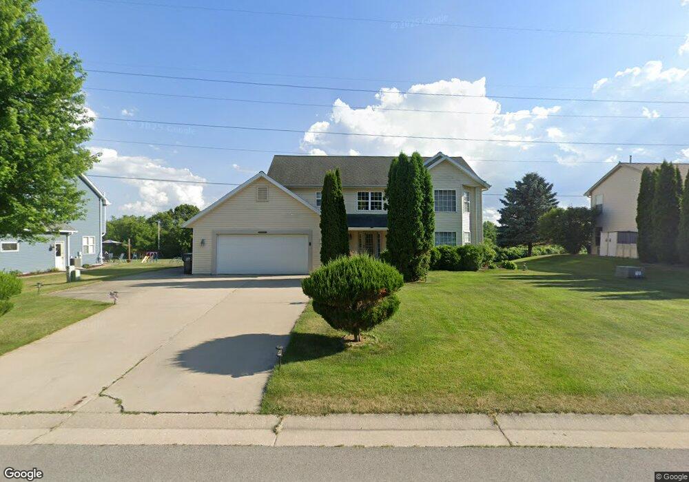
N66W23517 Linda Dr Sussex, WI 53089
Estimated Value: $545,000 - $606,000
4
Beds
3
Baths
3,083
Sq Ft
$190/Sq Ft
Est. Value
About This Home
This home is located at N66W23517 Linda Dr, Sussex, WI 53089 and is currently estimated at $585,569, approximately $189 per square foot. N66W23517 Linda Dr is a home located in Waukesha County with nearby schools including Templeton Middle School, Hamilton High School, and St. John's Lutheran School.
Ownership History
Date
Name
Owned For
Owner Type
Purchase Details
Closed on
Aug 27, 2004
Sold by
Hashek Joseph J
Bought by
Rosiak William and Rosiak Sharon
Current Estimated Value
Home Financials for this Owner
Home Financials are based on the most recent Mortgage that was taken out on this home.
Original Mortgage
$237,000
Outstanding Balance
$102,319
Interest Rate
3.98%
Mortgage Type
Purchase Money Mortgage
Estimated Equity
$483,250
Purchase Details
Closed on
May 17, 2004
Sold by
Ohio Savings Bank
Bought by
Hashek Joseph
Purchase Details
Closed on
Mar 10, 2003
Sold by
Picard Russell A and Picard Rachel
Bought by
Ohio Savings Bank
Purchase Details
Closed on
Jul 6, 2000
Sold by
Mclaughlin Edward J
Bought by
Picard Russell A
Home Financials for this Owner
Home Financials are based on the most recent Mortgage that was taken out on this home.
Original Mortgage
$178,500
Interest Rate
8.27%
Mortgage Type
Construction
Create a Home Valuation Report for This Property
The Home Valuation Report is an in-depth analysis detailing your home's value as well as a comparison with similar homes in the area
Home Values in the Area
Average Home Value in this Area
Purchase History
| Date | Buyer | Sale Price | Title Company |
|---|---|---|---|
| Rosiak William | $297,000 | Nations Title Agency | |
| Hashek Joseph | $253,900 | -- | |
| Ohio Savings Bank | $221,000 | -- | |
| Picard Russell A | $42,900 | -- |
Source: Public Records
Mortgage History
| Date | Status | Borrower | Loan Amount |
|---|---|---|---|
| Open | Rosiak William | $237,000 | |
| Previous Owner | Picard Russell A | $178,500 |
Source: Public Records
Tax History Compared to Growth
Tax History
| Year | Tax Paid | Tax Assessment Tax Assessment Total Assessment is a certain percentage of the fair market value that is determined by local assessors to be the total taxable value of land and additions on the property. | Land | Improvement |
|---|---|---|---|---|
| 2024 | $5,802 | $478,300 | $80,500 | $397,800 |
| 2023 | $5,147 | $414,900 | $80,500 | $334,400 |
| 2022 | $5,225 | $374,800 | $80,500 | $294,300 |
| 2021 | $4,916 | $348,500 | $72,000 | $276,500 |
| 2020 | $5,007 | $333,500 | $72,000 | $261,500 |
| 2019 | $5,065 | $325,300 | $69,300 | $256,000 |
| 2018 | $4,988 | $325,300 | $69,300 | $256,000 |
| 2017 | $4,573 | $304,700 | $69,300 | $235,400 |
| 2016 | $4,584 | $295,300 | $69,300 | $226,000 |
| 2015 | $4,669 | $295,300 | $69,300 | $226,000 |
| 2014 | $4,628 | $289,000 | $69,300 | $219,700 |
| 2013 | $4,628 | $278,100 | $69,300 | $208,800 |
Source: Public Records
Map
Nearby Homes
- W233N6997 Salem Dr
- Lt0 Maple Ave
- N63w23524 Silver Spring Dr
- N63W23954 Terrace Dr
- W238N7214 Michele Ln
- W233N7504 Highview Dr
- W247N7543 Overland Rd
- N71W24818 Wildwood Way
- W243N7650 Hilltop Ct
- N55W23842 Fieldstone Pass Cir
- W247N5929 Grouse Ct
- W238N5544 Fieldstone Pass Cir
- N55W23912 Fieldstone Pass Cir
- W237N5478 Fieldstone Pass Cir
- W237N5468 Limestone Ct
- W220N7095 Town Line St
- W242N5607 Simona Ct
- N66W25720 Big Sky Dr
- 21679 S Weather Edge Cir
- 21864 N Weather Edge Cir Unit A
- N67W23535 Linda Dr
- N66W23505 Linda Dr
- N66W23475 Linda Dr
- N67W23500 Linda Dr
- N67W23520 Linda Dr
- N67W23551 Linda Dr
- N67W23540 Linda Dr
- N67W23569 Linda Dr
- N66W23459 Linda Dr
- N67W23470 Linda Dr Unit N67W23470
- N67W23560 Linda Dr
- N67W23585 Linda Dr
- N66W23441 Linda Dr
- W234N6719 Salem Dr
- N67W23576 Linda Dr
- 0 Linda Dr
- N66W23598 Hillview Dr
- N67W23601 Linda Dr
- N66W23430 Linda Dr
- W234N6741 Salem Dr