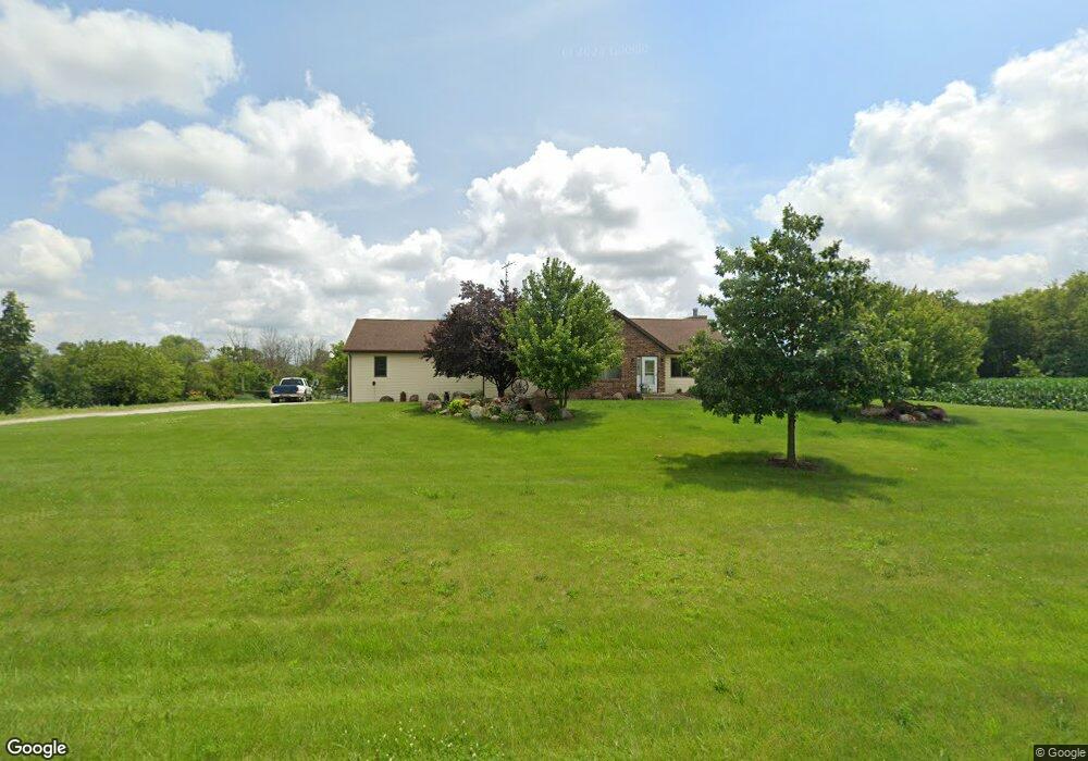
N8166 Airport Rd Watertown, WI 53094
Estimated Value: $47,000 - $441,158
--
Bed
--
Bath
--
Sq Ft
1.41
Acres
About This Home
This home is located at N8166 Airport Rd, Watertown, WI 53094 and is currently estimated at $335,540. N8166 Airport Rd is a home located in Jefferson County with nearby schools including Watertown High School, eCampus Academy Charter School, and Trinity-St. Luke's Lutheran Elementary School.
Ownership History
Date
Name
Owned For
Owner Type
Purchase Details
Closed on
Jun 3, 2008
Sold by
Witte Ernest
Bought by
Midwest Land Holdings Llc
Current Estimated Value
Purchase Details
Closed on
Apr 17, 2006
Sold by
Witts Ernest
Bought by
Midwest Land Holdings Llc
Create a Home Valuation Report for This Property
The Home Valuation Report is an in-depth analysis detailing your home's value as well as a comparison with similar homes in the area
Home Values in the Area
Average Home Value in this Area
Purchase History
| Date | Buyer | Sale Price | Title Company |
|---|---|---|---|
| Midwest Land Holdings Llc | $58,680 | None Available | |
| Midwest Land Holdings Llc | $60,000 | None Available |
Source: Public Records
Tax History Compared to Growth
Tax History
| Year | Tax Paid | Tax Assessment Tax Assessment Total Assessment is a certain percentage of the fair market value that is determined by local assessors to be the total taxable value of land and additions on the property. | Land | Improvement |
|---|---|---|---|---|
| 2024 | $4,181 | $424,900 | $72,800 | $352,100 |
| 2023 | $3,878 | $231,100 | $44,100 | $187,000 |
| 2022 | $4,006 | $231,100 | $44,100 | $187,000 |
| 2021 | $3,928 | $231,100 | $44,100 | $187,000 |
| 2020 | $3,892 | $231,100 | $44,100 | $187,000 |
| 2019 | $3,708 | $231,100 | $44,100 | $187,000 |
| 2018 | $3,545 | $231,100 | $44,100 | $187,000 |
| 2017 | $3,659 | $231,100 | $44,100 | $187,000 |
| 2016 | $3,622 | $231,100 | $44,100 | $187,000 |
| 2015 | $3,458 | $231,100 | $44,100 | $187,000 |
| 2014 | $3,994 | $290,000 | $66,500 | $223,500 |
| 2013 | $4,172 | $290,000 | $66,500 | $223,500 |
Source: Public Records
Map
Nearby Homes
- 0 E Confidential St Unit 1889932
- Lt0 Gateway Dr
- 908 Franklin St
- Lot 2 Reichart Ln
- 1507 S 10th St
- Lot 1 Reichart Ln
- 1418 S 9th St
- 1314 Waldron St
- 1313 Utah St
- 1330 S 10th St
- N8002 County Road A
- 131 Cedar Ct
- 758 Johnson St
- 750 Johnson St
- 1215 Utah St
- The Saybrook Plan at Rock River Ridge
- The Atwater Plan at Rock River Ridge
- The Hudson Plan at Rock River Ridge
- The Coral Plan at Rock River Ridge
- The Drake Plan at Rock River Ridge
- N8140 Airport Rd
- N8170 Airport Rd
- W4011 Ebenezer Dr
- W3957 Ebenezer Dr
- W3951 Ebenezer Dr
- N8259 Airport Rd
- N8259 Airport Rd
- W4085 Ebenezer Dr
- N8068 Switzke Rd
- W4114 Ebenezer Dr
- Lot 72 Flyway Run
- N8060 Switzke Rd
- N8210 High Rd
- N8020 Switzke Rd
- N8020 Switzke Rd
- 21 Acres Airport Rd Ebenezer Road Rd
- 21 Acres Airport Rd Ebenezer Rd
- 21 Acres Airport Rd Ebenezer Rd
- N8143 High Rd
- N8167 High Rd