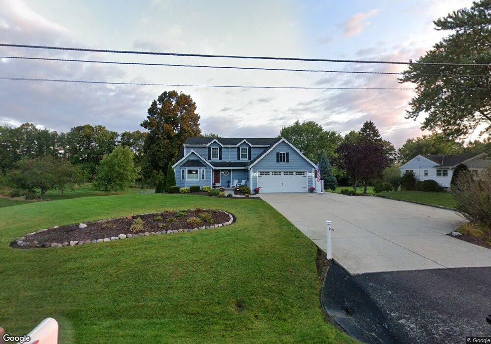
N81W16038 Robinhood Dr Menomonee Falls, WI 53051
Estimated Value: $484,000 - $550,000
--
Bed
--
Bath
2,384
Sq Ft
$213/Sq Ft
Est. Value
About This Home
This home is located at N81W16038 Robinhood Dr, Menomonee Falls, WI 53051 and is currently estimated at $508,780, approximately $213 per square foot. N81W16038 Robinhood Dr is a home located in Waukesha County with nearby schools including Valley View Elementary School, North Middle School, and Menomonee Falls High School.
Ownership History
Date
Name
Owned For
Owner Type
Purchase Details
Closed on
May 14, 1998
Sold by
Paul Davis Systems Of S E Wisconsin Inc
Bought by
Mattson Greg S and Mattson Deborah A
Current Estimated Value
Home Financials for this Owner
Home Financials are based on the most recent Mortgage that was taken out on this home.
Original Mortgage
$196,200
Outstanding Balance
$38,905
Interest Rate
7.27%
Estimated Equity
$469,875
Create a Home Valuation Report for This Property
The Home Valuation Report is an in-depth analysis detailing your home's value as well as a comparison with similar homes in the area
Home Values in the Area
Average Home Value in this Area
Purchase History
| Date | Buyer | Sale Price | Title Company |
|---|---|---|---|
| Mattson Greg S | $218,000 | -- |
Source: Public Records
Mortgage History
| Date | Status | Borrower | Loan Amount |
|---|---|---|---|
| Open | Mattson Greg S | $196,200 |
Source: Public Records
Tax History Compared to Growth
Tax History
| Year | Tax Paid | Tax Assessment Tax Assessment Total Assessment is a certain percentage of the fair market value that is determined by local assessors to be the total taxable value of land and additions on the property. | Land | Improvement |
|---|---|---|---|---|
| 2024 | $4,830 | $427,700 | $122,800 | $304,900 |
| 2023 | $4,649 | $427,700 | $122,800 | $304,900 |
| 2022 | $4,099 | $255,300 | $84,400 | $170,900 |
| 2021 | $3,923 | $255,300 | $84,400 | $170,900 |
| 2020 | $4,126 | $255,300 | $84,400 | $170,900 |
| 2019 | $3,948 | $255,300 | $84,400 | $170,900 |
| 2018 | $5,040 | $255,300 | $84,400 | $170,900 |
| 2017 | $5,400 | $255,300 | $84,400 | $170,900 |
| 2016 | $4,635 | $255,300 | $84,400 | $170,900 |
| 2015 | $4,376 | $255,300 | $84,400 | $170,900 |
| 2014 | $4,660 | $255,300 | $84,400 | $170,900 |
| 2013 | $4,660 | $255,300 | $84,400 | $170,900 |
Source: Public Records
Map
Nearby Homes
- N84W15750 Ridge Rd Unit 204
- W163N8459 Arthur Ave
- N84W16544 Ann Ave
- N53W19764 Kingair Dr
- N53W19776 Kingair Dr
- N86W16193 Arthur Ave
- N86W16387 Appleton Ave
- N84W15170 Knoll Terrace
- N86W16564 Jacobson Dr
- W174N8125 Shady Ln Unit 1
- W155N7481 Pebble Ct
- N79W17331 Bluejay Ct Unit 1
- Lt101 Main St
- Lt54 Main St
- Lt8 Main St
- Lt53 Main St
- Lt57 Main St
- Lt13 Main St
- Lt87 Main St
- Lt45 Main St
- N81W15982 Robinhood Dr
- N81W16060 Robinhood Dr
- N81W16017 Robinhood Dr
- N81W15940 Robinhood Dr
- N81W15977 Robinhood Dr
- N81W16059 Robinhood Dr
- N81W16100 Robinhood Dr
- W160N8211 Old Orchard Ct
- W160N8212 Old Orchard Ct
- N81W15939 Robinhood Dr
- N81W16101 Robinhood Dr
- W160N8218 Pine Tree Ct
- N81W15900 Robinhood Dr
- N81W16140 Robinhood Dr
- W160N8225 Old Orchard Ct
- W160N8224 Old Orchard Ct
- N82W16121 Pine Tree Ct
- N81W15899 Robinhood Dr
- N81W16145 Robinhood Dr
- W160N8241 Old Orchard Ct