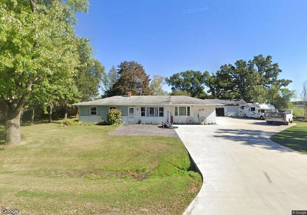
N8506 Airport Rd Watertown, WI 53094
Estimated Value: $285,000 - $491,000
--
Bed
--
Bath
--
Sq Ft
1
Acres
About This Home
This home is located at N8506 Airport Rd, Watertown, WI 53094 and is currently estimated at $364,785. N8506 Airport Rd is a home located in Jefferson County with nearby schools including Watertown High School, eCampus Academy Charter School, and Trinity-St. Luke's Lutheran Elementary School.
Ownership History
Date
Name
Owned For
Owner Type
Purchase Details
Closed on
Sep 27, 2016
Sold by
Cahoon Matt J
Bought by
Heaton Jon
Current Estimated Value
Home Financials for this Owner
Home Financials are based on the most recent Mortgage that was taken out on this home.
Original Mortgage
$85,300
Outstanding Balance
$68,384
Interest Rate
3.46%
Mortgage Type
New Conventional
Estimated Equity
$296,401
Create a Home Valuation Report for This Property
The Home Valuation Report is an in-depth analysis detailing your home's value as well as a comparison with similar homes in the area
Home Values in the Area
Average Home Value in this Area
Purchase History
| Date | Buyer | Sale Price | Title Company |
|---|---|---|---|
| Heaton Jon | -- | None Available |
Source: Public Records
Mortgage History
| Date | Status | Borrower | Loan Amount |
|---|---|---|---|
| Open | Heaton Jon | $85,300 |
Source: Public Records
Tax History Compared to Growth
Tax History
| Year | Tax Paid | Tax Assessment Tax Assessment Total Assessment is a certain percentage of the fair market value that is determined by local assessors to be the total taxable value of land and additions on the property. | Land | Improvement |
|---|---|---|---|---|
| 2024 | $2,487 | $260,400 | $77,500 | $182,900 |
| 2023 | $2,326 | $143,300 | $49,900 | $93,400 |
| 2022 | $2,406 | $143,300 | $49,900 | $93,400 |
| 2021 | $2,357 | $143,300 | $49,900 | $93,400 |
| 2020 | $2,338 | $143,300 | $49,900 | $93,400 |
| 2019 | $2,225 | $143,300 | $49,900 | $93,400 |
| 2018 | $2,126 | $143,300 | $49,900 | $93,400 |
| 2017 | $2,200 | $143,300 | $49,900 | $93,400 |
| 2016 | $2,079 | $136,800 | $49,900 | $86,900 |
| 2015 | $1,985 | $136,800 | $49,900 | $86,900 |
| 2014 | $2,436 | $182,400 | $65,000 | $117,400 |
| 2013 | $2,549 | $182,400 | $65,000 | $117,400 |
Source: Public Records
Map
Nearby Homes
- Lt0 Gateway Dr
- 0 E Confidential St Unit 1889932
- 908 Franklin St
- 1507 S 10th St
- 1418 S 9th St
- 1314 Waldron St
- 1313 Utah St
- 1330 S 10th St
- 131 Cedar Ct
- 1215 Utah St
- 758 Johnson St
- 750 Johnson St
- The Saybrook Plan at Rock River Ridge
- The Atwater Plan at Rock River Ridge
- The Hudson Plan at Rock River Ridge
- The Coral Plan at Rock River Ridge
- The Drake Plan at Rock River Ridge
- The Addison Plan at Rock River Ridge
- The Bradford Plan at Rock River Ridge
- The Catalina Plan at Rock River Ridge
- Lt1 Airport Rd
- 0 Airport Rd Unit LOT 1 1514592
- N8516 Airport Rd
- N8495 Airport Rd
- N8526 Airport Rd
- N8538 Airport Rd
- N8560 Airport Rd
- 2011 Airport Rd
- N8570 Airport Rd
- 2002 Airport Rd
- 2001 Airport Rd
- Lt0 Gateway Dr Unit Lt0
- Lot 71 Gateway Dr
- 1931 Gateway Dr
- 1929 Gateway Dr
- Lot 42 Gateway Dr
- Lot 43 Gateway Dr
- Lot 44 Gateway Dr
- Lot 79 Gateway Dr
- Lot 45 Gateway Dr