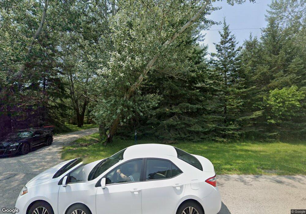
N9033 River Rd Watertown, WI 53094
Estimated Value: $601,000 - $710,000
--
Bed
--
Bath
--
Sq Ft
4.76
Acres
About This Home
This home is located at N9033 River Rd, Watertown, WI 53094 and is currently estimated at $638,262. N9033 River Rd is a home located in Jefferson County with nearby schools including Watertown High School, Good Shepherd Lutheran School, and St. Mark's Lutheran School.
Ownership History
Date
Name
Owned For
Owner Type
Purchase Details
Closed on
Apr 19, 2021
Sold by
Bartolowits Todd and Scheiber Jerry D
Bought by
Martin Michael L and Martin Laurie A
Current Estimated Value
Purchase Details
Closed on
Oct 13, 2011
Sold by
Martin Michael L and Martin Laurie A
Bought by
Bartolowits Todd and Scheiber Jerry D
Purchase Details
Closed on
Mar 31, 2005
Sold by
Wisconsin Electric Power Co
Bought by
Martin Michael L and Martin Laurie A
Home Financials for this Owner
Home Financials are based on the most recent Mortgage that was taken out on this home.
Original Mortgage
$306,460
Interest Rate
5.64%
Mortgage Type
Future Advance Clause Open End Mortgage
Create a Home Valuation Report for This Property
The Home Valuation Report is an in-depth analysis detailing your home's value as well as a comparison with similar homes in the area
Home Values in the Area
Average Home Value in this Area
Purchase History
| Date | Buyer | Sale Price | Title Company |
|---|---|---|---|
| Martin Michael L | $136,600 | None Available | |
| Bartolowits Todd | $218,000 | None Available | |
| Martin Michael L | $306,500 | None Available |
Source: Public Records
Mortgage History
| Date | Status | Borrower | Loan Amount |
|---|---|---|---|
| Previous Owner | Martin Michael L | $306,460 |
Source: Public Records
Tax History Compared to Growth
Tax History
| Year | Tax Paid | Tax Assessment Tax Assessment Total Assessment is a certain percentage of the fair market value that is determined by local assessors to be the total taxable value of land and additions on the property. | Land | Improvement |
|---|---|---|---|---|
| 2024 | $5,012 | $519,000 | $188,400 | $330,600 |
| 2023 | $5,025 | $307,600 | $110,800 | $196,800 |
| 2022 | $5,162 | $305,100 | $110,800 | $194,300 |
| 2021 | $5,046 | $303,800 | $110,800 | $193,000 |
| 2020 | $4,735 | $286,300 | $110,800 | $175,500 |
| 2019 | $4,510 | $286,300 | $110,800 | $175,500 |
| 2018 | $4,311 | $286,300 | $110,800 | $175,500 |
| 2017 | $4,456 | $286,300 | $110,800 | $175,500 |
| 2016 | $4,398 | $286,300 | $110,800 | $175,500 |
| 2015 | $4,198 | $286,300 | $110,800 | $175,500 |
| 2014 | $4,303 | $314,600 | $133,500 | $181,100 |
| 2013 | $4,497 | $314,600 | $133,500 | $181,100 |
Source: Public Records
Map
Nearby Homes
- 225 E Haven Dr Unit B
- 1402 Richards Ave
- 412 Bradley St
- 1568 E Gate Dr
- 409 Humboldt St Unit 1
- 323 Summit Ave
- 1025 Richards Ave
- N8538 River Rd
- LT3 Rock River Paradise
- 219 E Water St
- 1507 S 10th St
- 1330 S 10th St
- 908 Franklin St
- 809 Richards Ave
- 625 S 12th St
- 1149 Boughton St Unit Lt3
- 623 S 12th St
- 1418 S 9th St
- 110 Riverlawn Ave
- 709 S 10th St
- N9021 River Rd
- N9045 River Rd
- N9027 River Rd
- Lot 1 River Rd
- N8989 Michael Ln
- Lt15 Michael Ln
- Lot 15 Michael Ln
- N9050N River Rd
- W3059 Matthew Ct
- W3047 Matthew Ct
- N9072 River Rd
- Lot 9 Michael Ln
- N9081 River Rd
- W3053 Matthew Ct
- N8990 Michael Ln
- N8972 Michael Ln
- N9082 River Rd
- Lt7 River Rd Rd
- N9087 River Rd
- N8949 Michael Ln
