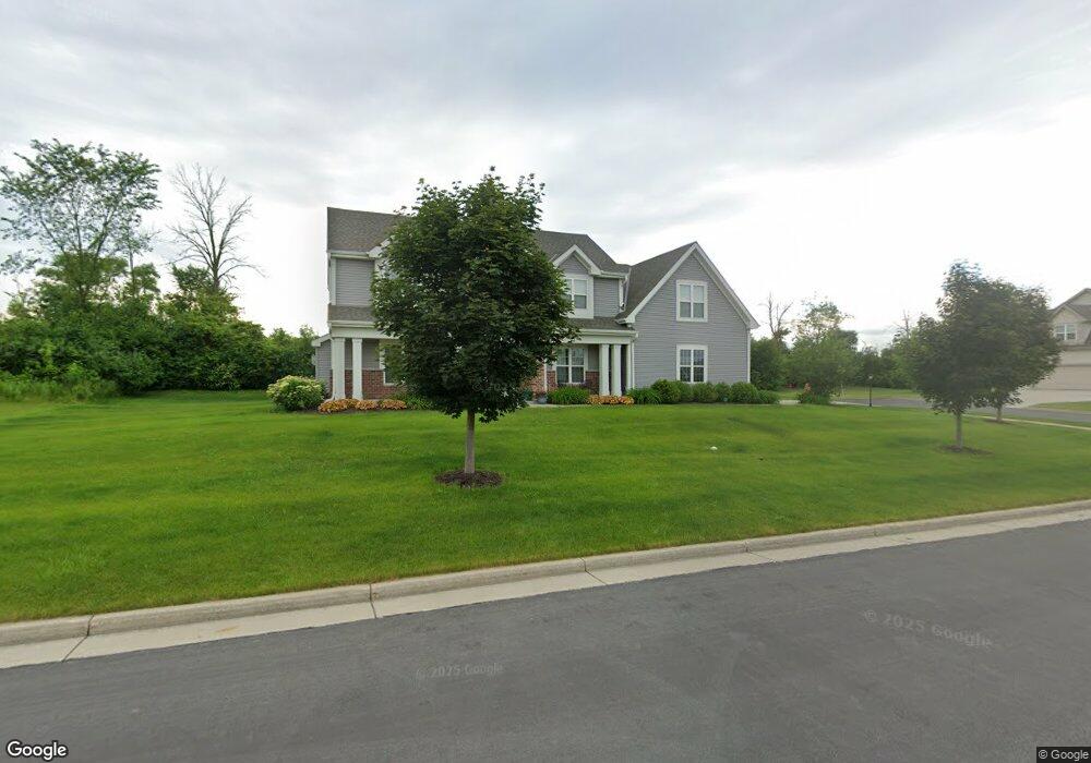
W198N5701 Powell Dr Menomonee Falls, WI 53051
Estimated Value: $720,000 - $804,000
4
Beds
3
Baths
2,658
Sq Ft
$281/Sq Ft
Est. Value
About This Home
This home is located at W198N5701 Powell Dr, Menomonee Falls, WI 53051 and is currently estimated at $748,025, approximately $281 per square foot. W198N5701 Powell Dr is a home with nearby schools including Lannon Elementary School, Templeton Middle School, and Hamilton High School.
Ownership History
Date
Name
Owned For
Owner Type
Purchase Details
Closed on
Jul 25, 2016
Sold by
Tomich Investments Iv Llc
Bought by
Michor Robert and Michor Angela
Current Estimated Value
Home Financials for this Owner
Home Financials are based on the most recent Mortgage that was taken out on this home.
Original Mortgage
$417,000
Outstanding Balance
$331,964
Interest Rate
3.41%
Mortgage Type
New Conventional
Estimated Equity
$416,061
Create a Home Valuation Report for This Property
The Home Valuation Report is an in-depth analysis detailing your home's value as well as a comparison with similar homes in the area
Home Values in the Area
Average Home Value in this Area
Purchase History
| Date | Buyer | Sale Price | Title Company |
|---|---|---|---|
| Michor Robert | $445,000 | None Available |
Source: Public Records
Mortgage History
| Date | Status | Borrower | Loan Amount |
|---|---|---|---|
| Open | Michor Robert | $417,000 |
Source: Public Records
Tax History Compared to Growth
Tax History
| Year | Tax Paid | Tax Assessment Tax Assessment Total Assessment is a certain percentage of the fair market value that is determined by local assessors to be the total taxable value of land and additions on the property. | Land | Improvement |
|---|---|---|---|---|
| 2024 | $7,276 | $642,900 | $156,300 | $486,600 |
| 2023 | $7,016 | $642,900 | $156,300 | $486,600 |
| 2022 | $7,005 | $433,100 | $107,800 | $325,300 |
| 2021 | $6,597 | $433,100 | $107,800 | $325,300 |
| 2020 | $6,581 | $433,100 | $107,800 | $325,300 |
| 2019 | $6,640 | $433,100 | $107,800 | $325,300 |
| 2018 | $6,404 | $433,100 | $107,800 | $325,300 |
| 2017 | $6,206 | $433,100 | $107,800 | $325,300 |
| 2016 | $6,465 | $433,100 | $107,800 | $325,300 |
| 2015 | $1,674 | $107,800 | $107,800 | $0 |
Source: Public Records
Map
Nearby Homes
- N57W19673 Holly Ct
- W198N5408 Boxwood Blvd
- The Cooper Plan at Evergreen Fields
- The Hoffman Plan at Evergreen Fields
- The Beryl Plan at Evergreen Fields
- The Sawyer Plan at Evergreen Fields
- The Everest Plan at Evergreen Fields
- The Emerald Plan at Evergreen Fields
- The Hudson Plan at Evergreen Fields
- W195N5814 Deer Park Ct
- N56W19246 Spencers Ct
- W192N5472 Red Crown Ln
- N55W19373 Red Crown Ln
- N58W19314 Fox River Way
- N53W19954 Kingair Dr
- N53W19776 Kingair Dr
- N53W19798 Kingair Dr
- N53W19928 Kingair Dr
- N54W19358 Broadwing Place
- N54W19219 Broadwing Place
- W198N5700 Powell Dr
- W198N5727 Little Star Ct
- W198N5686 Powell Dr
- W198N5673 Powell Dr
- W198N5728 Little Star Ct
- N56W19814 Powell Dr
- N56W19954 Silver Spring Dr
- W198N5745 Little Star Ct
- N57W19763 Holly Ct
- N56W19841 Powell Dr
- N56W19780 Powell Dr
- W198N5744 Little Star Ct
- N56W19815 Powell Dr
- N57W19737 Holly Ct
- W198N5757 Little Star Ct
- W198N5750 Little Star Ct
- N56W19752 Powell Dr
- N57W19742 Holly Ct
- n57w Holly Ct
- N56W19878 Silver Spring Dr