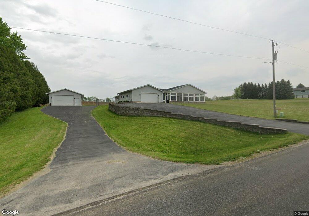
W2065 Auburn Ashford Dr Campbellsport, WI 53010
Estimated Value: $286,000 - $371,000
--
Bed
--
Bath
--
Sq Ft
1.41
Acres
About This Home
This home is located at W2065 Auburn Ashford Dr, Campbellsport, WI 53010 and is currently estimated at $338,355. W2065 Auburn Ashford Dr is a home located in Fond du Lac County with nearby schools including Campbellsport High School, St. Matthew Elementary School, and Holy Trinity Catholic School.
Ownership History
Date
Name
Owned For
Owner Type
Purchase Details
Closed on
May 19, 2016
Sold by
Carrao Connie L
Bought by
Zoesch David A and Zoesch Jennifer L
Current Estimated Value
Home Financials for this Owner
Home Financials are based on the most recent Mortgage that was taken out on this home.
Original Mortgage
$188,955
Outstanding Balance
$150,077
Interest Rate
3.59%
Mortgage Type
New Conventional
Estimated Equity
$188,278
Create a Home Valuation Report for This Property
The Home Valuation Report is an in-depth analysis detailing your home's value as well as a comparison with similar homes in the area
Home Values in the Area
Average Home Value in this Area
Purchase History
| Date | Buyer | Sale Price | Title Company |
|---|---|---|---|
| Zoesch David A | $198,900 | Abstract & Title Company |
Source: Public Records
Mortgage History
| Date | Status | Borrower | Loan Amount |
|---|---|---|---|
| Open | Zoesch David A | $188,955 |
Source: Public Records
Tax History Compared to Growth
Tax History
| Year | Tax Paid | Tax Assessment Tax Assessment Total Assessment is a certain percentage of the fair market value that is determined by local assessors to be the total taxable value of land and additions on the property. | Land | Improvement |
|---|---|---|---|---|
| 2024 | $3,673 | $342,400 | $53,300 | $289,100 |
| 2023 | $3,438 | $198,800 | $34,000 | $164,800 |
| 2022 | $3,495 | $198,800 | $34,000 | $164,800 |
| 2021 | $3,461 | $198,800 | $34,000 | $164,800 |
| 2020 | $3,545 | $198,800 | $34,000 | $164,800 |
| 2019 | $3,536 | $198,800 | $34,000 | $164,800 |
| 2018 | $3,382 | $198,800 | $34,000 | $164,800 |
| 2017 | $3,307 | $198,800 | $34,000 | $164,800 |
| 2016 | $3,328 | $198,800 | $34,000 | $164,800 |
| 2015 | $3,410 | $212,400 | $36,000 | $176,400 |
| 2014 | $3,301 | $212,400 | $36,000 | $176,400 |
| 2013 | $3,405 | $212,400 | $36,000 | $176,400 |
Source: Public Records
Map
Nearby Homes
- W2368 Timber Ridge Ct
- N254 U S 45
- N1169 County Road V
- N1231 County Road V
- Lt0 Badger Dr
- 664 Valley View Dr
- Lt0 St Killian Dr
- 226 Killdeer Ave
- 627 Valley View Dr
- Lt1 St Killian Dr
- Lt0 Industrial Pkwy
- 350 Auburn Meadows Ct Unit D
- W2974 Elmore Dr
- 372 Windell St
- N850 County Road G
- Lt2 Veterans Cir
- Lt4 Veterans Cir
- Lt1 Veterans Cir
- Simen II Plan at Soaring Eagle
- Simen Plan at Soaring Eagle
- W2085 Auburn Ashford Dr
- W2035 Auburn Ashford Dr
- N713 Maple Dr
- N703 Maple Dr
- W2113 Auburn Ashford Dr
- W2112 Auburn Ashford Dr
- W2005 Auburn Ashford Dr
- W2002 Auburn Ashford Dr
- N805 Maple Dr
- N610 County Road V
- N825 Maple Dr
- N405 Hwy V
- N849 Maple Dr
- W2202 Auburn Ashford Dr
- N858 Maple Dr
- N857 Maple Dr
- N828 County Road V
- N865 Maple Dr
- N536 Maple Dr
- N889 Maple Dr