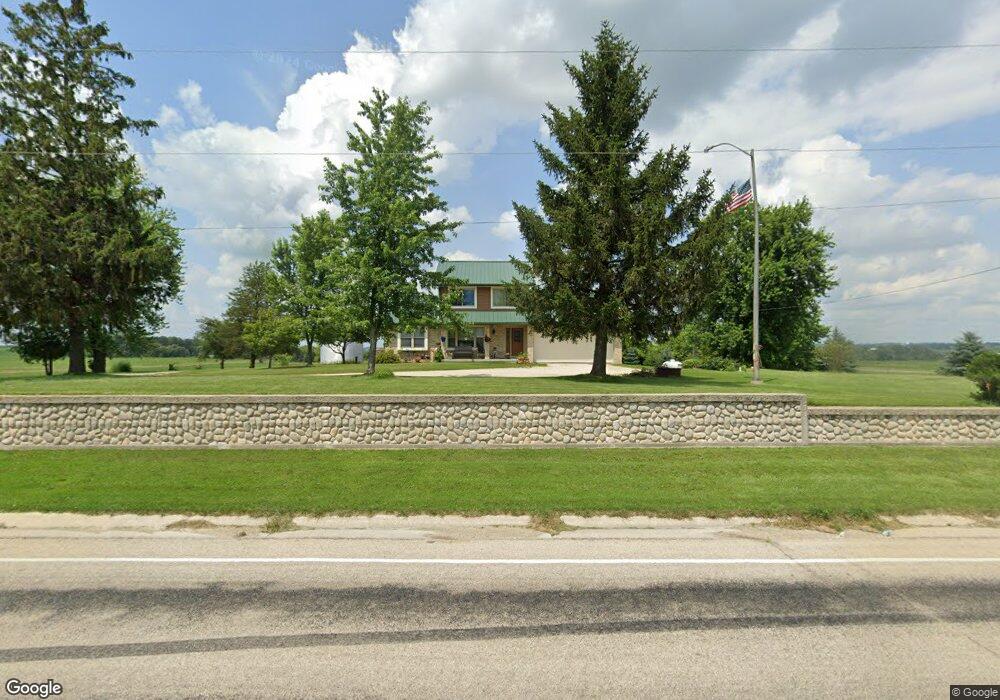
W3372 County Road R Iron Ridge, WI 53035
Estimated Value: $329,271 - $446,000
--
Bed
--
Bath
--
Sq Ft
0.55
Acres
About This Home
This home is located at W3372 County Road R, Iron Ridge, WI 53035 and is currently estimated at $389,318. W3372 County Road R is a home located in Dodge County with nearby schools including John Hustis Elementary School, Hustisford High School, and Bethany Lutheran School.
Ownership History
Date
Name
Owned For
Owner Type
Purchase Details
Closed on
Dec 19, 2022
Sold by
Firari Diane
Bought by
Firari Steven J and Westphal Shawn M
Current Estimated Value
Purchase Details
Closed on
Aug 17, 2010
Sold by
White Jason R
Bought by
Firari Diane M
Home Financials for this Owner
Home Financials are based on the most recent Mortgage that was taken out on this home.
Original Mortgage
$150,000
Interest Rate
4.58%
Mortgage Type
Future Advance Clause Open End Mortgage
Purchase Details
Closed on
May 10, 2006
Sold by
Firari Michael A
Bought by
Firari Diane M
Create a Home Valuation Report for This Property
The Home Valuation Report is an in-depth analysis detailing your home's value as well as a comparison with similar homes in the area
Home Values in the Area
Average Home Value in this Area
Purchase History
| Date | Buyer | Sale Price | Title Company |
|---|---|---|---|
| Firari Steven J | -- | None Listed On Document | |
| Firari Diane M | $92,000 | -- | |
| Firari Diane M | -- | -- |
Source: Public Records
Mortgage History
| Date | Status | Borrower | Loan Amount |
|---|---|---|---|
| Previous Owner | Firari Diane M | $150,000 |
Source: Public Records
Tax History Compared to Growth
Tax History
| Year | Tax Paid | Tax Assessment Tax Assessment Total Assessment is a certain percentage of the fair market value that is determined by local assessors to be the total taxable value of land and additions on the property. | Land | Improvement |
|---|---|---|---|---|
| 2024 | $2,869 | $196,200 | $28,600 | $167,600 |
| 2023 | $2,664 | $196,200 | $28,600 | $167,600 |
| 2022 | $2,584 | $196,200 | $28,600 | $167,600 |
| 2021 | $2,829 | $196,200 | $28,600 | $167,600 |
| 2020 | $3,072 | $196,200 | $28,600 | $167,600 |
| 2019 | $2,784 | $196,200 | $28,600 | $167,600 |
| 2018 | $2,720 | $196,200 | $28,600 | $167,600 |
| 2017 | $2,925 | $196,200 | $28,600 | $167,600 |
| 2016 | $3,044 | $196,200 | $28,600 | $167,600 |
| 2015 | $2,974 | $196,200 | $28,600 | $167,600 |
| 2014 | $3,061 | $196,200 | $28,600 | $167,600 |
Source: Public Records
Map
Nearby Homes
- N4973 Lake Dr
- N4569 Hazelwood Rd
- N4690 Lake Dr
- N4510 & N4504 Anthony Island
- N4510 Anthony Island -
- N5413 County Rd S
- 0 Burkwald Ave
- .68 Acre Parcel Anthony Island
- 244 S Ridge St
- 252 S Hustis St
- 727 E Lakeview Rd Unit 8
- W4436 E Lakeview Rd
- 441 Sandy Ln
- 202 East Ave
- 827 E Lakeview Rd
- 234 Watertower Cir
- N4557 Lakeview Rd
- Lt38 Sinissippi Point Rd
- N4554 Lakeview Rd
- Lt0 E Neda Rd
- W3562 County Road R
- W3582 Perch Rd
- N5100 Cedar Rd
- N4875 S Gray Rd
- W3515 Sawmill Rd
- N4863 S Gray Rd
- N4747 S Cedar Ln
- N4730 S Cedar Ln
- N4794 County Road R
- Lt1 Brown Rd
- W3493 Sawmill Rd
- Lt2 Brown Rd
- N4867 Brown Rd
- N4847 Brown Rd
- W3583 Sawmill Rd
- W3626 Sawmill Rd
- N4809 Brown Rd
- N5200 Cedar Rd
- W3673 Sawmill Rd
- W3027 Oak Lawn Rd