
Seller's Agent in 2020
Keenan Shanholtz
WEST VIRGINIA LAND & HOME REALTY
(304) 813-4858
487 Total Sales
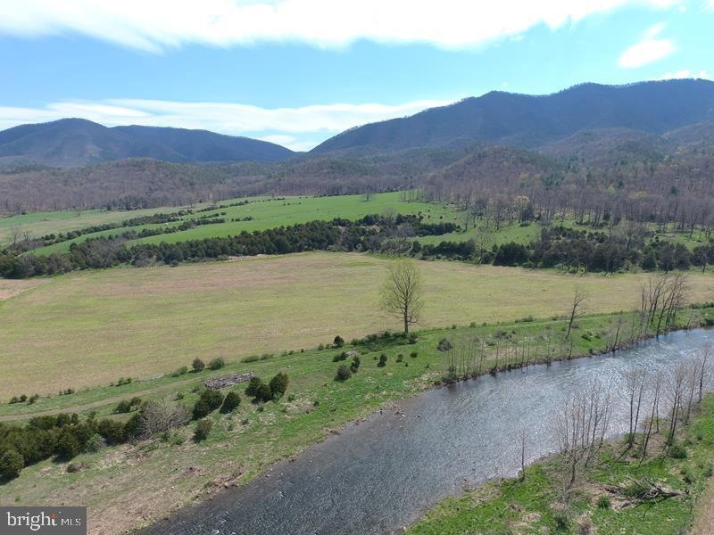
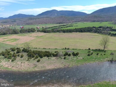
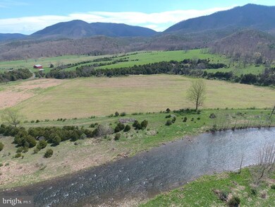
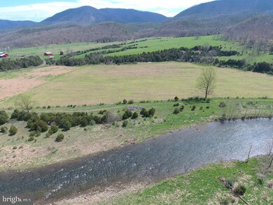
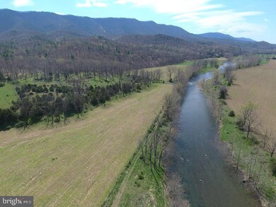
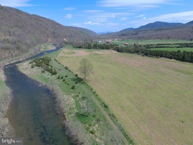
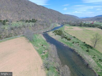
SOUTH FORK RIVER RANCH! 338 ACRES OF WEST VIRGINIA BLISS. OVER 2600 FT OF THE SOUTH FORK RIVER FLOWS THROUGH THE PROPERTY, 60 ACRES OF BOTTOM LAND CROP GROUND FOR CORN & BEANS, 40 ACRES OF HIGH PASTURE FOR LIVESTOCK OR HAY, 238 ACRES OF WOODS FOR HUNTING & ATV'S AND JAW DROPPING VIEWS ANY DIRECTION YOU LOOK. FRONTAGE ON SOUTH FORK ROAD AND GOOD ACCESS VIA 50 FT RIGHT OF WAY ACROSS BRIDGE TO LAND ON OPPOSITE SIDE OF THE RIVER. THIS PLACE CHECKS ALL THE BOXES....HUNT, SHOOT, FISH, ATV'S, CROPS, LIVESTOCK, INCREDIBLE VIEWS.....BUILD YOUR WEEKEND GETAWAY OR FOREVER HOME. LOADED WITH DEER, BEAR & TURKEY.....FROM THE RIVER BOTTOM TO THE MOUNTAIN TOP, ALL IN ONE PROPERTY! YOU CAN DO JUST ABOUT ANYTHING ON THIS LAND......THE NATURAL BEAUTY WILL BLOW YOU AWAY.....IT'S UNBELIEVABLE TO HAVE THIS MUCH DIVERSITY ON 338 ACRES....IF YOU'VE BEEN LOOKING FOR A PROPERTY LIKE THIS AND YOU DON'T BUY THIS ONE....QUIT LOOKING.....YOU'RE NOT A BUYER!
Last Agent to Sell the Property
(304) 822-4488 4wvland@gmail.com WEST VIRGINIA LAND & HOME REALTY Listed on: 08/11/2020
Last Buyer's Agent
(304) 822-4488 4wvland@gmail.com WEST VIRGINIA LAND & HOME REALTY Listed on: 08/11/2020
| Date | Event | Price | List to Sale | Price per Sq Ft |
|---|---|---|---|---|
| 08/14/2020 08/14/20 | Sold | $620,000 | -11.4% | -- |
| 08/11/2020 08/11/20 | Pending | -- | -- | -- |
| 08/11/2020 08/11/20 | For Sale | $700,000 | -- | -- |
Seller's Agent in 2020
Keenan Shanholtz
WEST VIRGINIA LAND & HOME REALTY
(304) 813-4858
487 Total Sales
Source: Bright MLS
MLS Number: WVHD105930
Disclaimer: Certain information contained herein is derived from information provided by parties other than Homes.com. All information provided is deemed reliable, but is not guaranteed to be accurate and should be independently verified.
![]() The data relating to real estate for sale on this website appears in part through the BRIGHT Internet Data Exchange program, a voluntary cooperative exchange of property listing data between licensed real estate brokerage firms, and is provided by BRIGHT through a licensing agreement.
The data relating to real estate for sale on this website appears in part through the BRIGHT Internet Data Exchange program, a voluntary cooperative exchange of property listing data between licensed real estate brokerage firms, and is provided by BRIGHT through a licensing agreement.
Listing information is from various brokers who participate in the Bright MLS IDX program and not all listings may be visible on the site.
The property information being provided on or through the website is for the personal, non-commercial use of consumers and such information may not be used for any purpose other than to identify prospective properties consumers may be interested in purchasing.
Some properties which appear for sale on the website may no longer be available because they are for instance, under contract, sold or are no longer being offered for sale.
Property information displayed is deemed reliable but is not guaranteed.
Copyright 2026 Bright MLS, Inc.
Ask me questions while you tour the home.