
Seller's Agent in 2025
Betsy Adamovich
Real Broker LLC
(802) 772-0330
1 in this area
105 Total Sales
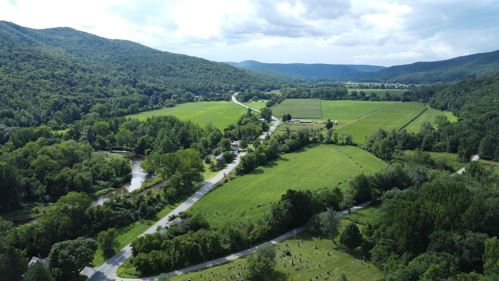

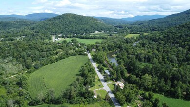
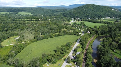
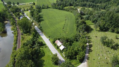
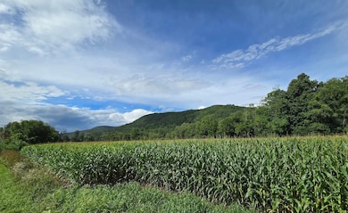
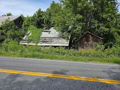
Explore this nearly ten-acre agricultural (or residential) parcel located at the intersection of Indian Massacre Road and Route 346 in Pownal, VT. This flat and fertile land, currently cultivated for corn, offers the potential to be leased by a farmer, providing income opportunities. The property features an 1800s Dutch-built barn, rich in historical character, though it requires restoration—an exciting prospect for those looking to preserve a piece of the past or envision something new. Pownal, Vermont’s southernmost town, is nestled between the Berkshire and Green Mountains, offering stunning scenic views and a peaceful rural setting. The area is conveniently situated near Bennington and Williamstown, MA, where you can enjoy cultural attractions, dining, and shopping. Whether you're interested in continuing agricultural use or seeking a serene location to build your dream home, this property is a unique opportunity waiting to be realized. For information on potential grants available for barn restoration, contact your agent about Vermont's Historic Preservation Barn Grants available through the Agency of Commerce and Community Development!
Last Agent to Sell the Property
Real Broker LLC License #082.0135053 Listed on: 08/14/2024
| Date | Event | Price | List to Sale | Price per Sq Ft |
|---|---|---|---|---|
| 08/13/2025 08/13/25 | Sold | $80,000 | -15.8% | -- |
| 11/09/2024 11/09/24 | For Sale | $95,000 | 0.0% | -- |
| 10/22/2024 10/22/24 | Pending | -- | -- | -- |
| 08/14/2024 08/14/24 | For Sale | $95,000 | -- | -- |
Seller's Agent in 2025
Betsy Adamovich
Real Broker LLC
(802) 772-0330
1 in this area
105 Total Sales
J
Buyer's Agent in 2025
Justin Tegen
McChesney RE, Inc.
(802) 325-3100
1 in this area
3 Total Sales
Source: PrimeMLS
MLS Number: 5009745
Disclaimer: Certain information contained herein is derived from information provided by parties other than Homes.com. All information provided is deemed reliable, but is not guaranteed to be accurate and should be independently verified.
![]() Copyright 2026 PrimeMLS, Inc. All rights reserved. This information is deemed reliable, but not guaranteed. The data relating to real estate displayed on this display comes in part from the IDX Program of PrimeMLS. The information being provided is for consumers’ personal, non-commercial use and may not be used for any purpose other than to identify prospective properties consumers may be interested in purchasing.
Copyright 2026 PrimeMLS, Inc. All rights reserved. This information is deemed reliable, but not guaranteed. The data relating to real estate displayed on this display comes in part from the IDX Program of PrimeMLS. The information being provided is for consumers’ personal, non-commercial use and may not be used for any purpose other than to identify prospective properties consumers may be interested in purchasing.
Ask me questions while you tour the home.