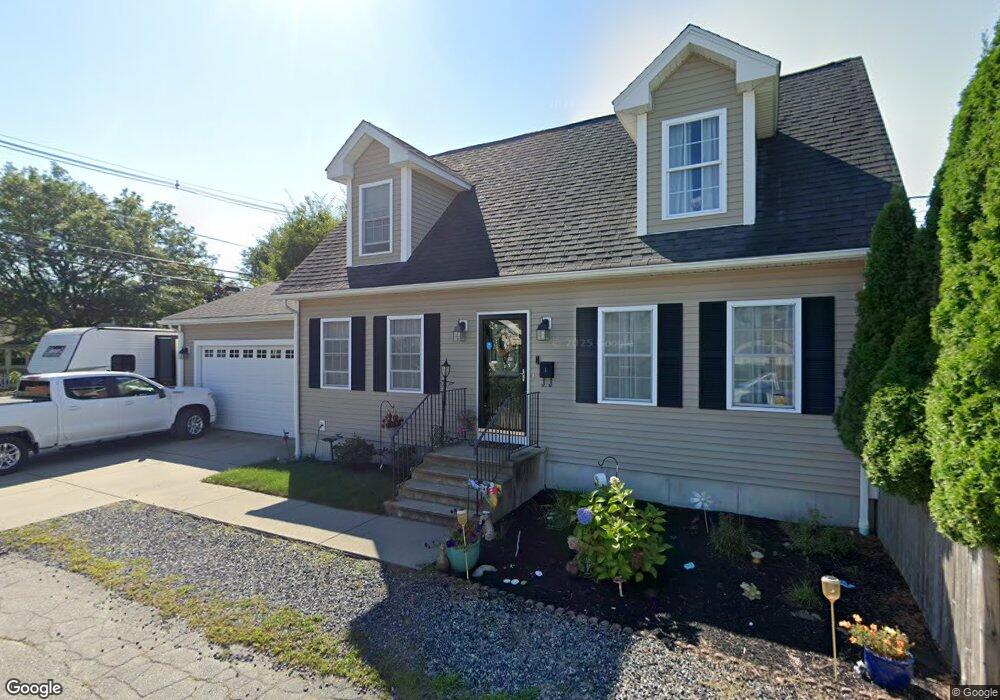
1 Clarke Ave Riverside, RI 02915
Riverside NeighborhoodEstimated Value: $499,000 - $651,000
3
Beds
2
Baths
1,547
Sq Ft
$361/Sq Ft
Est. Value
About This Home
This home is located at 1 Clarke Ave, Riverside, RI 02915 and is currently estimated at $558,157, approximately $360 per square foot. 1 Clarke Ave is a home with nearby schools including East Providence High School, St Luke Elementary School, and St Mary Academy-Bay View.
Ownership History
Date
Name
Owned For
Owner Type
Purchase Details
Closed on
Dec 14, 2009
Sold by
Costa Dev Llc
Bought by
Swanson Paul J and Swanson Heather M
Current Estimated Value
Home Financials for this Owner
Home Financials are based on the most recent Mortgage that was taken out on this home.
Original Mortgage
$250,282
Interest Rate
5.02%
Mortgage Type
Purchase Money Mortgage
Create a Home Valuation Report for This Property
The Home Valuation Report is an in-depth analysis detailing your home's value as well as a comparison with similar homes in the area
Home Values in the Area
Average Home Value in this Area
Purchase History
| Date | Buyer | Sale Price | Title Company |
|---|---|---|---|
| Swanson Paul J | $255,000 | -- | |
| Swanson Paul J | $255,000 | -- |
Source: Public Records
Mortgage History
| Date | Status | Borrower | Loan Amount |
|---|---|---|---|
| Open | Swanson Paul J | $236,000 | |
| Closed | Swanson Paul J | $250,282 |
Source: Public Records
Tax History
| Year | Tax Paid | Tax Assessment Tax Assessment Total Assessment is a certain percentage of the fair market value that is determined by local assessors to be the total taxable value of land and additions on the property. | Land | Improvement |
|---|---|---|---|---|
| 2025 | $6,032 | $461,500 | $97,400 | $364,100 |
| 2024 | $5,411 | $353,000 | $81,200 | $271,800 |
| 2023 | $5,210 | $353,000 | $81,200 | $271,800 |
| 2022 | $6,280 | $287,300 | $65,900 | $221,400 |
| 2021 | $6,177 | $287,300 | $65,900 | $221,400 |
| 2020 | $5,916 | $287,300 | $65,900 | $221,400 |
| 2019 | $5,752 | $287,300 | $65,900 | $221,400 |
| 2018 | $5,937 | $259,500 | $66,100 | $193,400 |
| 2017 | $5,805 | $259,500 | $66,100 | $193,400 |
| 2016 | $5,776 | $259,500 | $66,100 | $193,400 |
| 2015 | $5,361 | $233,600 | $53,800 | $179,800 |
| 2014 | $5,361 | $233,600 | $53,800 | $179,800 |
Source: Public Records
Map
Nearby Homes
- 595 Bullocks Point Ave
- 579 Bullocks Pt Ave
- 579 Bullocks Point Ave
- 56 White Ave
- 605 Bullocks Point Ave
- 577 Bullocks Point Ave
- 67 White Ave
- 52 White Ave
- 61 White Ave
- 59 White Ave
- 637 Bullocks Point Ave
- 680 Bullocks Point Ave
- 69 White Ave
- 57 White Ave
- 65 White Ave
- 53 White Ave
- 55 White Ave
- 71 White Ave
- 561 Bullocks Point Ave
- 639 Bullocks Point Ave
Your Personal Tour Guide
Ask me questions while you tour the home.