M
Seller's Agent in 2026
Maggie Gavin
William Pitt
(413) 822-4580
102 in this area
162 Total Sales
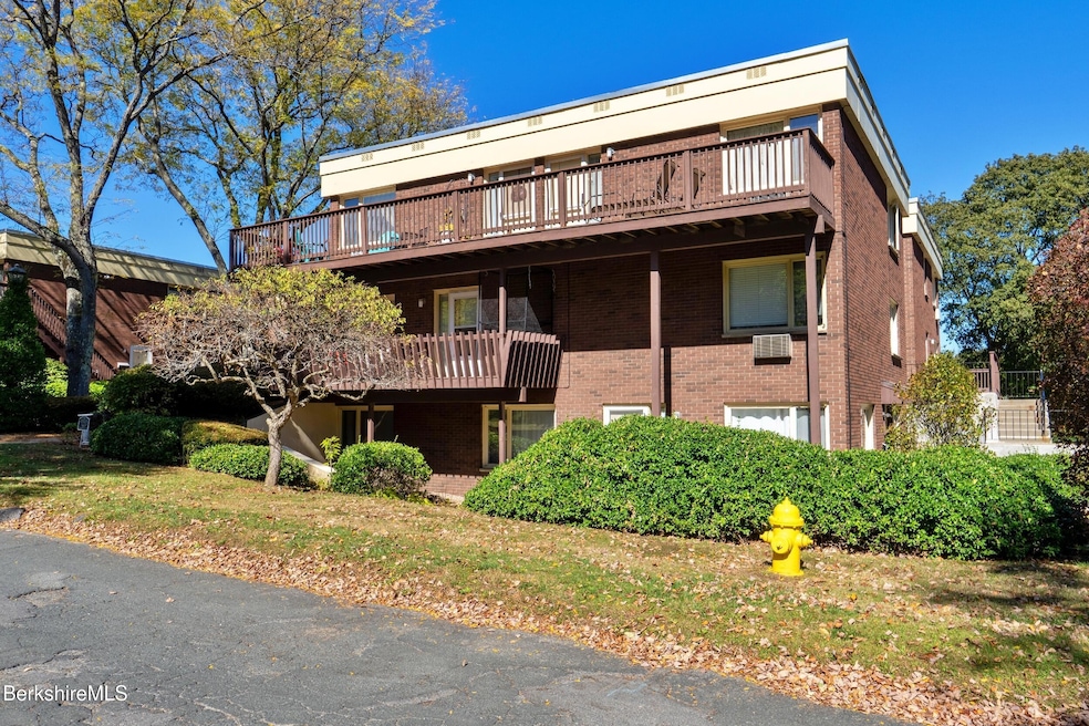
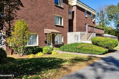
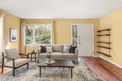
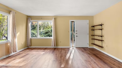
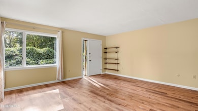
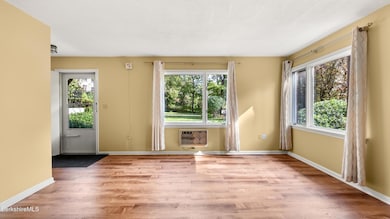
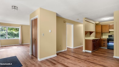
Enjoy easy, low-maintenance living in this charming 2-bedroom, 1-bathroom main-level condo that includes a freestanding garage. Perfectly located just moments from downtown Pittsfield, this home offers the ideal blend of comfort and convenience.Step inside to a bright, open living space with single-level access throughout. The kitchen and living areas flow seamlessly, making everyday living and entertaining a breeze. Two comfortable bedrooms and a full bath provide an efficient yet welcoming layout.Outside your door, enjoy all that Pittsfield has to offer -- the Colonial Theatre is right around the corner, and Barrington Stage Company, local eateries, coffee shops, and boutiques are just a stones throw away. With quick access to both North and South County
Last Agent to Sell the Property
WILLIAM PITT SOTHEBY'S - LENOX License #009529558 Listed on: 10/07/2025

Last Buyer's Agent
WILLIAM PITT SOTHEBY'S - LENOX License #009529558 Listed on: 10/07/2025
We collect this data history from publicly available records. To have your information removed, we recommend requesting removal directly through your county’s website.
| Date | Type | Sale Price | Title Company |
|---|---|---|---|
| Condominium Deed | $210,000 | -- | |
| Deed | -- | -- | |
| Deed | $127,000 | -- | |
| Deed | -- | -- |
We collect this data history from publicly available records. To have your information removed, we recommend requesting removal directly through your county’s website.
| Date | Status | Loan Amount | Loan Type |
|---|---|---|---|
| Open | $168,000 | New Conventional |
| Date | Event | Price | List to Sale | Price per Sq Ft |
|---|---|---|---|---|
| 04/01/2026 04/01/26 | Sold | $210,000 | -8.7% | $175 / Sq Ft |
| 01/30/2026 01/30/26 | Pending | -- | -- | -- |
| 01/07/2026 01/07/26 | Price Changed | $229,900 | -8.0% | $192 / Sq Ft |
| 10/07/2025 10/07/25 | For Sale | $249,900 | -- | $208 / Sq Ft |
| Year | Tax Paid | Tax Assessment Tax Assessment Total Assessment is a certain percentage of the fair market value that is determined by local assessors to be the total taxable value of land and additions on the property. | Land | Improvement |
|---|---|---|---|---|
| 2025 | $5,197 | $289,700 | $0 | $289,700 |
| 2024 | $4,797 | $260,000 | $0 | $260,000 |
| 2023 | $3,920 | $214,000 | $0 | $214,000 |
| 2022 | $3,322 | $179,000 | $0 | $179,000 |
| 2021 | $3,274 | $170,100 | $0 | $170,100 |
| 2020 | $3,305 | $167,700 | $0 | $167,700 |
| 2019 | $3,356 | $172,800 | $0 | $172,800 |
| 2018 | $3,334 | $166,600 | $0 | $166,600 |
| 2017 | $3,210 | $163,500 | $0 | $163,500 |
| 2016 | $3,122 | $166,400 | $0 | $166,400 |
| 2015 | $3,005 | $166,400 | $0 | $166,400 |
M
Seller's Agent in 2026
Maggie Gavin
William Pitt
(413) 822-4580
102 in this area
162 Total Sales
C
Seller Co-Listing Agent in 2026
Cody Gavin
William Pitt
(413) 822-4261
24 in this area
40 Total Sales
Source: Berkshire County Board of REALTORS®
MLS Number: 247964
APN: PITT-000007H-000099-000002
Disclaimer: Certain information contained herein is derived from information provided by parties other than Homes.com. All information provided is deemed reliable, but is not guaranteed to be accurate and should be independently verified.
![]() IDX information is provided exclusively for consumers' personal, non-commercial use, that it may not be used for any purpose other than to identify prospective properties consumers may be interested in purchasing. Information deemed to be reliable but not guaranteed.
IDX information is provided exclusively for consumers' personal, non-commercial use, that it may not be used for any purpose other than to identify prospective properties consumers may be interested in purchasing. Information deemed to be reliable but not guaranteed.
The data relating to real estate for sale on this website comes from Berkshire County Board of Realtors and the Broker Reciprocity Program.
Copyright 2026 Berkshire County Board of Realtors. All rights reserved.
Ask me questions while you tour the home.