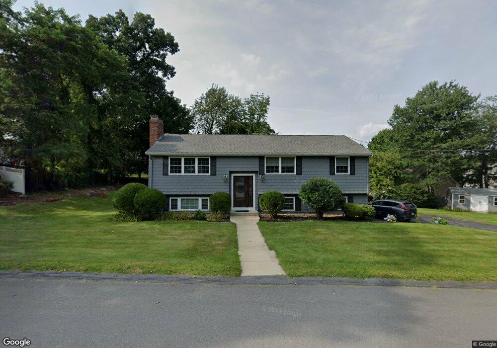
1 Hearthstone Dr Burlington, MA 01803
Burlington Town Center NeighborhoodEstimated Value: $790,153 - $1,126,000
3
Beds
3
Baths
1,765
Sq Ft
$511/Sq Ft
Est. Value
About This Home
This home is located at 1 Hearthstone Dr, Burlington, MA 01803 and is currently estimated at $902,038, approximately $511 per square foot. 1 Hearthstone Dr is a home located in Middlesex County with nearby schools including Burlington High School, Memorial Elementary School, and Marshall Simonds Middle School.
Ownership History
Date
Name
Owned For
Owner Type
Purchase Details
Closed on
Sep 2, 2016
Sold by
Sheldon Cheryl A
Bought by
Cheryl A Sheldon Ret
Current Estimated Value
Purchase Details
Closed on
Jun 3, 1991
Sold by
Puccia Mildred
Bought by
Sheldon Timothy P and Forti Cheryl A
Create a Home Valuation Report for This Property
The Home Valuation Report is an in-depth analysis detailing your home's value as well as a comparison with similar homes in the area
Home Values in the Area
Average Home Value in this Area
Purchase History
| Date | Buyer | Sale Price | Title Company |
|---|---|---|---|
| Cheryl A Sheldon Ret | -- | -- | |
| Sheldon Timothy P | $155,000 | -- |
Source: Public Records
Mortgage History
| Date | Status | Borrower | Loan Amount |
|---|---|---|---|
| Previous Owner | Sheldon Timothy P | $324,000 | |
| Previous Owner | Sheldon Timothy P | $50,000 | |
| Previous Owner | Sheldon Timothy P | $170,000 | |
| Previous Owner | Sheldon Timothy P | $25,000 |
Source: Public Records
Tax History
| Year | Tax Paid | Tax Assessment Tax Assessment Total Assessment is a certain percentage of the fair market value that is determined by local assessors to be the total taxable value of land and additions on the property. | Land | Improvement |
|---|---|---|---|---|
| 2025 | $6,205 | $716,500 | $414,100 | $302,400 |
| 2024 | $5,850 | $654,400 | $378,100 | $276,300 |
| 2023 | $5,609 | $596,700 | $327,700 | $269,000 |
| 2022 | $5,485 | $551,300 | $298,000 | $253,300 |
| 2021 | $5,342 | $536,900 | $283,600 | $253,300 |
| 2020 | $3,866 | $533,900 | $279,100 | $254,800 |
| 2019 | $5,073 | $484,100 | $261,100 | $223,000 |
| 2018 | $11,505 | $458,500 | $261,100 | $197,400 |
| 2017 | $4,798 | $458,500 | $261,100 | $197,400 |
| 2016 | $4,762 | $415,500 | $225,100 | $190,400 |
| 2015 | $4,715 | $415,400 | $225,100 | $190,300 |
| 2014 | $4,468 | $372,300 | $194,500 | $177,800 |
Source: Public Records
Map
Nearby Homes
Your Personal Tour Guide
Ask me questions while you tour the home.