1 Lanewood Rd Cumberland Foreside, ME 04110
Cumberland Foreside NeighborhoodEstimated Value: $1,364,000 - $1,645,000
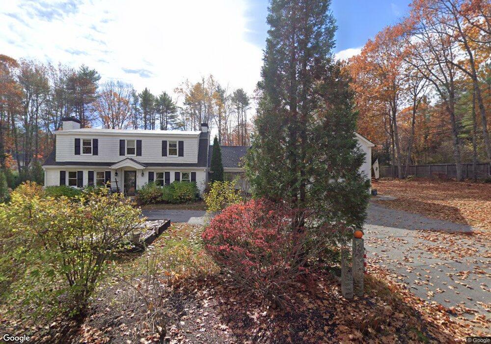
About This Home
This home is located at 1 Lanewood Rd, Cumberland Foreside, ME 04110 and is currently estimated at $1,500,209, approximately $393 per square foot. 1 Lanewood Rd is a home located in Cumberland County with nearby schools including Mabel I. Wilson School, Greely Middle School 4-5, and Greely Middle School.
Ownership History
We collect this data history from publicly available records. To have your information removed, we recommend requesting removal directly through your county’s website.
Purchase Details
Home Values in the Area
Average Home Value in this Area
Purchase History
We collect this data history from publicly available records. To have your information removed, we recommend requesting removal directly through your county’s website.
| Date | Buyer | Sale Price | Title Company |
|---|---|---|---|
| -- | -- | ||
| -- | -- | ||
| -- | -- |
Mortgage History
We collect this data history from publicly available records. To have your information removed, we recommend requesting removal directly through your county’s website.
| Date | Status | Borrower | Loan Amount |
|---|---|---|---|
| Open | $417,000 | ||
| Closed | $410,000 | ||
| Closed | $150,000 |
Tax History
We collect this data history from publicly available records. To have your information removed, we recommend requesting removal directly through your county’s website.
| Year | Tax Paid | Tax Assessment Tax Assessment Total Assessment is a certain percentage of the fair market value that is determined by local assessors to be the total taxable value of land and additions on the property. | Land | Improvement |
|---|---|---|---|---|
| 2025 | $13,776 | $547,100 | $235,400 | $311,700 |
| 2024 | $12,720 | $547,100 | $235,400 | $311,700 |
| 2023 | $12,118 | $547,100 | $235,400 | $311,700 |
| 2022 | $11,599 | $547,100 | $235,400 | $311,700 |
| 2021 | $11,243 | $547,100 | $235,400 | $311,700 |
| 2020 | $11,133 | $547,100 | $235,400 | $311,700 |
| 2019 | $10,860 | $547,100 | $235,400 | $311,700 |
| 2018 | $10,664 | $541,300 | $235,400 | $305,900 |
| 2017 | $8,640 | $459,600 | $235,400 | $224,200 |
| 2016 | $8,379 | $459,100 | $235,400 | $223,700 |
| 2015 | $8,310 | $459,100 | $235,400 | $223,700 |
| 2014 | $7,988 | $459,100 | $235,400 | $223,700 |
| 2013 | $7,805 | $459,100 | $235,400 | $223,700 |
Map
- 9 Conifer Ridge
- 59 Maeves Way
- 14 Pine Ridge Rd
- 86 Underwood Rd
- 59 Underwood Rd
- Lot 8 Sturdivant Island
- 255 Foreside Rd
- 337 Middle Rd
- 5 & 6 Harmony Way
- 5 Harmony Way
- 18 Greely Rd
- 9 Sea Spray Reach
- 142 Longwoods Rd
- 0 Ravine Dr Unit 1652137
- 135 Fairwind Ln
- 25 Daybreak Ln
- 275 Middle Rd
- 267 U S Route 1 Unit 308
- 267 U S 1 Unit 304
- 267 U S 1 Unit 305
- 97 Foreside Rd
- 13 Deans Way
- 3 Lanewood Rd
- 2 Lanewood Rd
- 96 Foreside Rd
- 113 Foreside Rd
- 41 Nubbin Way
- 100 Foreside Rd
- 26 Deans Way
- 4 Lanewood Rd
- 104 Foreside Rd Unit East Lot
- 104 Foreside Rd Unit West Lot
- 104 Foreside Rd
- 9 Osprey Reach
- 92 Foreside Rd
- 11 Lanewood Rd
- 106 Foreside Rd
- Lot B Chestnut Way
- 109 Foreside Rd
- 21 Heron Ln
Ask me questions while you tour the home.