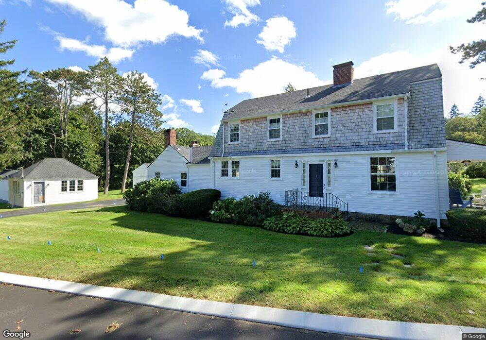
1 Longmeadow Rd Cumberland Foreside, ME 04110
Cumberland Foreside NeighborhoodEstimated Value: $1,345,234 - $1,668,000
2
Beds
3
Baths
2,933
Sq Ft
$527/Sq Ft
Est. Value
About This Home
This home is located at 1 Longmeadow Rd, Cumberland Foreside, ME 04110 and is currently estimated at $1,544,309, approximately $526 per square foot. 1 Longmeadow Rd is a home located in Cumberland County with nearby schools including Mabel I. Wilson School, Greely Middle School 4-5, and Greely Middle School.
Ownership History
Date
Name
Owned For
Owner Type
Purchase Details
Closed on
Sep 7, 2023
Sold by
Stevens Mark R
Bought by
Stevens Mark R and Mathieson Kristin M
Current Estimated Value
Create a Home Valuation Report for This Property
The Home Valuation Report is an in-depth analysis detailing your home's value as well as a comparison with similar homes in the area
Home Values in the Area
Average Home Value in this Area
Purchase History
| Date | Buyer | Sale Price | Title Company |
|---|---|---|---|
| Stevens Mark R | -- | None Available | |
| Stevens Mark R | -- | None Available |
Source: Public Records
Tax History
| Year | Tax Paid | Tax Assessment Tax Assessment Total Assessment is a certain percentage of the fair market value that is determined by local assessors to be the total taxable value of land and additions on the property. | Land | Improvement |
|---|---|---|---|---|
| 2025 | $14,018 | $556,700 | $306,400 | $250,300 |
| 2024 | $12,827 | $551,700 | $306,400 | $245,300 |
| 2023 | $12,220 | $551,700 | $306,400 | $245,300 |
| 2022 | $11,696 | $551,700 | $306,400 | $245,300 |
| 2021 | $11,337 | $551,700 | $306,400 | $245,300 |
| 2020 | $11,227 | $551,700 | $306,400 | $245,300 |
| 2019 | $10,951 | $551,700 | $306,400 | $245,300 |
| 2018 | $10,658 | $541,000 | $306,400 | $234,600 |
| 2017 | $10,171 | $541,000 | $306,400 | $234,600 |
| 2016 | $9,873 | $541,000 | $306,400 | $234,600 |
| 2015 | $9,792 | $541,000 | $306,400 | $234,600 |
| 2014 | $9,413 | $541,000 | $306,400 | $234,600 |
| 2013 | $9,197 | $541,000 | $306,400 | $234,600 |
Source: Public Records
Map
Nearby Homes
- 9 Conifer Ridge
- 59 Underwood Rd
- 24 Amerescoggin Rd
- 21 Johnson Rd
- 252 Foreside Rd
- 16 Town Landing Rd
- 5 & 6 Harmony Way
- 5 Harmony Way
- 18 Greely Rd
- 267 U S Route 1 Unit 308
- 127 Foreside Rd
- 140 Longwoods Rd
- 275 Middle Rd
- 0 Ravine Dr Unit 1652137
- 267 U S 1 Unit 304
- 267 U S 1 Unit 305
- 267 U S 1 Unit 301
- 267 U S 1 Unit 404
- 267 U S 1 Unit 201
- 267 U S 1 Unit 309
Your Personal Tour Guide
Ask me questions while you tour the home.