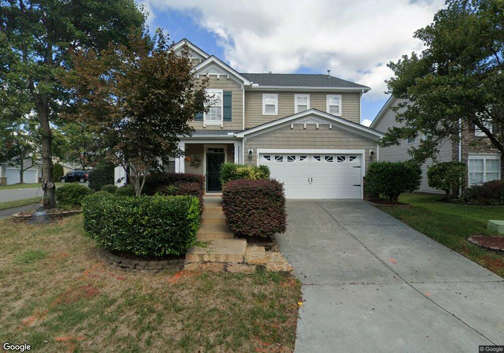
1 Red Sage Ct Durham, NC 27703
Eastern Durham NeighborhoodEstimated Value: $467,000 - $489,000
4
Beds
3
Baths
3,186
Sq Ft
$150/Sq Ft
Est. Value
About This Home
This home is located at 1 Red Sage Ct, Durham, NC 27703 and is currently estimated at $478,380, approximately $150 per square foot. 1 Red Sage Ct is a home located in Durham County with nearby schools including Spring Valley Elementary School, John W Neal Middle School, and Southern School of Energy & Sustainability.
Ownership History
Date
Name
Owned For
Owner Type
Purchase Details
Closed on
Apr 11, 2016
Sold by
Porter Billy W
Bought by
Lambert Katie and Lambert Matthew
Current Estimated Value
Home Financials for this Owner
Home Financials are based on the most recent Mortgage that was taken out on this home.
Original Mortgage
$261,250
Outstanding Balance
$207,887
Interest Rate
3.73%
Estimated Equity
$270,493
Purchase Details
Closed on
Jun 26, 2006
Sold by
Kb Home Raleigh Durham Llc
Bought by
Porter Billy W and Porter Claudette M
Home Financials for this Owner
Home Financials are based on the most recent Mortgage that was taken out on this home.
Original Mortgage
$143,000
Interest Rate
6.57%
Create a Home Valuation Report for This Property
The Home Valuation Report is an in-depth analysis detailing your home's value as well as a comparison with similar homes in the area
Home Values in the Area
Average Home Value in this Area
Purchase History
| Date | Buyer | Sale Price | Title Company |
|---|---|---|---|
| Lambert Katie | $275,000 | -- | |
| Porter Billy W | $278,500 | None Available |
Source: Public Records
Mortgage History
| Date | Status | Borrower | Loan Amount |
|---|---|---|---|
| Open | Lambert Katie | $261,250 | |
| Previous Owner | Porter Billy W | $143,000 |
Source: Public Records
Tax History
| Year | Tax Paid | Tax Assessment Tax Assessment Total Assessment is a certain percentage of the fair market value that is determined by local assessors to be the total taxable value of land and additions on the property. | Land | Improvement |
|---|---|---|---|---|
| 2025 | $5,019 | $506,275 | $107,625 | $398,650 |
| 2024 | $4,014 | $287,785 | $49,320 | $238,465 |
| 2023 | $3,770 | $287,785 | $49,320 | $238,465 |
| 2022 | $3,683 | $287,785 | $49,320 | $238,465 |
| 2021 | $3,666 | $287,785 | $49,320 | $238,465 |
| 2020 | $3,580 | $287,785 | $49,320 | $238,465 |
| 2019 | $3,580 | $287,785 | $49,320 | $238,465 |
| 2018 | $3,273 | $241,269 | $36,990 | $204,279 |
| 2017 | $3,249 | $241,269 | $36,990 | $204,279 |
| 2016 | $3,139 | $241,269 | $36,990 | $204,279 |
| 2015 | $3,536 | $255,400 | $45,157 | $210,243 |
| 2014 | $3,536 | $255,400 | $45,157 | $210,243 |
Source: Public Records
Map
Nearby Homes
- 6 Spicewood Ct
- 607 Ravenstone Ln
- 639 Conover Rd Unit A
- 639 Conover Rd Unit B
- 635 Conover Rd Unit A
- 635 Conover Rd Unit B
- 637 Conover Rd Unit B
- 634 Conover Rd
- 631 Ashburn Ln
- 2024 Bunchberry Ln
- 508 Ashburn Ln
- 1056 Arbor Edge Ln
- 1057 Arbor Edge Ln
- 403 Ravenstone Ln
- 618 Starry Sky Dr
- 626 Starry Sky Dr
- 339 Olive Branch Rd
- 636 Starry Sky Dr
- 817 Hester Rd
- 428 Holly Blossom Dr
- 3 Red Sage Ct
- 5 Red Sage Ct
- 608 Weathervane Dr
- 319 Hillview Dr
- 606 Weathervane Dr
- 610 Weathervane Dr
- 7 Red Sage Ct
- 317 Hillview Dr
- 702 Weathervane Dr
- 604 Weathervane Dr
- 315 Hillview Dr
- 4 Red Sage Ct
- 313 Hillview Dr
- 9 Red Sage Ct
- 704 Weathervane Dr
- 6 Red Sage Ct
- 602 Weathervane Dr
- 311 Hillview Dr
- 706 Weathervane Dr
- 11 Red Sage Ct
Your Personal Tour Guide
Ask me questions while you tour the home.