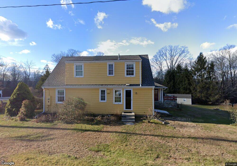
1 Route 87 Columbia, CT 06237
Columbia AreaEstimated Value: $311,000 - $389,000
About This Home
This home is located at 1 Route 87, Columbia, CT 06237 and is currently estimated at $359,170, approximately $222 per square foot. 1 Route 87 is a home located in Tolland County with nearby schools including Horace W. Porter School.
Ownership History
We collect this data history from publicly available records. To have your information removed, we recommend requesting removal directly through your county’s website.
Purchase Details
Home Values in the Area
Average Home Value in this Area
Purchase History
We collect this data history from publicly available records. To have your information removed, we recommend requesting removal directly through your county’s website.
| Date | Buyer | Sale Price | Title Company |
|---|---|---|---|
| $170,000 | -- |
Mortgage History
We collect this data history from publicly available records. To have your information removed, we recommend requesting removal directly through your county’s website.
| Date | Status | Borrower | Loan Amount |
|---|---|---|---|
| Closed | $55,000 | ||
| Closed | $83,210 | ||
| Closed | $45,000 |
Tax History
We collect this data history from publicly available records. To have your information removed, we recommend requesting removal directly through your county’s website.
| Year | Tax Paid | Tax Assessment Tax Assessment Total Assessment is a certain percentage of the fair market value that is determined by local assessors to be the total taxable value of land and additions on the property. | Land | Improvement |
|---|---|---|---|---|
| 2025 | $4,415 | $150,850 | $36,190 | $114,660 |
| 2024 | $4,242 | $150,850 | $36,190 | $114,660 |
| 2023 | $3,909 | $150,850 | $36,190 | $114,660 |
| 2022 | $3,984 | $154,000 | $36,190 | $117,810 |
| 2021 | $3,608 | $123,000 | $32,600 | $90,400 |
| 2020 | $3,608 | $123,000 | $32,600 | $90,400 |
| 2019 | $3,608 | $123,000 | $32,600 | $90,400 |
| 2018 | $3,608 | $123,000 | $32,600 | $90,400 |
| 2017 | $3,552 | $123,000 | $32,600 | $90,400 |
| 2016 | $3,315 | $120,800 | $32,600 | $88,200 |
| 2015 | $3,277 | $120,800 | $32,600 | $88,200 |
| 2014 | $3,277 | $120,800 | $32,600 | $88,200 |
Map
- 52 Whitney Rd
- 13 Route 6
- 59 Route 6 Unit U21-2
- 15 Dilaj Dr
- 209R Lake Rd
- 9 Gilead Rd
- 11 Bunker Hill Rd
- 0 Route 6 Unit 24187049
- Parcel 07-3 Wall St
- 141 Hop River Rd
- 87 Windrush Ln
- 486 Wall St
- 47 Cindy Dr
- 805 Pucker St
- 255 Cross St
- 90 Forest Rd
- 124 Shoddy Mill Rd
- 862 Babcock Hill Rd
- 355 Wall St
- 0 Seneca Trail
Ask me questions while you tour the home.