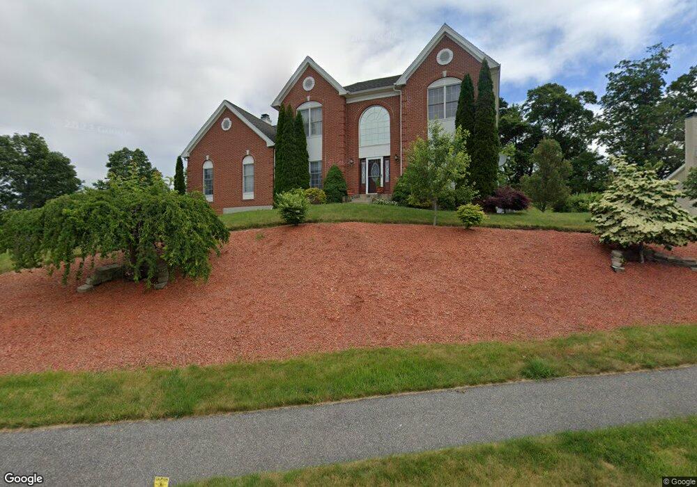
1 Sinclair Rd Shrewsbury, MA 01545
Estimated Value: $1,040,639 - $1,205,000
4
Beds
3
Baths
3,014
Sq Ft
$380/Sq Ft
Est. Value
About This Home
This home is located at 1 Sinclair Rd, Shrewsbury, MA 01545 and is currently estimated at $1,145,160, approximately $379 per square foot. 1 Sinclair Rd is a home located in Worcester County with nearby schools including Floral Street School, Sherwood Middle School, and Oak Middle School.
Create a Home Valuation Report for This Property
The Home Valuation Report is an in-depth analysis detailing your home's value as well as a comparison with similar homes in the area
Home Values in the Area
Average Home Value in this Area
Tax History
| Year | Tax Paid | Tax Assessment Tax Assessment Total Assessment is a certain percentage of the fair market value that is determined by local assessors to be the total taxable value of land and additions on the property. | Land | Improvement |
|---|---|---|---|---|
| 2025 | $111 | $920,400 | $284,700 | $635,700 |
| 2024 | $11,250 | $908,700 | $270,900 | $637,800 |
| 2023 | $10,482 | $798,900 | $270,900 | $528,000 |
| 2022 | $9,630 | $682,500 | $240,800 | $441,700 |
| 2021 | $8,589 | $651,200 | $240,800 | $410,400 |
| 2020 | $8,234 | $660,300 | $240,800 | $419,500 |
| 2019 | $7,834 | $623,200 | $230,900 | $392,300 |
| 2018 | $7,767 | $613,500 | $213,200 | $400,300 |
| 2017 | $7,444 | $580,200 | $193,000 | $387,200 |
| 2016 | $7,493 | $576,400 | $181,000 | $395,400 |
| 2015 | $7,152 | $541,800 | $162,500 | $379,300 |
Source: Public Records
Map
Nearby Homes
- 495 Grafton St
- 21 Grove St
- 7 Dickinson Cir
- 25 Farmington Dr
- 95 Grove St
- 9 Howe Ave
- 650 Grafton St
- 20 Rockwell Dr
- 194 Oak St
- 90 Cherry St
- 172 Crescent St
- 17 Stone Ave
- 565 Lake St
- 12 Williamsburg Ct Unit 1
- 29 Harrington Farms Way
- 12 Casavan Ave
- 7 Blossom Tree Dr
- 30 Clews St
- 70 Orchard Meadow Dr
- 47 Orchard Meadow Dr
Your Personal Tour Guide
Ask me questions while you tour the home.