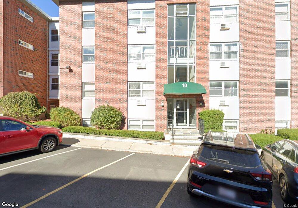
10 Commonwealth Ct Unit 9 Brighton, MA 02135
Commonwealth NeighborhoodEstimated Value: $441,000 - $476,000
2
Beds
1
Bath
738
Sq Ft
$627/Sq Ft
Est. Value
About This Home
This home is located at 10 Commonwealth Ct Unit 9, Brighton, MA 02135 and is currently estimated at $463,031, approximately $627 per square foot. 10 Commonwealth Ct Unit 9 is a home located in Suffolk County with nearby schools including Boston Green Academy Horace Mann Charter School, Torah Academy, and St Joseph Preparatory High School.
Ownership History
Date
Name
Owned For
Owner Type
Purchase Details
Closed on
Nov 19, 1997
Sold by
Tsang Ming G and Kao Ya C
Bought by
Einhorn Robert
Current Estimated Value
Home Financials for this Owner
Home Financials are based on the most recent Mortgage that was taken out on this home.
Original Mortgage
$71,200
Outstanding Balance
$10,326
Interest Rate
7.17%
Mortgage Type
Purchase Money Mortgage
Estimated Equity
$452,705
Purchase Details
Closed on
Jan 22, 1993
Sold by
Rodriguez Adriana P and Clinton Leroy P
Bought by
Tsang Ming G and Kao Ya C
Home Financials for this Owner
Home Financials are based on the most recent Mortgage that was taken out on this home.
Original Mortgage
$58,000
Interest Rate
8.15%
Mortgage Type
Purchase Money Mortgage
Create a Home Valuation Report for This Property
The Home Valuation Report is an in-depth analysis detailing your home's value as well as a comparison with similar homes in the area
Home Values in the Area
Average Home Value in this Area
Purchase History
| Date | Buyer | Sale Price | Title Company |
|---|---|---|---|
| Einhorn Robert | $89,000 | -- | |
| Einhorn Robert | $89,000 | -- | |
| Tsang Ming G | $72,500 | -- | |
| Tsang Ming G | $72,500 | -- |
Source: Public Records
Mortgage History
| Date | Status | Borrower | Loan Amount |
|---|---|---|---|
| Open | Einhorn Robert | $71,200 | |
| Closed | Tsang Ming G | $71,200 | |
| Previous Owner | Tsang Ming G | $58,000 |
Source: Public Records
Tax History
| Year | Tax Paid | Tax Assessment Tax Assessment Total Assessment is a certain percentage of the fair market value that is determined by local assessors to be the total taxable value of land and additions on the property. | Land | Improvement |
|---|---|---|---|---|
| 2025 | $4,468 | $385,800 | $0 | $385,800 |
| 2024 | $4,115 | $377,500 | $0 | $377,500 |
| 2023 | $4,054 | $377,500 | $0 | $377,500 |
| 2022 | $3,875 | $356,200 | $0 | $356,200 |
| 2021 | $3,761 | $352,500 | $0 | $352,500 |
| 2020 | $3,288 | $311,400 | $0 | $311,400 |
| 2019 | $3,217 | $305,200 | $0 | $305,200 |
| 2018 | $2,990 | $285,300 | $0 | $285,300 |
| 2017 | $2,798 | $264,200 | $0 | $264,200 |
| 2016 | $2,666 | $242,400 | $0 | $242,400 |
| 2015 | $3,026 | $249,900 | $0 | $249,900 |
| 2014 | $2,968 | $235,900 | $0 | $235,900 |
Source: Public Records
Map
Nearby Homes
- 15 Commonwealth Ct Unit 10
- 8 Commonwealth Ct Unit 7
- 208 Allston St Unit 4
- 1480 Commonwealth Ave Unit 10
- 4 Commonwealth Ct Unit 17
- 11 Vinal St Unit 5
- 198 Allston St Unit 3
- 1515 Commonwealth Ave Unit 503
- 1515 Commonwealth Ave Unit 508
- 1515 Commonwealth Ave Unit 504
- 1515 Commonwealth Ave Unit 509
- 1515 Commonwealth Ave Unit 702
- 1515 Commonwealth Ave Unit 303
- 1515 Commonwealth Ave Unit 714
- 1515 Commonwealth Ave Unit 311
- 1515 Commonwealth Ave Unit 607
- 1515 Commonwealth Ave Unit 405
- 300 Allston St Unit 401
- 300 Allston St Unit 205
- 147 Kelton St Unit 305
- 10 Commonwealth Ct Unit 10
- 10 Commonwealth Ct Unit 16
- 10 Commonwealth Ct Unit 15
- 10 Commonwealth Ct Unit 14
- 10 Commonwealth Ct Unit 13
- 10 Commonwealth Ct Unit 12
- 10 Commonwealth Ct Unit 11
- 10 Commonwealth Ct
- 10 Commonwealth Ct Unit 8
- 10 Commonwealth Ct Unit 7
- 10 Commonwealth Ct Unit 6
- 10 Commonwealth Ct Unit 5
- 10 Commonwealth Ct Unit 4
- 10 Commonwealth Ct Unit 2
- 10 Commonwealth Ct Unit 1
- 10 Commonwealth Ct Unit 12-505
- 10 Commonwealth Ct Unit 12-605
- 10 Commonwealth Ct Unit 17
- 10 Commonwealth Ct Unit 13 10
- 10 Commonwealth Ct Unit 1,10
Your Personal Tour Guide
Ask me questions while you tour the home.