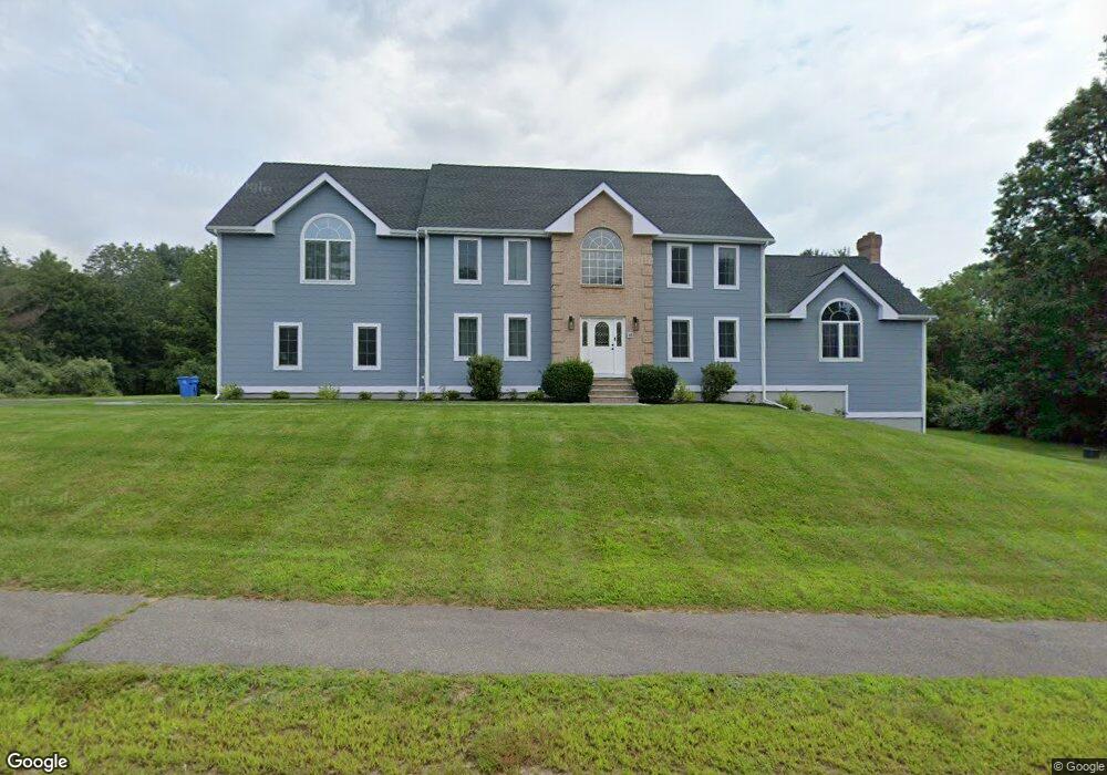
10 Comstock Dr Wrentham, MA 02093
West Wrentham NeighborhoodEstimated Value: $1,160,831 - $1,490,000
About This Home
This home is located at 10 Comstock Dr, Wrentham, MA 02093 and is currently estimated at $1,270,708, approximately $309 per square foot. 10 Comstock Dr is a home located in Norfolk County with nearby schools including Delaney Elementary School, Charles E Roderick, and Benjamin Franklin Classical Charter Public School.
Ownership History
We collect this data history from publicly available records. To have your information removed, we recommend requesting removal directly through your county’s website.
Purchase Details
Home Values in the Area
Average Home Value in this Area
Purchase History
We collect this data history from publicly available records. To have your information removed, we recommend requesting removal directly through your county’s website.
| Date | Buyer | Sale Price | Title Company |
|---|---|---|---|
| $95,000 | -- |
Mortgage History
We collect this data history from publicly available records. To have your information removed, we recommend requesting removal directly through your county’s website.
| Date | Status | Borrower | Loan Amount |
|---|---|---|---|
| Open | $200,000 |
Tax History
We collect this data history from publicly available records. To have your information removed, we recommend requesting removal directly through your county’s website.
| Year | Tax Paid | Tax Assessment Tax Assessment Total Assessment is a certain percentage of the fair market value that is determined by local assessors to be the total taxable value of land and additions on the property. | Land | Improvement |
|---|---|---|---|---|
| 2025 | $12,393 | $1,069,300 | $299,600 | $769,700 |
| 2024 | $11,816 | $984,700 | $299,600 | $685,100 |
| 2023 | $11,926 | $945,000 | $272,400 | $672,600 |
| 2022 | $11,390 | $833,200 | $245,600 | $587,600 |
| 2021 | $10,683 | $759,300 | $219,400 | $539,900 |
| 2020 | $11,220 | $787,400 | $200,400 | $587,000 |
| 2019 | $10,476 | $741,900 | $182,100 | $559,800 |
| 2018 | $10,095 | $708,900 | $181,900 | $527,000 |
| 2017 | $9,760 | $684,900 | $178,400 | $506,500 |
| 2016 | $9,650 | $675,800 | $173,200 | $502,600 |
| 2015 | $9,789 | $653,500 | $166,500 | $487,000 |
| 2014 | $9,578 | $625,600 | $160,100 | $465,500 |
Map
- 42 Georgiana Dr
- 22 Rhodes Dr
- 18 Manchester Dr
- 20 Peggy Dr
- 4 Dix Rd
- 2 Harrison Place
- 80 Fisher Rd Unit 77
- 80 Fisher Rd Unit 73
- 80 Fisher Rd Unit 97
- 172 Pine Swamp Rd
- 165 Pine Swamp Rd
- 180 Pine Swamp Rd
- 15 Austin Dr
- 39 Jackson Cir
- 152 Forest St
- 74 Whipple Brook Rd
- 365 W Wrentham Rd
- 36 Jackson Cir
- 15 Oakhill Ave
- 376 Hancock St
- 0 Lot 5 Comstock Unit 50357240
- 5 Comstock Dr
- 20 Comstock Dr
- 15 Comstock Dr
- 80 Cumberland Rd
- 133 Cumberland Rd
- 10 Heather Ln
- 87 Cumberland Rd
- 15 Boyden Rd
- 30 Comstock Dr
- 20 Heather Ln
- 145 Cumberland Rd
- 25 Comstock Dr
- 57 Ray Rd
- 155 Cumberland Rd
- 44 Ray Rd
- 15 Heather Ln
- 134 Cumberland Rd
- 20 Boyden Rd
- 25 Boyden Rd
Ask me questions while you tour the home.