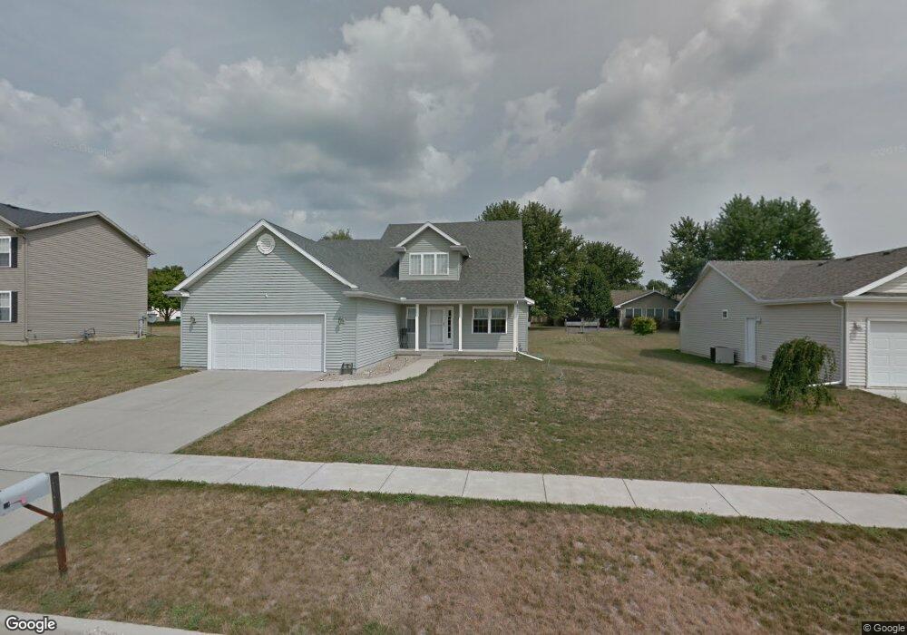
10 Delmar Dr Clinton, IL 61727
Estimated Value: $300,000 - $319,000
5
Beds
4
Baths
3,468
Sq Ft
$90/Sq Ft
Est. Value
About This Home
This home is located at 10 Delmar Dr, Clinton, IL 61727 and is currently estimated at $313,728, approximately $90 per square foot. 10 Delmar Dr is a home located in De Witt County with nearby schools including Clinton High School and Clinton Christian Academy.
Ownership History
Date
Name
Owned For
Owner Type
Purchase Details
Closed on
May 3, 2021
Sold by
Koritz Karle E and Koritz Katy L
Bought by
Holl Timothy M and Hines-Holl Hillary B
Current Estimated Value
Home Financials for this Owner
Home Financials are based on the most recent Mortgage that was taken out on this home.
Original Mortgage
$223,250
Outstanding Balance
$202,320
Interest Rate
3.1%
Mortgage Type
New Conventional
Estimated Equity
$111,408
Purchase Details
Closed on
Jul 12, 2012
Sold by
Lamothe Levi J
Bought by
Koritz Karlee and Koritz Katy L
Home Financials for this Owner
Home Financials are based on the most recent Mortgage that was taken out on this home.
Original Mortgage
$194,750
Interest Rate
3.65%
Purchase Details
Closed on
Jul 11, 2012
Sold by
Lamothe Ulana
Bought by
Koritz Karlee and Koritz Katy L
Home Financials for this Owner
Home Financials are based on the most recent Mortgage that was taken out on this home.
Original Mortgage
$194,750
Interest Rate
3.65%
Create a Home Valuation Report for This Property
The Home Valuation Report is an in-depth analysis detailing your home's value as well as a comparison with similar homes in the area
Home Values in the Area
Average Home Value in this Area
Purchase History
| Date | Buyer | Sale Price | Title Company |
|---|---|---|---|
| Holl Timothy M | -- | None Listed On Document | |
| Koritz Karlee | $102,500 | -- | |
| Koritz Karlee | $102,500 | -- |
Source: Public Records
Mortgage History
| Date | Status | Borrower | Loan Amount |
|---|---|---|---|
| Open | Holl Timothy M | $223,250 | |
| Previous Owner | Koritz Karlee | $194,750 | |
| Previous Owner | Koritz Karlee | $194,750 |
Source: Public Records
Tax History
| Year | Tax Paid | Tax Assessment Tax Assessment Total Assessment is a certain percentage of the fair market value that is determined by local assessors to be the total taxable value of land and additions on the property. | Land | Improvement |
|---|---|---|---|---|
| 2024 | $6,366 | $87,456 | $12,684 | $74,772 |
| 2023 | $5,916 | $79,650 | $11,552 | $68,098 |
| 2022 | $5,636 | $75,141 | $10,898 | $64,243 |
| 2021 | $5,512 | $72,953 | $10,581 | $62,372 |
| 2020 | $5,704 | $72,953 | $10,581 | $62,372 |
| 2019 | $5,740 | $72,953 | $10,581 | $62,372 |
| 2018 | $5,584 | $71,243 | $10,333 | $60,910 |
| 2017 | $5,492 | $69,360 | $9,936 | $59,424 |
| 2016 | $5,388 | $68,000 | $9,741 | $58,259 |
| 2015 | $5,210 | $68,000 | $9,741 | $58,259 |
| 2014 | $5,210 | $68,000 | $9,741 | $58,259 |
| 2013 | -- | $68,000 | $9,741 | $58,259 |
Source: Public Records
Map
Nearby Homes
- 66 Holiday Dr
- 8 Edgelea Cir
- 0 Betty Ln Unit 10514801
- 901 Illinois 10
- 301 S Walnut St
- 700 W Main St
- 715 W Main St
- 3 Deerefield Ct
- 219 S Jackson St
- 319 W Washington St
- 517 N Walnut St
- 509 W Clay St
- 701 S Cain St
- 709 N Center St
- 504 S Isabella St
- 609 E Clay St
- 7845 Fitzgerald Rd
- 1202 E Jefferson St
- 713 N George St
- 1210 E Main St
Your Personal Tour Guide
Ask me questions while you tour the home.