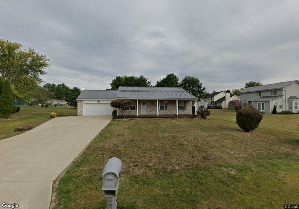
10 Douglas Cir Georgetown, OH 45121
Estimated Value: $215,416 - $241,000
3
Beds
2
Baths
1,200
Sq Ft
$190/Sq Ft
Est. Value
About This Home
This home is located at 10 Douglas Cir, Georgetown, OH 45121 and is currently estimated at $228,354, approximately $190 per square foot. 10 Douglas Cir is a home located in Brown County with nearby schools including Georgetown Elementary School and Georgetown Jr/Sr High School.
Ownership History
Date
Name
Owned For
Owner Type
Purchase Details
Closed on
Oct 22, 2002
Sold by
Schuster John
Bought by
Jodrey John S Thomas Judy
Current Estimated Value
Home Financials for this Owner
Home Financials are based on the most recent Mortgage that was taken out on this home.
Original Mortgage
$87,000
Outstanding Balance
$34,594
Interest Rate
6.24%
Mortgage Type
New Conventional
Estimated Equity
$193,760
Purchase Details
Closed on
Jul 23, 2002
Sold by
Ptns J R
Bought by
Schuster John and Schuster Cheryl
Create a Home Valuation Report for This Property
The Home Valuation Report is an in-depth analysis detailing your home's value as well as a comparison with similar homes in the area
Home Values in the Area
Average Home Value in this Area
Purchase History
We collect this data history from publicly available records. To have your information removed, we recommend requesting removal directly through your county’s website.
| Date | Buyer | Sale Price | Title Company |
|---|---|---|---|
| Jodrey John S Thomas Judy | $92,000 | -- | |
| Schuster John | $12,500 | -- |
Source: Public Records
Mortgage History
We collect this data history from publicly available records. To have your information removed, we recommend requesting removal directly through your county’s website.
| Date | Status | Borrower | Loan Amount |
|---|---|---|---|
| Open | Jodrey John S Thomas Judy | $87,000 |
Source: Public Records
Tax History
| Year | Tax Paid | Tax Assessment Tax Assessment Total Assessment is a certain percentage of the fair market value that is determined by local assessors to be the total taxable value of land and additions on the property. | Land | Improvement |
|---|---|---|---|---|
| 2025 | $1,667 | $57,220 | $9,710 | $47,510 |
| 2024 | $1,667 | $57,220 | $9,710 | $47,510 |
| 2023 | $1,680 | $45,360 | $8,400 | $36,960 |
| 2022 | $1,749 | $45,360 | $8,400 | $36,960 |
| 2021 | $1,733 | $45,360 | $8,400 | $36,960 |
| 2020 | $1,534 | $37,800 | $7,000 | $30,800 |
| 2019 | $1,523 | $37,800 | $7,000 | $30,800 |
| 2018 | $1,512 | $37,800 | $7,000 | $30,800 |
| 2017 | $1,215 | $36,050 | $7,700 | $28,350 |
| 2016 | $1,214 | $36,050 | $7,700 | $28,350 |
| 2015 | $1,230 | $36,050 | $7,700 | $28,350 |
| 2014 | $1,257 | $35,350 | $7,000 | $28,350 |
| 2013 | $1,253 | $35,350 | $7,000 | $28,350 |
Source: Public Records
Map
Nearby Homes
- 110 Douglas Ln
- 95 Harmony Ln
- 100 Douglas Ln
- 44 Douglas Cir
- 28 Douglas Cir
- 90 Douglas Ln
- 100 Harmony Ln
- 85 Harmony Ln
- 85 Harmony Ln
- 215 Douglas Cir
- 30 Douglas Cir
- 0 Douglas Ln Unit 1641744
- 0 Douglas Ln
- 80 Douglas Ln
- 40 Douglas Cir
- 55 Douglas Cir
- 105 Douglas Ln
- 75 Harmony Ln
- 85 Douglas Ln
- 210 Douglas Cir
Your Personal Tour Guide
Ask me questions while you tour the home.