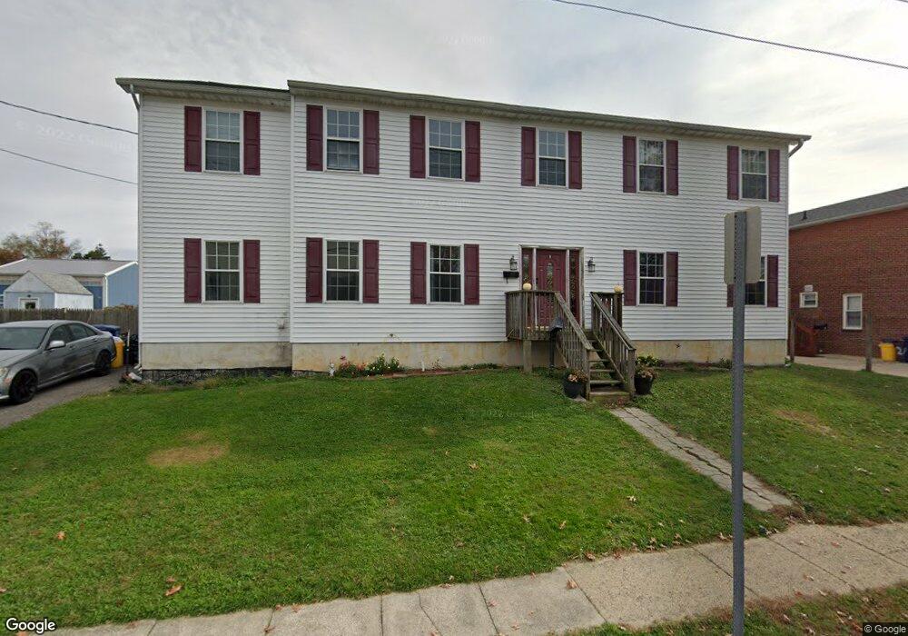
10 E Mill Rd Maple Shade, NJ 08052
Estimated Value: $272,000 - $605,121
4
Beds
4
Baths
3,340
Sq Ft
$150/Sq Ft
Est. Value
About This Home
This home is located at 10 E Mill Rd, Maple Shade, NJ 08052 and is currently estimated at $501,030, approximately $150 per square foot. 10 E Mill Rd is a home located in Burlington County with nearby schools including Maude M. Wilkins Elementary School, Ralph J Steinhauer Elementary School, and Howard R Yocum School.
Ownership History
Date
Name
Owned For
Owner Type
Purchase Details
Closed on
Sep 13, 2005
Sold by
Murphy Edward V
Bought by
Layne Charles J and Layne Catherine
Current Estimated Value
Home Financials for this Owner
Home Financials are based on the most recent Mortgage that was taken out on this home.
Original Mortgage
$189,000
Outstanding Balance
$114,245
Interest Rate
7.99%
Mortgage Type
Fannie Mae Freddie Mac
Estimated Equity
$386,785
Create a Home Valuation Report for This Property
The Home Valuation Report is an in-depth analysis detailing your home's value as well as a comparison with similar homes in the area
Home Values in the Area
Average Home Value in this Area
Purchase History
| Date | Buyer | Sale Price | Title Company |
|---|---|---|---|
| Layne Charles J | $210,000 | New Jersey Title Ins Co |
Source: Public Records
Mortgage History
| Date | Status | Borrower | Loan Amount |
|---|---|---|---|
| Open | Layne Charles J | $189,000 |
Source: Public Records
Tax History
| Year | Tax Paid | Tax Assessment Tax Assessment Total Assessment is a certain percentage of the fair market value that is determined by local assessors to be the total taxable value of land and additions on the property. | Land | Improvement |
|---|---|---|---|---|
| 2025 | $11,111 | $292,700 | $49,800 | $242,900 |
| 2024 | $10,789 | $292,700 | $49,800 | $242,900 |
| 2023 | $10,789 | $292,700 | $49,800 | $242,900 |
| 2022 | $10,622 | $292,700 | $49,800 | $242,900 |
| 2021 | $10,520 | $292,700 | $49,800 | $242,900 |
| 2020 | $10,549 | $292,700 | $49,800 | $242,900 |
| 2019 | $10,163 | $292,700 | $49,800 | $242,900 |
| 2018 | $9,987 | $292,700 | $49,800 | $242,900 |
| 2017 | $9,870 | $292,700 | $49,800 | $242,900 |
| 2016 | $9,723 | $292,700 | $49,800 | $242,900 |
| 2015 | $9,513 | $292,700 | $49,800 | $242,900 |
| 2014 | $9,223 | $292,700 | $49,800 | $242,900 |
Source: Public Records
Map
Nearby Homes
- 109 E Mill Rd
- 204 E Mill Rd
- 105 County Ave
- 106 W Mill Rd
- 28 W Center Ave
- 427 Cutler Ave
- 66 W Center Ave
- 223 Ruth Ave
- 226 Ruth Ave
- 61 S Maple Ave
- 115 S Walnut Ave
- 42 Spruce Ave
- 47 S Lippincott Ave
- 44 S Pine Ave
- 48 Helen Ave
- 57 S Terrace Ave
- 311 Gradwell Ave
- 15 S Pine Ave
- 10 Coles Ave
- 180 Cherry Tree Ln
- 2 E Mill Rd Unit A
- 2 E Mill Rd Unit 2c
- 2 E Mill Rd
- 14 E Mill Rd
- 516 Buena Vista Ave
- 515 S Forklanding Rd
- 0 W Mill Rd Unit 1002578696
- 22 E Mill Rd
- 7 E Mill Rd Unit D
- 7 E Mill Rd
- 521 S Forklanding Rd
- 520 Buena Vista Ave
- 450 S Forklanding Rd
- 28 E Mill Rd
- 15 E Mill Rd
- 510 S Forklanding Rd
- 451 S Forklanding Rd
- 19 E Mill Rd
- 521 Buena Vista Ave
- 446 S Forklanding Rd
Your Personal Tour Guide
Ask me questions while you tour the home.