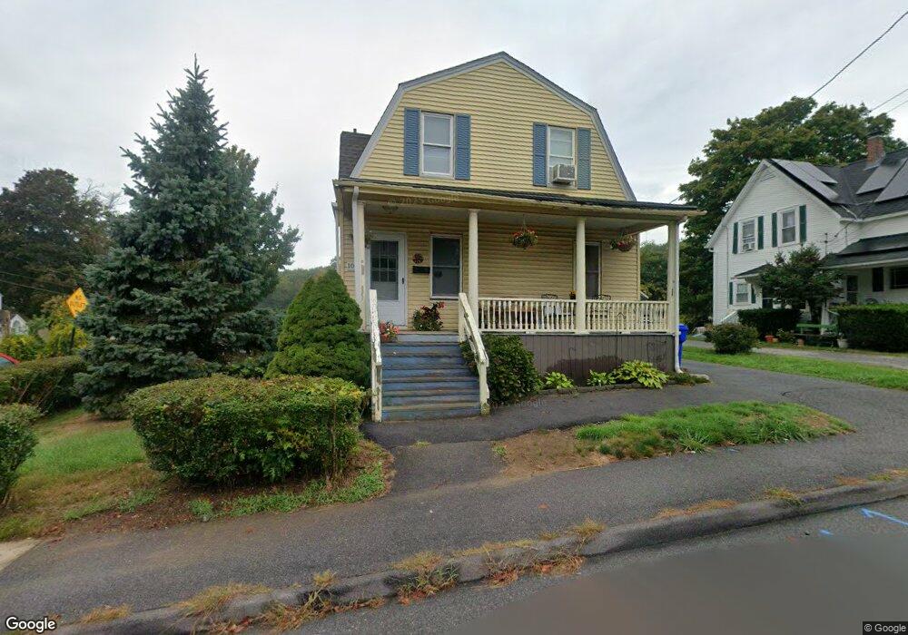
10 Fairview Ave Taunton, MA 02780
Estimated Value: $431,375 - $533,000
4
Beds
1
Bath
1,555
Sq Ft
$308/Sq Ft
Est. Value
About This Home
This home is located at 10 Fairview Ave, Taunton, MA 02780 and is currently estimated at $479,094, approximately $308 per square foot. 10 Fairview Ave is a home located in Bristol County with nearby schools including Mulcahey Elementary School, Taunton High School, and John F. Parker Middle School.
Ownership History
Date
Name
Owned For
Owner Type
Purchase Details
Closed on
Jun 8, 2022
Sold by
Decastro Edward E
Bought by
Machado Susan E
Current Estimated Value
Purchase Details
Closed on
Aug 18, 1995
Sold by
Menoche Josephine E
Bought by
Decastro Joanne L
Home Financials for this Owner
Home Financials are based on the most recent Mortgage that was taken out on this home.
Original Mortgage
$70,000
Interest Rate
7.61%
Mortgage Type
Purchase Money Mortgage
Create a Home Valuation Report for This Property
The Home Valuation Report is an in-depth analysis detailing your home's value as well as a comparison with similar homes in the area
Home Values in the Area
Average Home Value in this Area
Purchase History
We collect this data history from publicly available records. To have your information removed, we recommend requesting removal directly through your county’s website.
| Date | Buyer | Sale Price | Title Company |
|---|---|---|---|
| Machado Susan E | -- | None Available | |
| Decastro Edward E | -- | None Available | |
| Decastro Joanne L | $87,500 | -- |
Source: Public Records
Mortgage History
We collect this data history from publicly available records. To have your information removed, we recommend requesting removal directly through your county’s website.
| Date | Status | Borrower | Loan Amount |
|---|---|---|---|
| Previous Owner | Decastro Joanne L | $70,000 |
Source: Public Records
Tax History
| Year | Tax Paid | Tax Assessment Tax Assessment Total Assessment is a certain percentage of the fair market value that is determined by local assessors to be the total taxable value of land and additions on the property. | Land | Improvement |
|---|---|---|---|---|
| 2025 | $3,944 | $360,500 | $105,700 | $254,800 |
| 2024 | $3,543 | $316,600 | $105,700 | $210,900 |
| 2023 | $3,545 | $294,200 | $110,500 | $183,700 |
| 2022 | $3,295 | $250,000 | $85,700 | $164,300 |
| 2021 | $3,164 | $222,800 | $77,900 | $144,900 |
| 2020 | $3,040 | $204,600 | $77,900 | $126,700 |
| 2019 | $2,919 | $185,200 | $77,900 | $107,300 |
| 2018 | $2,836 | $180,400 | $77,700 | $102,700 |
| 2017 | $2,553 | $162,500 | $73,700 | $88,800 |
| 2016 | $2,473 | $157,700 | $71,500 | $86,200 |
| 2015 | $2,430 | $161,900 | $72,200 | $89,700 |
| 2014 | $2,342 | $160,300 | $69,300 | $91,000 |
Source: Public Records
Map
Nearby Homes
- 196 Highland St
- 198 Highland St
- 3 Crossman St Unit B
- 162 Oak St Unit 18
- 321 Winthrop St Unit 103
- 321 Winthrop St Unit 105
- 321 Winthrop St Unit 121
- 24 Highland Terrace
- 686 Cohannet St
- 10 Edson St
- 10 Oak Ave
- 125 Highland St Unit 308
- 85 Kilmer Ave
- 79 Kilmer Ave
- 16 Kilmer Ave
- 50 Highland St Unit 137
- 50 Highland St Unit 260
- 50 Highland St Unit 222
- 50 Highland St Unit 30
- 410 Cohannet St
- 18 Fairview Ave
- 20 Fairview Ave
- 16 Fairview Ave
- 3 Alpine Ave
- 22 Fairview Ave
- 17 Fairview Ave
- 13 Fairview Ave
- 15 Fairview Ave
- 15 Fairview Ave Unit 15
- 5 Alpine Ave
- 19 Fairview Ave
- 24 Fairview Ave
- 11 Fairview Ave
- 7 Alpine Ave
- 8 Fairview Ave
- 23 Fairview Ave
- 14 Laurel St
- 2 Alpine Ave
- 2 Alpine Ave Unit 1
- 26 Fairview Ave
Your Personal Tour Guide
Ask me questions while you tour the home.