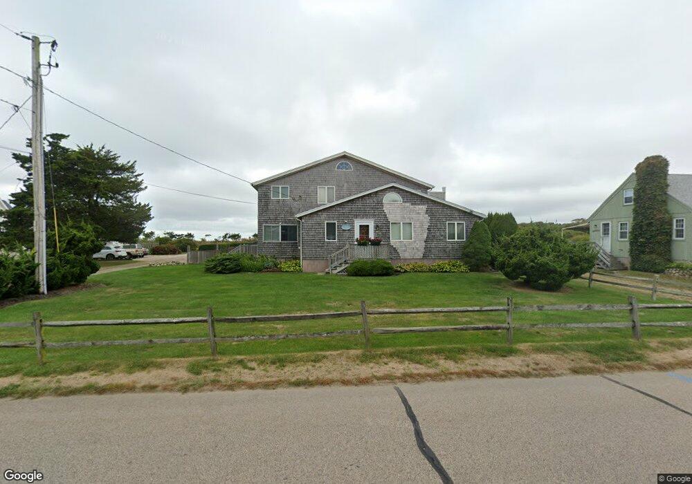
10 Maplewood Ave Westerly, RI 02891
Estimated Value: $1,690,000 - $2,387,000
5
Beds
4
Baths
2,600
Sq Ft
$800/Sq Ft
Est. Value
About This Home
This home is located at 10 Maplewood Ave, Westerly, RI 02891 and is currently estimated at $2,078,825, approximately $799 per square foot. 10 Maplewood Ave is a home located in Washington County with nearby schools including Westerly High School.
Ownership History
Date
Name
Owned For
Owner Type
Purchase Details
Closed on
Nov 26, 2012
Sold by
Mygatt Lois A
Bought by
Beaudry Amanda J and Beaudry Andrew R
Current Estimated Value
Home Financials for this Owner
Home Financials are based on the most recent Mortgage that was taken out on this home.
Original Mortgage
$820,000
Outstanding Balance
$559,291
Interest Rate
3.42%
Mortgage Type
Purchase Money Mortgage
Estimated Equity
$1,519,534
Create a Home Valuation Report for This Property
The Home Valuation Report is an in-depth analysis detailing your home's value as well as a comparison with similar homes in the area
Home Values in the Area
Average Home Value in this Area
Purchase History
We collect this data history from publicly available records. To have your information removed, we recommend requesting removal directly through your county’s website.
| Date | Buyer | Sale Price | Title Company |
|---|---|---|---|
| Beaudry Amanda J | $1,025,000 | -- | |
| Beaudry Amanda J | $1,025,000 | -- |
Source: Public Records
Mortgage History
We collect this data history from publicly available records. To have your information removed, we recommend requesting removal directly through your county’s website.
| Date | Status | Borrower | Loan Amount |
|---|---|---|---|
| Open | Beaudry Amanda J | $820,000 | |
| Closed | Beaudry Amanda J | $820,000 | |
| Previous Owner | Beaudry Amanda J | $150,000 |
Source: Public Records
Tax History
| Year | Tax Paid | Tax Assessment Tax Assessment Total Assessment is a certain percentage of the fair market value that is determined by local assessors to be the total taxable value of land and additions on the property. | Land | Improvement |
|---|---|---|---|---|
| 2025 | $12,159 | $1,710,100 | $1,338,900 | $371,200 |
| 2024 | $12,425 | $1,266,600 | $956,600 | $310,000 |
| 2023 | $12,185 | $1,266,600 | $956,600 | $310,000 |
| 2022 | $12,109 | $1,266,600 | $956,600 | $310,000 |
| 2021 | $10,848 | $941,700 | $693,600 | $248,100 |
| 2020 | $10,651 | $941,700 | $693,600 | $248,100 |
| 2019 | $10,547 | $941,700 | $693,600 | $248,100 |
| 2018 | $10,170 | $856,100 | $630,500 | $225,600 |
| 2017 | $9,922 | $856,100 | $630,500 | $225,600 |
| 2016 | $9,999 | $856,100 | $630,500 | $225,600 |
| 2015 | $9,392 | $868,000 | $643,500 | $224,500 |
| 2014 | $9,236 | $868,000 | $643,500 | $224,500 |
Source: Public Records
Map
Nearby Homes
- 27 Benson Ave
- 115 Atlantic Ave
- 26 Windward Dr
- 16 Rabbit Run
- 4 Shore Rd
- 50 Ocean View Hwy
- 13 No Bottom Ridge Rd
- 4 Quail Run
- 6 Fox Run Run
- 18 No Bottom Ridge Ridge
- 20 Browning Rd
- 6 S Essex Dr
- 111 Avondale Rd
- 1 Compass Way Unit A103
- 43 Avondale Rd
- 8 Kettle Close
- 8 Pasadena Ave
- 60 Avondale Rd
- 417 River Rd
- 10 Cedar Crest Dr
- 12 Maplewood Ave
- 6 Maplewood Ave
- 2 Dogwood Ave
- 4 Dogwood Ave
- 9 Maplewood Ave
- 11 Maplewood Ave
- 14 Maplewood Ave
- 1 Dogwood Ave
- 4 Maplewood Ave
- 13 Maplewood Ave
- 16 Maplewood Ave
- 10 Dogwood Ave
- 1 Elmwood Ave
- 15 Maplewood Ave
- 5 Maplewood Ave
- 3 Maplewood Ave
- 12 Dogwood Ave
- 1 Maplewood Ave
- 9 Elmwood Ave
- 11 Dogwood Ave
Your Personal Tour Guide
Ask me questions while you tour the home.