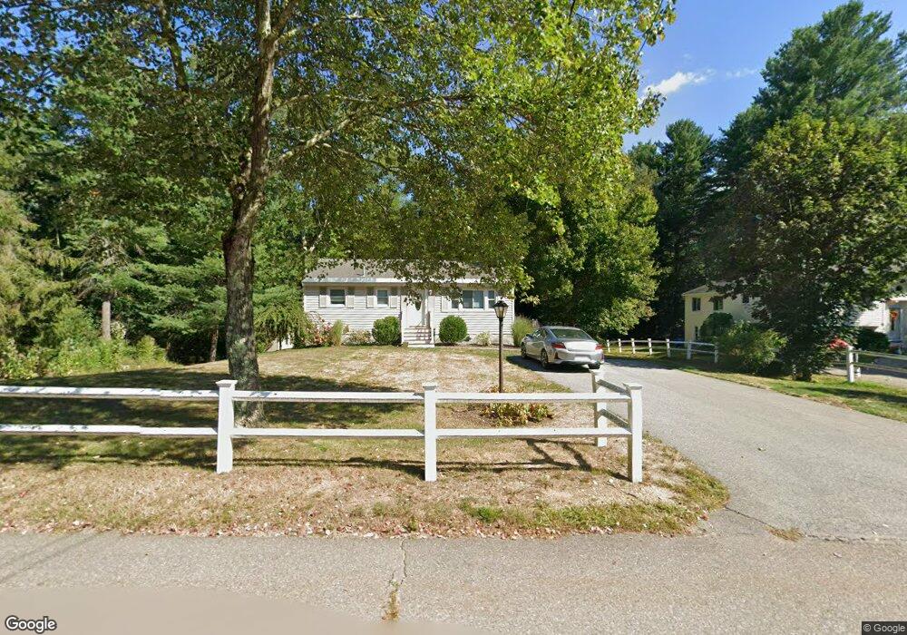
10 Mccarthy Dr Groton, MA 01450
Estimated Value: $468,000 - $568,000
About This Home
This home is located at 10 Mccarthy Dr, Groton, MA 01450 and is currently estimated at $503,756, approximately $547 per square foot. 10 Mccarthy Dr is a home located in Middlesex County with nearby schools including Groton Dunstable Regional High School, Seven Hills At Groton, and Lawrence Academy.
Ownership History
We collect this data history from publicly available records. To have your information removed, we recommend requesting removal directly through your county’s website.
Purchase Details
Home Values in the Area
Average Home Value in this Area
Purchase History
We collect this data history from publicly available records. To have your information removed, we recommend requesting removal directly through your county’s website.
| Date | Buyer | Sale Price | Title Company |
|---|---|---|---|
| -- | -- | ||
| -- | -- | ||
| -- | -- |
Mortgage History
We collect this data history from publicly available records. To have your information removed, we recommend requesting removal directly through your county’s website.
| Date | Status | Borrower | Loan Amount |
|---|---|---|---|
| Previous Owner | $50,000 |
Tax History
We collect this data history from publicly available records. To have your information removed, we recommend requesting removal directly through your county’s website.
| Year | Tax Paid | Tax Assessment Tax Assessment Total Assessment is a certain percentage of the fair market value that is determined by local assessors to be the total taxable value of land and additions on the property. | Land | Improvement |
|---|---|---|---|---|
| 2025 | $5,827 | $382,100 | $184,700 | $197,400 |
| 2024 | $5,278 | $349,800 | $184,700 | $165,100 |
| 2023 | $5,160 | $329,900 | $184,700 | $145,200 |
| 2022 | $5,007 | $291,300 | $165,500 | $125,800 |
| 2021 | $4,763 | $270,600 | $157,500 | $113,100 |
| 2020 | $4,338 | $249,600 | $157,500 | $92,100 |
| 2019 | $4,004 | $221,100 | $150,000 | $71,100 |
| 2018 | $3,975 | $212,900 | $150,000 | $62,900 |
| 2017 | $3,957 | $216,700 | $150,000 | $66,700 |
| 2016 | $4,066 | $216,500 | $150,200 | $66,300 |
| 2015 | $3,955 | $216,500 | $150,200 | $66,300 |
Map
- 27 Old Homestead Rd
- 25 Whitney Pond Rd
- 9 Georgia Rd
- 338 Cow Pond Brook Rd
- 49 Boat House Rd
- 0 Alder Rd
- 12 Cowdry Hill Rd
- 2 Maura Cir
- 0 Old Dunstable Rd
- 11 West St
- 64 Lakeside Dr
- 28 W Prescott St
- 6 New Pond Rd
- 168 Groton Rd
- 15 Gilson Rd
- 104 School House Rd
- 797 Boston Rd
- 561 Old Dunstable Rd
- 17 Maple St
- 3 Clark Rd
- 8 Mccarthy Dr
- 18 Mccarthy Dr Unit 20
- 15 Mccarthy Dr
- 7 Mccarthy Dr
- 26 Mccarthy Dr Unit 28
- 26 Mccarthy Dr Unit 26
- 26 Mccarthy Dr Unit 1
- 28 Mccarthy Dr Unit 28
- 2 Old Homestead Rd
- 948 Lowell Rd
- 963 Lowell Rd
- 34 Mccarthy Dr
- 29 Mccarthy Dr
- 936 Lowell Rd
- 936 Lowell Rd Unit 1
- 960 Lowell Rd
- 952 Lowell Rd
- 7 Amanda's Way Unit 7
- 9 Amanda's Way
- 4 Old Homestead Rd
Ask me questions while you tour the home.