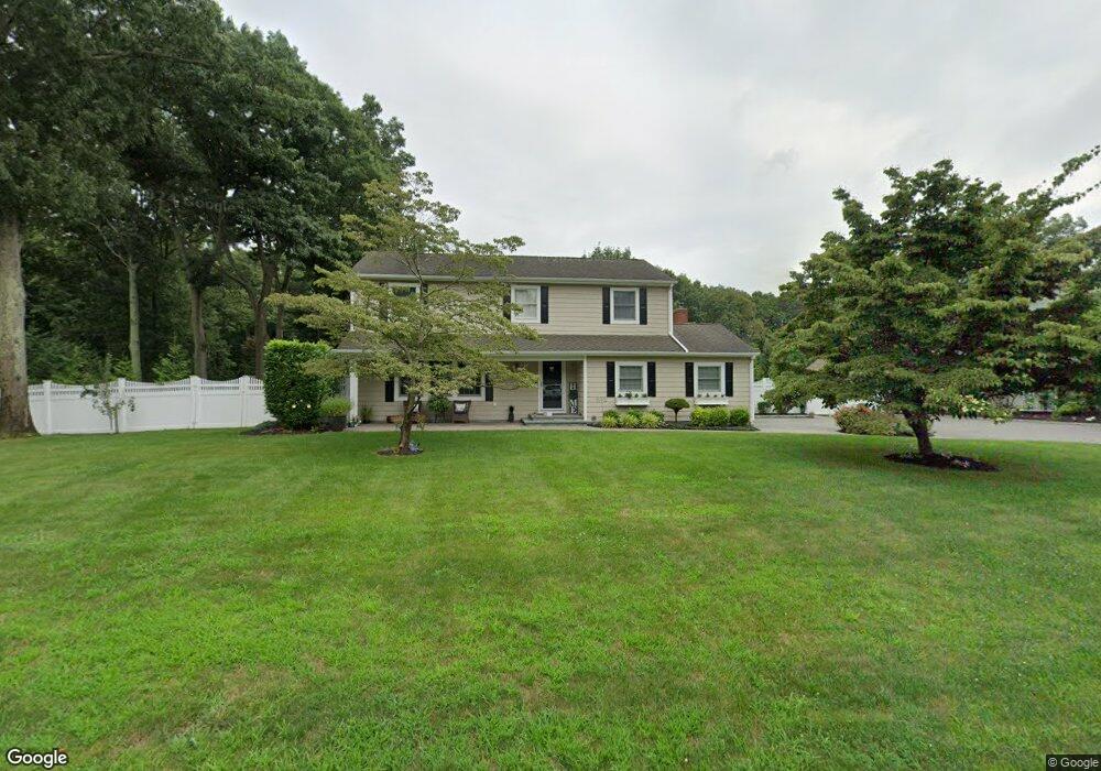
10 Michael Place Nesconset, NY 11767
Estimated Value: $815,000 - $994,000
4
Beds
4
Baths
2,060
Sq Ft
$444/Sq Ft
Est. Value
About This Home
This home is located at 10 Michael Place, Nesconset, NY 11767 and is currently estimated at $913,979, approximately $443 per square foot. 10 Michael Place is a home located in Suffolk County with nearby schools including Mills Pond Elementary School and St Patrick Elementary School.
Create a Home Valuation Report for This Property
The Home Valuation Report is an in-depth analysis detailing your home's value as well as a comparison with similar homes in the area
Home Values in the Area
Average Home Value in this Area
Tax History
| Year | Tax Paid | Tax Assessment Tax Assessment Total Assessment is a certain percentage of the fair market value that is determined by local assessors to be the total taxable value of land and additions on the property. | Land | Improvement |
|---|---|---|---|---|
| 2024 | $16,705 | $6,450 | $500 | $5,950 |
| 2023 | $16,705 | $6,450 | $500 | $5,950 |
| 2022 | $13,544 | $6,450 | $500 | $5,950 |
| 2021 | $13,544 | $6,450 | $500 | $5,950 |
| 2020 | $7,457 | $6,450 | $500 | $5,950 |
| 2019 | $7,457 | $0 | $0 | $0 |
| 2018 | -- | $6,450 | $500 | $5,950 |
| 2017 | $13,850 | $6,450 | $500 | $5,950 |
| 2016 | $13,691 | $6,450 | $500 | $5,950 |
| 2015 | -- | $6,450 | $500 | $5,950 |
| 2014 | -- | $6,450 | $500 | $5,950 |
Source: Public Records
Map
Nearby Homes
- 7 Sara Ct
- 105 Browns Rd
- 12 Crystal Brook Ct
- 0 Middle Country Rd
- 112 S Hillside Ave
- 48 Roy Dr
- 18 Lloyd Ln
- 56 Snowdance Ln Unit 76
- 5 Louis Place
- 88 Astor Ave
- 3 Louis Place
- 29 Snowdance Ln
- 31 Snowdance Ln Unit 111
- 1 6th St
- Lot 6 Sycamore Estates
- Lot 1 Sycamore Estates
- Lot 3 Sycamore Estates
- 8 Brookstan Rd
- 23 Dellmarie Ln
- 67 Paddington Cir
- 6 Michael Place
- 4 Gary Dr
- 14 Michael Place
- 11 Michael Place
- 9 Michael Place
- 4 Michael Place
- 57 Gibbs Pond Rd
- 15 Michael Place
- 3 Gary Dr
- 7 Michael Place
- 17 Michael Place
- 5 Michael Place
- 16 Michael Place
- 2 Michael Place
- 18 Michael Place
- 1 Michael Place
- 3 Zausin Ct
- 39 Gibbs Pond Rd
- 56 Gibbs Pond Rd
- 4 Zausin Ct
Your Personal Tour Guide
Ask me questions while you tour the home.