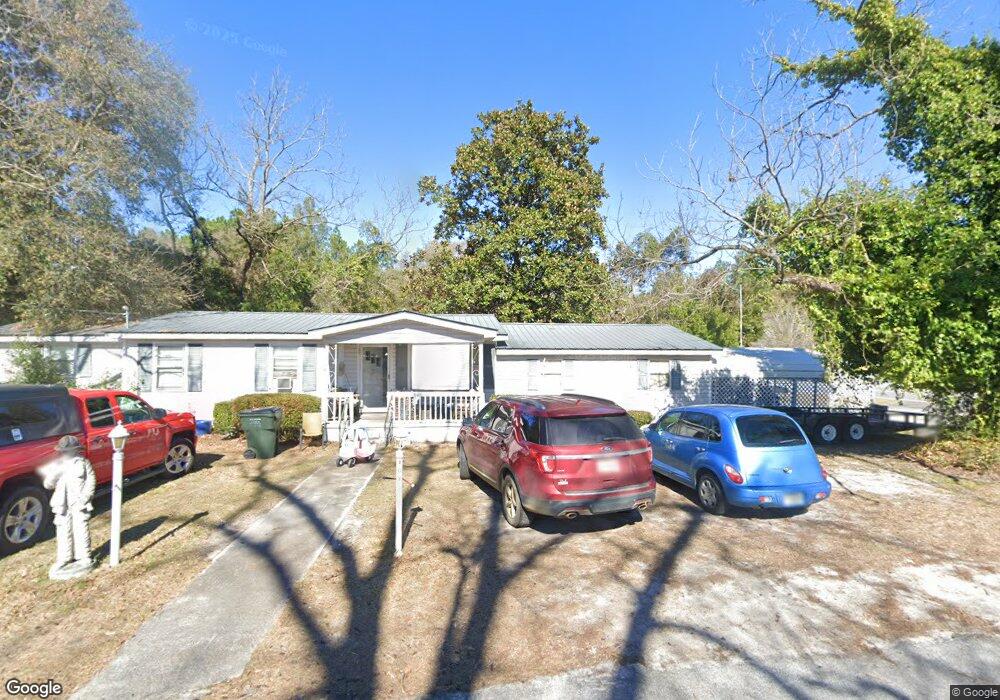
10 North Ave Adrian, GA 31002
Estimated Value: $57,000 - $185,000
Studio
1
Bath
1,744
Sq Ft
$66/Sq Ft
Est. Value
About This Home
This home is located at 10 North Ave, Adrian, GA 31002 and is currently estimated at $114,510, approximately $65 per square foot. 10 North Ave is a home with nearby schools including Johnson County Elementary School, Johnson County Middle School, and Johnson County High School.
Ownership History
Date
Name
Owned For
Owner Type
Purchase Details
Closed on
Dec 3, 2025
Sold by
Yawn Jesse Eugene
Bought by
Parrish Troy Lee
Current Estimated Value
Home Financials for this Owner
Home Financials are based on the most recent Mortgage that was taken out on this home.
Original Mortgage
$108,022
Outstanding Balance
$103,784
Interest Rate
6.22%
Mortgage Type
Unknown
Estimated Equity
$10,726
Purchase Details
Closed on
Jul 21, 2022
Sold by
Poole Donna S
Bought by
Yawn Jesse Eugene and Yawn Mary Katherine
Home Financials for this Owner
Home Financials are based on the most recent Mortgage that was taken out on this home.
Original Mortgage
$42,010
Interest Rate
5.81%
Mortgage Type
New Conventional
Purchase Details
Closed on
Jun 27, 2003
Sold by
Poole James S
Bought by
Poole Donna S
Create a Home Valuation Report for This Property
The Home Valuation Report is an in-depth analysis detailing your home's value as well as a comparison with similar homes in the area
Purchase History
We collect this data history from publicly available records. To have your information removed, we recommend requesting removal directly through your county’s website.
| Date | Buyer | Sale Price | Title Company |
|---|---|---|---|
| Parrish Troy Lee | $58,000 | -- | |
| Yawn Jesse Eugene | $40,000 | -- | |
| Poole Donna S | -- | -- |
Source: Public Records
Mortgage History
We collect this data history from publicly available records. To have your information removed, we recommend requesting removal directly through your county’s website.
| Date | Status | Borrower | Loan Amount |
|---|---|---|---|
| Open | Parrish Troy Lee | $108,022 | |
| Previous Owner | Yawn Jesse Eugene | $42,010 |
Source: Public Records
Tax History
| Year | Tax Paid | Tax Assessment Tax Assessment Total Assessment is a certain percentage of the fair market value that is determined by local assessors to be the total taxable value of land and additions on the property. | Land | Improvement |
|---|---|---|---|---|
| 2025 | $1,182 | $40,283 | $871 | $39,412 |
| 2024 | $1,217 | $32,397 | $871 | $31,526 |
| 2023 | $603 | $32,397 | $871 | $31,526 |
| 2022 | $700 | $26,674 | $871 | $25,803 |
| 2021 | $850 | $21,695 | $871 | $20,824 |
| 2020 | $595 | $21,695 | $871 | $20,824 |
| 2019 | $606 | $21,695 | $871 | $20,824 |
| 2018 | $850 | $21,695 | $871 | $20,824 |
| 2017 | $595 | $21,695 | $871 | $20,824 |
| 2016 | $845 | $21,577 | $871 | $20,706 |
| 2015 | -- | $20,680 | $871 | $19,809 |
| 2014 | -- | $20,680 | $871 | $19,809 |
| 2013 | -- | $20,680 | $871 | $19,808 |
Source: Public Records
Map
Nearby Homes
- 1 Trinity S
- 114 Ohoopee Rd
- 2618 Georgia 86
- 9154 Crooked Run Rd
- 442 Fox Run Rd
- 241 Foskey Cemetery Rd
- 250 Archers Pond Smith Rd
- Pendleton Rreek Rd
- Trinity Church Rd
- 181 Faith Tabernacle Rd
- NA Rd
- 0 Muskogee Trail Unit LOT 84
- 0 Muskogee Trail Unit 30570
- 19 Cow Ford Bridge Rd
- Trinity Church Rd
- 87 Georgia Ave
- 84 J D Garnto Rd
- 546 Alton Lawson Rd
- 0 Sardis Church Rd Unit 10688482
- 108 Tanglewood Dr
- 144 Poplar St
- 152 Poplar St
- 107 N Poplar St
- 502 Nora Blvd
- 21 E Martin Luther King jr Dr
- 402 Nora Blvd
- 447 Nora Blvd
- 0 Nora Blvd
- 210 W College St
- 311 Nora Blvd
- 214 North Ave
- 214 North Ave
- 224 North Ave
- 75 N Poplar St
- 125 N Beasley St
- 0 Hwy 15 Unit 8A 7333944
- 0 Hwy 15 Unit 1A 7333940
- 0 Hwy 15 Unit 6,6B 7333932
- 76 Poplar St
- 21 E Green St
Your Personal Tour Guide
Ask me questions while you tour the home.