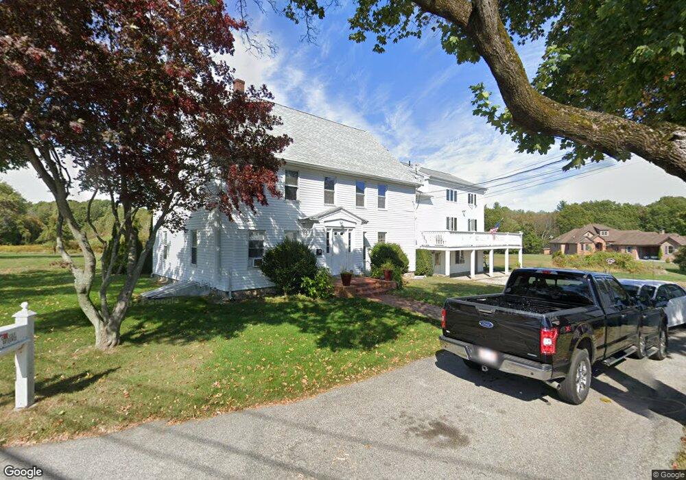
10 Stone Rd Millbury, MA 01527
Estimated Value: $558,000 - $865,000
9
Beds
5
Baths
5,182
Sq Ft
$134/Sq Ft
Est. Value
About This Home
This home is located at 10 Stone Rd, Millbury, MA 01527 and is currently estimated at $693,000, approximately $133 per square foot. 10 Stone Rd is a home located in Worcester County with nearby schools including Elmwood Street Elementary School, Raymond E. Shaw Elementary School, and Millbury Junior/Senior High School.
Ownership History
Date
Name
Owned For
Owner Type
Purchase Details
Closed on
Sep 3, 2015
Sold by
Hubley William P
Bought by
Hubley William P and Hubley Kristin L
Current Estimated Value
Purchase Details
Closed on
Sep 23, 2010
Sold by
Griggs William J
Bought by
Federal National Mortgage Association
Purchase Details
Closed on
Jan 6, 2003
Sold by
Debartolomeis Kathleen A and Debartolomeis James
Bought by
Griggs William J and Griggs Marylynn
Home Financials for this Owner
Home Financials are based on the most recent Mortgage that was taken out on this home.
Original Mortgage
$300,000
Interest Rate
6.08%
Mortgage Type
Purchase Money Mortgage
Create a Home Valuation Report for This Property
The Home Valuation Report is an in-depth analysis detailing your home's value as well as a comparison with similar homes in the area
Home Values in the Area
Average Home Value in this Area
Purchase History
| Date | Buyer | Sale Price | Title Company |
|---|---|---|---|
| Hubley William P | -- | -- | |
| Federal National Mortgage Association | $300,100 | -- | |
| Griggs William J | $100,000 | -- |
Source: Public Records
Mortgage History
| Date | Status | Borrower | Loan Amount |
|---|---|---|---|
| Previous Owner | Griggs William J | $300,000 | |
| Previous Owner | Griggs William J | $145,000 | |
| Previous Owner | Griggs William J | $33,000 |
Source: Public Records
Tax History
| Year | Tax Paid | Tax Assessment Tax Assessment Total Assessment is a certain percentage of the fair market value that is determined by local assessors to be the total taxable value of land and additions on the property. | Land | Improvement |
|---|---|---|---|---|
| 2025 | $9,390 | $701,300 | $147,900 | $553,400 |
| 2024 | $8,613 | $651,000 | $137,800 | $513,200 |
| 2023 | $8,237 | $570,000 | $100,000 | $470,000 |
| 2022 | $7,131 | $475,400 | $100,000 | $375,400 |
| 2021 | $7,075 | $458,500 | $100,000 | $358,500 |
| 2020 | $6,926 | $451,800 | $100,000 | $351,800 |
| 2019 | $6,619 | $417,600 | $99,500 | $318,100 |
| 2018 | $6,160 | $377,000 | $99,500 | $277,500 |
| 2017 | $6,349 | $386,400 | $103,400 | $283,000 |
| 2016 | $5,901 | $358,500 | $103,400 | $255,100 |
| 2015 | $5,731 | $348,200 | $109,100 | $239,100 |
| 2014 | $5,431 | $317,600 | $109,400 | $208,200 |
Source: Public Records
Map
Nearby Homes
- 3 S Oxford Rd
- 303 W Main St
- 15 Gilbert Way
- 137 South St
- 6 George St
- 55 Old Common Rd
- 9 Santom St
- 61 School St
- 291 Millbury St
- 8 South Terrace
- 196 Horne Way Unit 196
- 751 Washington St Unit 43A
- 9 Cyndy Ln
- 36 Central St
- 634 Oxford St S
- 6 Brenda Dr
- 0 W Main St
- 11 Laurel Dr
- 394 1/2 Greenwood St
- 5 Rice Rd
- 10 Stone Rd Unit A
- 10 Stone Rd Unit E
- 10 Stone Rd Unit C
- 10 Stone Rd Unit B
- 10 Stone Rd Unit A/B
- 10 Stone Rd Unit B/C
- 10 Stone Rd Unit D
- 10 Stone Rd Unit A-D
- 10A Stone Rd Unit B
- 14 Stone Rd
- 9 Stone Rd
- 6 Stone Rd
- 6 Stone Rd Unit A
- 6 Stone Rd Unit 2
- 6 Stone Rd Unit 1
- 7 Stone Rd
- 16 Stone Rd
- 352 W Main St
- 364 W Main St
- 13 Stone Rd
Your Personal Tour Guide
Ask me questions while you tour the home.