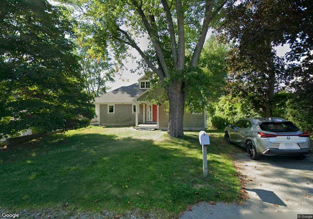
10 Vine St Gloucester, MA 01930
Estimated Value: $882,000 - $1,556,000
3
Beds
1
Bath
2,460
Sq Ft
$548/Sq Ft
Est. Value
About This Home
This home is located at 10 Vine St, Gloucester, MA 01930 and is currently estimated at $1,348,327, approximately $548 per square foot. 10 Vine St is a home located in Essex County with nearby schools including Plum Cove School, Ralph B O'maley Middle School, and Gloucester High School.
Ownership History
Date
Name
Owned For
Owner Type
Purchase Details
Closed on
May 22, 2024
Sold by
Lehar Alexander F and Lehar Margaret J
Bought by
Alexander Ft and Lehar
Current Estimated Value
Purchase Details
Closed on
Dec 21, 2001
Sold by
Mcgeoch Mary E
Bought by
Lehar Alexander F and Lehar Margaret Jane
Create a Home Valuation Report for This Property
The Home Valuation Report is an in-depth analysis detailing your home's value as well as a comparison with similar homes in the area
Purchase History
| Date | Buyer | Sale Price | Title Company |
|---|---|---|---|
| Alexander Ft | -- | None Available | |
| Alexander Ft | -- | None Available | |
| Lehar Alexander F | $355,000 | -- | |
| Lehar Alexander F | $355,000 | -- |
Source: Public Records
Tax History
| Year | Tax Paid | Tax Assessment Tax Assessment Total Assessment is a certain percentage of the fair market value that is determined by local assessors to be the total taxable value of land and additions on the property. | Land | Improvement |
|---|---|---|---|---|
| 2025 | $14,333 | $1,474,600 | $878,800 | $595,800 |
| 2024 | $13,848 | $1,423,200 | $836,500 | $586,700 |
| 2023 | $13,413 | $1,266,600 | $713,800 | $552,800 |
| 2022 | $12,908 | $1,100,400 | $620,900 | $479,500 |
| 2021 | $12,814 | $1,030,100 | $564,400 | $465,700 |
| 2020 | $12,263 | $994,600 | $564,400 | $430,200 |
| 2019 | $12,056 | $950,000 | $538,200 | $411,800 |
| 2018 | $11,920 | $921,900 | $525,000 | $396,900 |
| 2017 | $11,717 | $888,300 | $500,000 | $388,300 |
| 2016 | $11,062 | $812,800 | $478,300 | $334,500 |
| 2015 | $10,814 | $792,200 | $467,400 | $324,800 |
Source: Public Records
Map
Nearby Homes
- 2 Breezy Point Rd
- 672 Washington St
- 31 Echo Ave
- 13 Honeysuckle Rd
- 226 Atlantic St
- 167 Atlantic St
- 178 Atlantic St
- 136 Leonard St
- 8 Mystic Ave
- 3 Rockland St
- 98 Maplewood Ave
- 6 Monroe Ct
- 12 Arthur St
- 9 Cleveland Place
- 40 Sargent St
- 4 Ciaramitaro Ct
- 50 Warner St
- 7 Colburn St
- 113 Pleasant St
- 33 Maplewood Ave Unit 310
Your Personal Tour Guide
Ask me questions while you tour the home.