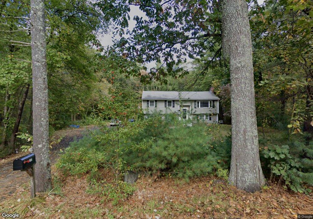
100 Campbell Rd North Andover, MA 01845
Estimated Value: $715,725 - $809,000
3
Beds
1
Bath
1,940
Sq Ft
$391/Sq Ft
Est. Value
About This Home
This home is located at 100 Campbell Rd, North Andover, MA 01845 and is currently estimated at $757,681, approximately $390 per square foot. 100 Campbell Rd is a home located in Essex County with nearby schools including Annie L Sargent Elementary School, North Andover Middle School, and North Andover High School.
Ownership History
Date
Name
Owned For
Owner Type
Purchase Details
Closed on
Aug 20, 1992
Sold by
Dewhurst William D
Bought by
Shorter Richard P
Current Estimated Value
Create a Home Valuation Report for This Property
The Home Valuation Report is an in-depth analysis detailing your home's value as well as a comparison with similar homes in the area
Home Values in the Area
Average Home Value in this Area
Purchase History
We collect this data history from publicly available records. To have your information removed, we recommend requesting removal directly through your county’s website.
| Date | Buyer | Sale Price | Title Company |
|---|---|---|---|
| Shorter Richard P | $155,050 | -- |
Source: Public Records
Mortgage History
We collect this data history from publicly available records. To have your information removed, we recommend requesting removal directly through your county’s website.
| Date | Status | Borrower | Loan Amount |
|---|---|---|---|
| Open | Shorter Richard P | $309,000 | |
| Closed | Shorter Richard P | $221,400 |
Source: Public Records
Tax History
| Year | Tax Paid | Tax Assessment Tax Assessment Total Assessment is a certain percentage of the fair market value that is determined by local assessors to be the total taxable value of land and additions on the property. | Land | Improvement |
|---|---|---|---|---|
| 2025 | $6,865 | $609,700 | $370,500 | $239,200 |
| 2024 | $6,520 | $587,900 | $348,700 | $239,200 |
| 2023 | $6,466 | $528,300 | $320,400 | $207,900 |
| 2022 | $6,424 | $474,800 | $287,700 | $187,100 |
| 2021 | $6,266 | $442,200 | $261,600 | $180,600 |
| 2020 | $6,009 | $437,300 | $261,600 | $175,700 |
| 2019 | $5,864 | $437,300 | $261,600 | $175,700 |
| 2018 | $6,354 | $437,300 | $261,600 | $175,700 |
| 2017 | $5,973 | $418,300 | $207,100 | $211,200 |
| 2016 | $5,851 | $410,000 | $203,100 | $206,900 |
| 2015 | $5,330 | $370,400 | $199,900 | $170,500 |
Source: Public Records
Map
Nearby Homes
- 10 Olympic Ln
- 1749 Salem St
- 66 Compass Point Unit 66
- 90 Compass Point Unit 90
- 3 Harvest Dr Unit 310
- 1 Harvest Dr Unit 103
- 1102 Acorn Dr Unit 1102
- 2302 Juniper Cir Unit 2302
- 45 Sugarcane Ln
- 94 Boxford St
- 10 White Cedar Dr Unit 10
- 143 Essex St
- 139 Essex St Unit 139
- 137 Essex St
- 141 Essex St
- 135 Essex St Unit 135
- 133 Essex St Unit 133
- 37 White Cedar Dr Unit 37
- 64 Jenkins Rd
- 105 Weyland Cir
- 90 Campbell Rd
- 95 Campbell Rd
- 111 Campbell Rd
- 121 Campbell Rd
- 83 Campbell Rd
- 60 Campbell Rd
- 133 Campbell Rd
- 50 Campbell Rd
- 40 Webster Woods Ln
- 80 Campbell Rd
- 149 Campbell Rd
- 299 Webster Woods Ln
- 40 Campbell Rd
- 300 Webster Woods Ln
- 30 Campbell Rd
- 161 Campbell Rd
- 168 Campbell Rd
- 23 Ash Campbell St
- 29 Stone Wedge Cir
- 290 Webster Woods Ln
Your Personal Tour Guide
Ask me questions while you tour the home.