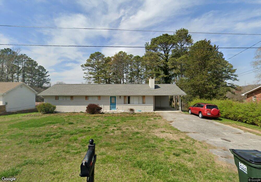
100 Crest Dr Rock Spring, GA 30739
Rock Spring NeighborhoodEstimated Value: $186,565 - $256,000
Studio
2
Baths
1,326
Sq Ft
$168/Sq Ft
Est. Value
About This Home
This home is located at 100 Crest Dr, Rock Spring, GA 30739 and is currently estimated at $222,141, approximately $167 per square foot. 100 Crest Dr is a home located in Walker County with nearby schools including Rock Spring Elementary School, Lafayette High School, and Alice M Daley Adventist School.
Ownership History
Date
Name
Owned For
Owner Type
Purchase Details
Closed on
Sep 11, 2020
Sold by
Wellborn Martha Ann Wallace
Bought by
Strickland Tracey Wellborn
Current Estimated Value
Purchase Details
Closed on
May 12, 2009
Sold by
Wellborn Robert Glenn
Bought by
Wellborn Martha Ann
Purchase Details
Closed on
Oct 24, 1962
Bought by
Wellborn Robert G and Wellb Martha W
Create a Home Valuation Report for This Property
The Home Valuation Report is an in-depth analysis detailing your home's value as well as a comparison with similar homes in the area
Home Values in the Area
Average Home Value in this Area
Purchase History
| Date | Buyer | Sale Price | Title Company |
|---|---|---|---|
| Strickland Tracey Wellborn | -- | -- | |
| Wellborn Martha Ann | -- | -- | |
| Wellborn Martha Ann | -- | -- | |
| Wellborn Robert G | -- | -- |
Source: Public Records
Tax History
| Year | Tax Paid | Tax Assessment Tax Assessment Total Assessment is a certain percentage of the fair market value that is determined by local assessors to be the total taxable value of land and additions on the property. | Land | Improvement |
|---|---|---|---|---|
| 2025 | $1,237 | $53,716 | $4,444 | $49,272 |
| 2024 | $1,279 | $53,816 | $4,040 | $49,776 |
| 2023 | $1,248 | $51,272 | $4,040 | $47,232 |
| 2022 | $1,176 | $44,888 | $4,040 | $40,848 |
| 2021 | $978 | $32,864 | $4,040 | $28,824 |
| 2020 | $133 | $29,040 | $4,200 | $24,840 |
| 2019 | $132 | $29,040 | $4,200 | $24,840 |
| 2018 | $768 | $29,040 | $4,200 | $24,840 |
| 2017 | $234 | $29,040 | $4,200 | $24,840 |
| 2016 | $130 | $29,040 | $4,200 | $24,840 |
| 2015 | $130 | $25,769 | $5,120 | $20,649 |
| 2014 | $65 | $25,769 | $5,120 | $20,649 |
| 2013 | -- | $25,769 | $5,120 | $20,649 |
Source: Public Records
Map
Nearby Homes
- 00 Georgia 95
- 1003 Highway N Old 27
- 797 Roy Bird Rd
- 1909 Old Lafayette Rd
- 348 Straight Gut Rd
- 1985 Peavine Rd
- 40 Blessed Way
- 1121 Arnold Rd
- 74 Hanshaw Dr
- 229 E Turnipseed Rd
- 136 Ginger Lake Dr
- 109 Rory Dr
- 22 Willow Cir
- 16 Willow Cir
- 488 Guy Williams Rd
- 498 Guy Williams Rd
- 788 Long Hollow Rd
- 532 Guy Williams Rd
- 130 Hankins Rd
- 918 Old Lafayette Rd
Your Personal Tour Guide
Ask me questions while you tour the home.