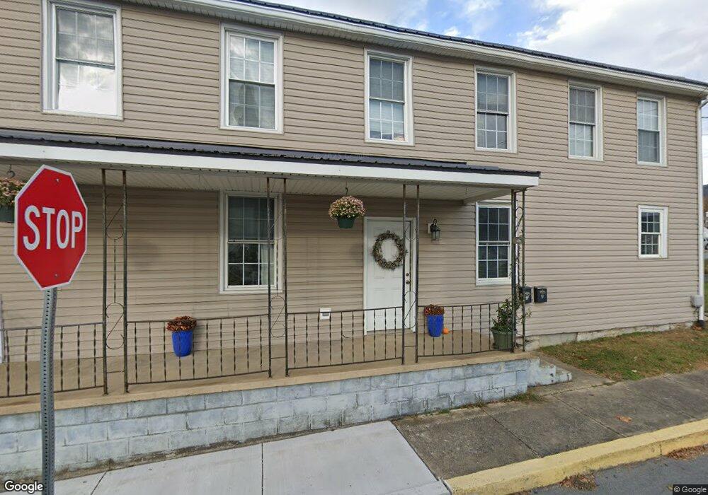
100 E Walnut St Mc Connellsburg, PA 17233
Estimated Value: $169,998 - $245,000
4
Beds
2
Baths
2,200
Sq Ft
$92/Sq Ft
Est. Value
About This Home
This home is located at 100 E Walnut St, Mc Connellsburg, PA 17233 and is currently estimated at $201,500, approximately $91 per square foot. 100 E Walnut St is a home located in Fulton County with nearby schools including McConnellsburg Elementary School, McConnellsburgh Middle School, and McConnellsburgh High School.
Ownership History
Date
Name
Owned For
Owner Type
Purchase Details
Closed on
Jun 6, 2011
Sold by
Atherton Marcia M and Atherton Rickey E
Bought by
Secretary Of Housing &Urban Develop
Current Estimated Value
Home Financials for this Owner
Home Financials are based on the most recent Mortgage that was taken out on this home.
Original Mortgage
$65,000
Outstanding Balance
$44,810
Interest Rate
4.63%
Estimated Equity
$156,690
Purchase Details
Closed on
Apr 5, 2010
Sold by
Chase Home Finance Llc
Bought by
Mellott Kristi L and Bishop Terry L
Create a Home Valuation Report for This Property
The Home Valuation Report is an in-depth analysis detailing your home's value as well as a comparison with similar homes in the area
Purchase History
| Date | Buyer | Sale Price | Title Company |
|---|---|---|---|
| Secretary Of Housing &Urban Develop | $35,000 | -- | |
| Mellott Kristi L | $1,908 | -- |
Source: Public Records
Mortgage History
| Date | Status | Borrower | Loan Amount |
|---|---|---|---|
| Open | Secretary Of Housing &Urban Develop | $65,000 |
Source: Public Records
Tax History
| Year | Tax Paid | Tax Assessment Tax Assessment Total Assessment is a certain percentage of the fair market value that is determined by local assessors to be the total taxable value of land and additions on the property. | Land | Improvement |
|---|---|---|---|---|
| 2025 | $2,806 | $50,680 | $4,000 | $46,680 |
| 2024 | $2,806 | $50,680 | $4,000 | $46,680 |
| 2023 | $2,589 | $50,680 | $4,000 | $46,680 |
| 2022 | $2,589 | $50,680 | $4,000 | $46,680 |
| 2021 | $2,485 | $50,680 | $4,000 | $46,680 |
| 2020 | $2,589 | $50,680 | $4,000 | $46,680 |
| 2019 | $2,538 | $50,680 | $4,000 | $46,680 |
| 2018 | $2,538 | $50,680 | $4,000 | $46,680 |
| 2017 | $2,485 | $50,680 | $4,000 | $46,680 |
| 2016 | -- | $50,680 | $4,000 | $46,680 |
| 2015 | -- | $50,680 | $4,000 | $46,680 |
| 2014 | -- | $28,900 | $4,000 | $24,900 |
Source: Public Records
Map
Nearby Homes
- 119 N 2nd St
- 107 Lincoln Way E
- 32 Hillside Estates
- 23 Hillside Estates
- 24 Hillside Estates
- 0 Hohman Dr Unit PAFU104250
- 0 Hohman Dr Unit 1000146175
- 313 S 1st St
- 305 Cooper Ln
- 2 Cloverleaf Ct
- 580 Buchanan Trail
- 0 Oliver Dr
- 478 Shady Grove Dr
- 875 R and D Ln
- 15483 Dogwood Dr
- 15416 Lincoln Way W
- 262 Jamie Rd
- 0 Tanks Trail Unit PAFU2001698
- 4391 Cito Rd
- 0 Lincoln Way W Unit PAFL2033466
Your Personal Tour Guide
Ask me questions while you tour the home.