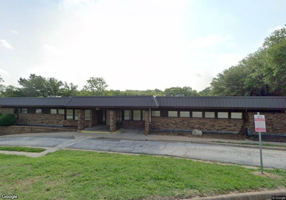
100 Memorial Dr Denison, TX 75020
Estimated Value: $221,441
Studio
--
Bath
14,000
Sq Ft
$16/Sq Ft
Est. Value
About This Home
This home is located at 100 Memorial Dr, Denison, TX 75020 and is currently estimated at $221,441, approximately $15 per square foot. 100 Memorial Dr is a home located in Grayson County with nearby schools including Terrell Elementary School, Scott Middle School, and Denison High School.
Ownership History
Date
Name
Owned For
Owner Type
Purchase Details
Closed on
Mar 6, 2023
Sold by
Texoma Community Center
Bought by
Sharbaf Properties Llc
Current Estimated Value
Purchase Details
Closed on
Aug 31, 2015
Sold by
Grayson County Juvenile Alternatives Inc
Bought by
Texoma Community Center
Purchase Details
Closed on
Dec 20, 2010
Sold by
Uhs Of Texoma Inc
Bought by
Grayson County Juvenile Alternative Inc
Create a Home Valuation Report for This Property
The Home Valuation Report is an in-depth analysis detailing your home's value as well as a comparison with similar homes in the area
Home Values in the Area
Average Home Value in this Area
Purchase History
| Date | Buyer | Sale Price | Title Company |
|---|---|---|---|
| Sharbaf Properties Llc | -- | Simplifile | |
| Texoma Community Center | -- | Chapin Title Co Inc | |
| Grayson County Juvenile Alternative Inc | -- | Chapin Title Co Inc |
Source: Public Records
Tax History
| Year | Tax Paid | Tax Assessment Tax Assessment Total Assessment is a certain percentage of the fair market value that is determined by local assessors to be the total taxable value of land and additions on the property. | Land | Improvement |
|---|---|---|---|---|
| 2025 | $5,111 | $429,625 | $233,364 | $196,261 |
| 2024 | $5,111 | $220,000 | $200,000 | $20,000 |
| 2023 | $5,227 | $220,000 | $200,000 | $20,000 |
| 2022 | $6,666 | $280,571 | $167,754 | $112,817 |
| 2021 | $7,076 | $280,571 | $79,963 | $200,608 |
| 2020 | $7,401 | $280,571 | $58,714 | $221,857 |
| 2019 | $7,721 | $280,571 | $48,089 | $232,482 |
| 2018 | $5,048 | $181,970 | $48,089 | $133,881 |
| 2017 | $5,091 | $181,970 | $48,089 | $133,881 |
| 2016 | $3,535 | $126,343 | $48,089 | $78,254 |
| 2015 | $0 | $126,343 | $48,089 | $78,254 |
| 2014 | -- | $311,653 | $96,179 | $215,474 |
Source: Public Records
Map
Nearby Homes
- 912 N Tone Ave
- 709 N Chandler Ave
- 1208 Martin Luther King St
- 1221 W Johnson St
- 728 W Walker St
- 610 W Elm St
- 1200 W Walker St
- 631 W Walker St
- 629 W Walker St
- 925 W Morton St Unit 927
- 1001 W Morton St
- 713 W Bond St
- 1201 N Mirick Ave
- 1200 N Mirick Ave
- 624 W Walker St
- 701 N Mirick Ave
- 712 W Bond St
- 503 Martin Luther King St
- 826 W Morton St
- 522-526 W Bond St
- 930 Martin Luther King St
- 1000 Martin Luther King St
- 102 Memorial Dr
- 1012 Martin Luther King St
- 901 Martin Luther King St
- 921 W Elm St
- 1001 W Elm St Unit 201
- 1001 W Elm St
- 911 W Elm St
- 105 Memorial Dr
- 831 Martin Luther King St
- 909 W Elm St
- 907 W Elm St
- 1017 W Elm St
- 931 W Elm St
- 929 W Elm St
- 901 W Elm St
- 1031 N Armstrong Ave
- 1021 W Elm St
- 903 W Elm St
Your Personal Tour Guide
Ask me questions while you tour the home.