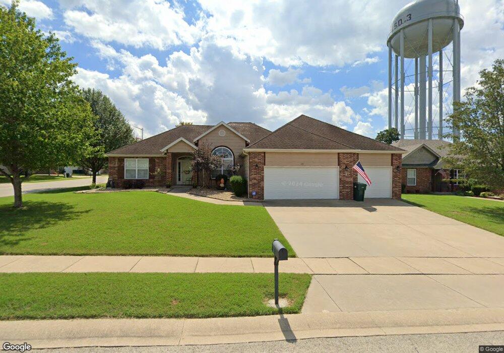
100 Tannin Trace Rd Branson, MO 65616
North Branson NeighborhoodEstimated Value: $348,626 - $376,000
3
Beds
2
Baths
1,907
Sq Ft
$191/Sq Ft
Est. Value
About This Home
This home is located at 100 Tannin Trace Rd, Branson, MO 65616 and is currently estimated at $363,907, approximately $190 per square foot. 100 Tannin Trace Rd is a home located in Taney County with nearby schools including Cedar Ridge Primary, Cedar Ridge Intermediate School, and Cedar Ridge Elementary School.
Ownership History
Date
Name
Owned For
Owner Type
Purchase Details
Closed on
Oct 26, 2010
Sold by
Nix Cindy Marie and Nix John Joseph
Bought by
Elliott Walter L and The Walter L Elliott Revocable
Current Estimated Value
Purchase Details
Closed on
Mar 30, 2010
Sold by
Nix John Joseph
Bought by
Nix Cindy Marie
Purchase Details
Closed on
Nov 15, 2005
Sold by
Webb James R and Webb Roxanne L
Bought by
Nix John Joseph and Nix Cindy Marie
Home Financials for this Owner
Home Financials are based on the most recent Mortgage that was taken out on this home.
Original Mortgage
$91,000
Interest Rate
6.06%
Mortgage Type
New Conventional
Create a Home Valuation Report for This Property
The Home Valuation Report is an in-depth analysis detailing your home's value as well as a comparison with similar homes in the area
Home Values in the Area
Average Home Value in this Area
Purchase History
| Date | Buyer | Sale Price | Title Company |
|---|---|---|---|
| Elliott Walter L | -- | Great American Title | |
| Nix Cindy Marie | -- | None Available | |
| Nix John Joseph | -- | -- |
Source: Public Records
Mortgage History
| Date | Status | Borrower | Loan Amount |
|---|---|---|---|
| Previous Owner | Nix John Joseph | $91,000 |
Source: Public Records
Tax History
| Year | Tax Paid | Tax Assessment Tax Assessment Total Assessment is a certain percentage of the fair market value that is determined by local assessors to be the total taxable value of land and additions on the property. | Land | Improvement |
|---|---|---|---|---|
| 2025 | $1,918 | $31,200 | -- | -- |
| 2023 | $1,918 | $35,870 | $0 | $0 |
| 2022 | $1,865 | $35,870 | $0 | $0 |
| 2021 | $1,853 | $35,870 | $0 | $0 |
| 2019 | $1,725 | $32,010 | $0 | $0 |
| 2018 | $1,726 | $32,010 | $0 | $0 |
| 2017 | $1,593 | $29,820 | $0 | $0 |
| 2016 | $1,589 | $29,820 | $0 | $0 |
| 2015 | $1,574 | $29,820 | $0 | $0 |
| 2014 | $1,444 | $28,670 | $0 | $0 |
Source: Public Records
Map
Nearby Homes
- 153 Sapling Dr
- 146 Sapling Dr
- 229 Stillwood Dr Unit 6a
- 301 Stillwood Dr
- 311 Stillwood Dr
- 119 Carmen Ln
- 125 Lakehills Dr Unit B
- 152 Rue de Villas Cir Unit 4
- 142 Rue de Villas Cir
- 155 Rue de Villas Cir
- 210 Rue de Villas Cir
- 160 Rue de Villas Cir
- Lot 96 Stone Valley Estates
- 110 Stone Cir
- 126 Rue de Villas Cir
- 134 Vixen Cir Unit G
- 328 Sunny Brook Dr
- 118 Rue de Villas Cir
- 121 Rue de Villas Cir
- 127 Vixen Cir Unit K
- 102 Tannin Trace Rd
- 107 Sapling Dr
- 108 Sapling Dr
- 110 Sapling Dr
- 104 Tannin Trace Rd
- 101 Tannin Trace Rd
- 101 Sapling Dr
- 103 Acorn Ln
- 106 Sapling Dr
- 103 Tannin Trace Rd
- 112 Sapling Dr
- 106 Tannin Trace Rd
- 104 Sapling Dr
- 104 Sapling Dr Unit T
- 105 Tannin Trace Rd
- 117 Sapling Dr
- 114 Sapling Dr
- 108 Tannin Trace Rd
- 102 Sapling Dr
- 109 Tannin Trace Rd
Your Personal Tour Guide
Ask me questions while you tour the home.