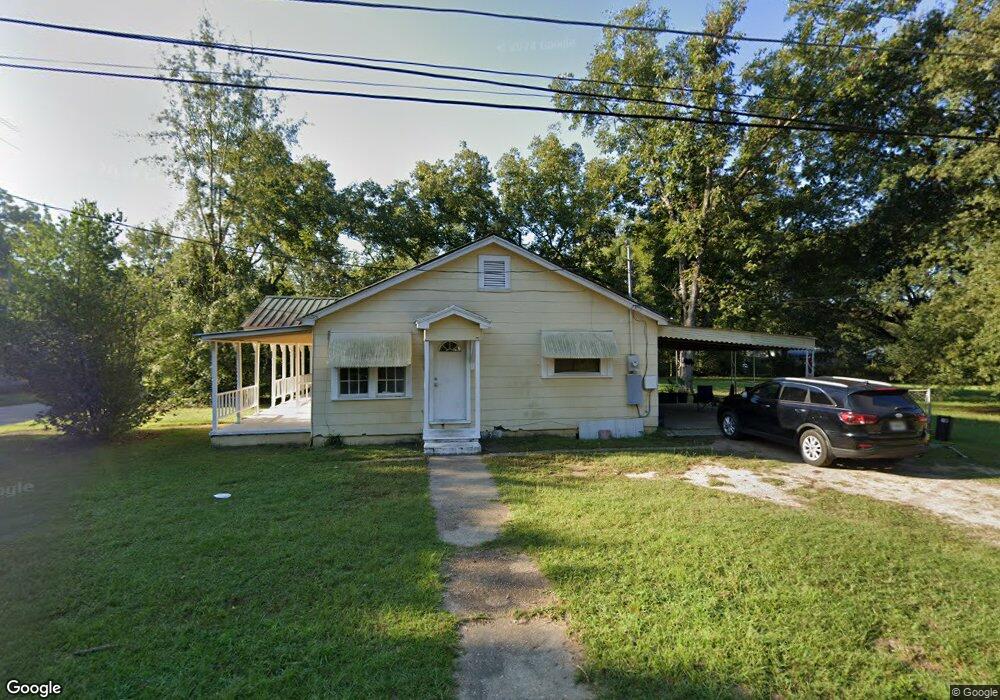
1000 S Range St Dothan, AL 36301
Estimated Value: $63,790 - $111,000
Studio
1
Bath
1,287
Sq Ft
$67/Sq Ft
Est. Value
About This Home
This home is located at 1000 S Range St, Dothan, AL 36301 and is currently estimated at $85,948, approximately $66 per square foot. 1000 S Range St is a home located in Houston County with nearby schools including Dothan City Early Education Center, Girard Elementary School, and Dothan 6th Grade Center.
Ownership History
Date
Name
Owned For
Owner Type
Purchase Details
Closed on
Jun 30, 2015
Sold by
Ameris Bank
Bought by
Parrish Harvey C and Parrish Rebecca J
Current Estimated Value
Purchase Details
Closed on
Oct 25, 2010
Sold by
Velez Rudy A
Bought by
Williams Jeremy Scott
Create a Home Valuation Report for This Property
The Home Valuation Report is an in-depth analysis detailing your home's value as well as a comparison with similar homes in the area
Purchase History
| Date | Buyer | Sale Price | Title Company |
|---|---|---|---|
| Parrish Harvey C | $11,000 | -- | |
| Williams Jeremy Scott | -- | -- |
Source: Public Records
Tax History
| Year | Tax Paid | Tax Assessment Tax Assessment Total Assessment is a certain percentage of the fair market value that is determined by local assessors to be the total taxable value of land and additions on the property. | Land | Improvement |
|---|---|---|---|---|
| 2025 | $340 | $9,440 | $0 | $0 |
| 2024 | $340 | $9,180 | $0 | $0 |
| 2023 | $330 | $8,880 | $0 | $0 |
| 2022 | $258 | $7,480 | $0 | $0 |
| 2021 | $254 | $9,100 | $0 | $0 |
| 2020 | $258 | $7,480 | $0 | $0 |
| 2019 | $269 | $7,800 | $0 | $0 |
| 2018 | $269 | $7,800 | $0 | $0 |
| 2017 | $206 | $5,960 | $0 | $0 |
| 2016 | $206 | $0 | $0 | $0 |
| 2015 | $206 | $0 | $0 | $0 |
| 2014 | $204 | $0 | $0 | $0 |
Source: Public Records
Map
Nearby Homes
- 502 Vassar St
- 808 Dutch St
- 411 Kornegay St
- 959 S Saint Andrews St
- 973 S Saint Andrews St
- 209 Pearl St
- 107 Roberts St
- 137 Highland St
- 211 Massee Dr
- 1657 Third Ave
- 737 S Saint Andrews St
- 732 S Saint Andrews St
- 300 Reid Dr
- 512 S College St
- 1208 Jonathan St
- 113 Cumberland Dr
- 1304 Jonathan St
- 605 Collier St
- 402 Hill St
- 804 Dusy St
- 513 Barnard St
- 511 Barnard St
- 1004 S Range St
- 504 Vassar St
- 509 Barnard St
- 513 Vassar St
- 904 S Range St
- 1003 S Range St
- 509 Vassar St
- 1001 S Range St
- 1005 S Range St
- 507 Barnard St
- 907 S Range St
- 1007 S Range St
- 507 Vassar St
- 505 Barnard St
- 516 Barnard St
- 1009 S Range St
- 905 S Range St
- 518 Barnard St
Your Personal Tour Guide
Ask me questions while you tour the home.