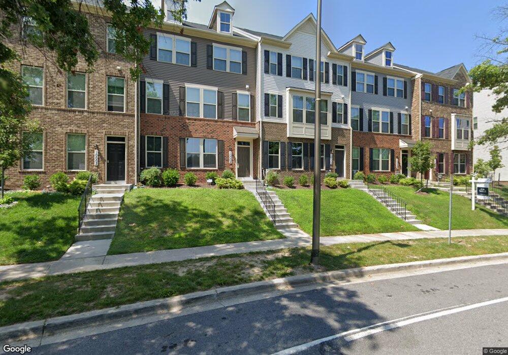
10006 Aerospace Rd Lanham, MD 20706
Estimated Value: $468,000 - $524,000
Studio
2
Baths
2,026
Sq Ft
$247/Sq Ft
Est. Value
About This Home
This home is located at 10006 Aerospace Rd, Lanham, MD 20706 and is currently estimated at $501,209, approximately $247 per square foot. 10006 Aerospace Rd is a home located in Prince George's County with nearby schools including Catherine T. Reed Elementary School, Thomas Johnson Middle School, and Duval High School.
Ownership History
Date
Name
Owned For
Owner Type
Purchase Details
Closed on
Apr 19, 2019
Sold by
Nvr Inc
Bought by
Brown Aaron and Reshkoska Ema
Current Estimated Value
Home Financials for this Owner
Home Financials are based on the most recent Mortgage that was taken out on this home.
Original Mortgage
$414,233
Outstanding Balance
$369,971
Interest Rate
5.12%
Mortgage Type
FHA
Estimated Equity
$131,238
Purchase Details
Closed on
Dec 14, 2018
Sold by
Gdc Md Llc
Bought by
Nvr Inc
Create a Home Valuation Report for This Property
The Home Valuation Report is an in-depth analysis detailing your home's value as well as a comparison with similar homes in the area
Home Values in the Area
Average Home Value in this Area
Purchase History
We collect this data history from publicly available records. To have your information removed, we recommend requesting removal directly through your county’s website.
| Date | Buyer | Sale Price | Title Company |
|---|---|---|---|
| Brown Aaron | $421,875 | Nvr Settlement Services | |
| Nvr Inc | $741,600 | Nvr Settlement Services |
Source: Public Records
Mortgage History
We collect this data history from publicly available records. To have your information removed, we recommend requesting removal directly through your county’s website.
| Date | Status | Borrower | Loan Amount |
|---|---|---|---|
| Open | Brown Aaron | $414,233 |
Source: Public Records
Tax History
| Year | Tax Paid | Tax Assessment Tax Assessment Total Assessment is a certain percentage of the fair market value that is determined by local assessors to be the total taxable value of land and additions on the property. | Land | Improvement |
|---|---|---|---|---|
| 2025 | $6,852 | $460,500 | $100,000 | $360,500 |
| 2024 | $6,852 | $440,567 | -- | -- |
| 2023 | $6,628 | $420,633 | $0 | $0 |
| 2022 | $6,331 | $400,700 | $100,000 | $300,700 |
| 2021 | $6,105 | $391,000 | $0 | $0 |
| 2020 | $6,020 | $381,300 | $0 | $0 |
| 2019 | $5,321 | $371,600 | $100,000 | $271,600 |
| 2018 | $1,135 | $75,000 | $75,000 | $0 |
| 2017 | $1,115 | $75,000 | $0 | $0 |
Source: Public Records
Map
Nearby Homes
- 10100 Aerospace Rd
- 10044 Dorsey Ln
- 10062 Dorsey Ln Unit 42
- 10202 Galaxy View Ln
- 7312 Wood Trail Dr
- 0 Greenbelt Rd Unit MDPG2199690
- 7206 Wood Trail Dr
- 10410 John Glenn St
- 10414 John Glenn St
- 10501 Neil Armstrong Way
- 10423 John Glenn St
- 10521 Jim Lovell Ln
- 7206 Wood Meadow Way
- 7200 Wood Meadow Way
- 10545 Jim Lovell Ln
- 7047 Palamar Turn
- 7652 Buzz Aldrin Ln Unit 1826
- 7028 Palamar Turn
- 7800 Mystic River Terrace
- 7023 Woodstream Ln
- 10008 Aerospace Rd Unit 111E
- 10008 Aerospace Rd
- 10004 Aerospace Rd Unit 111C
- 10004 Aerospace Rd
- 10010 Aerospace Rd
- 10010 Aerospace Rd Unit 111F
- 10000 Aerospace Rd
- 10012 Aerospace Rd Unit 110H
- 10012 Aerospace Rd
- 10035 Dorsey Ln
- 10035 Dorsey Ln Unit 113A
- 10011 Dorsey Ln Unit 112ASPEC
- 10011 Dorsey Ln
- 10014 Aerospace Rd
- 10033 Dorsey Ln
- 10033 Dorsey Ln Unit 113B
- 10013 Dorsey Ln Unit 112B
- 10013 Dorsey Ln
- 10015 Dorsey Ln Unit 112C
- 10015 Dorsey Ln
Your Personal Tour Guide
Ask me questions while you tour the home.