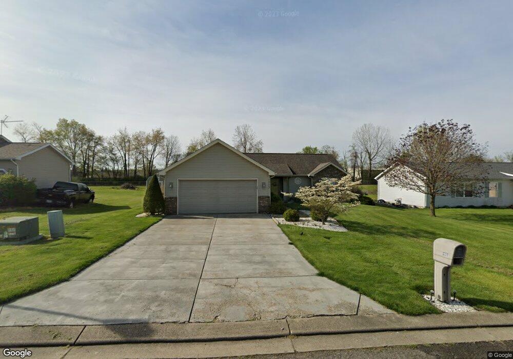
1003 Jones Ave Newark, OH 43055
Estimated Value: $231,000 - $283,000
3
Beds
1
Bath
1,368
Sq Ft
$181/Sq Ft
Est. Value
About This Home
This home is located at 1003 Jones Ave, Newark, OH 43055 and is currently estimated at $247,866, approximately $181 per square foot. 1003 Jones Ave is a home located in Licking County with nearby schools including Carson Elementary School, Heritage Middle School, and Newark High School.
Ownership History
Date
Name
Owned For
Owner Type
Purchase Details
Closed on
Sep 23, 2024
Sold by
Rieder Rudy R and Rieder Phyllis L
Bought by
Rieder Family Living Trust and Sellers
Current Estimated Value
Purchase Details
Closed on
Nov 21, 2006
Sold by
Rieder Rudy R and Rieder Phyllis L
Bought by
Rieder Rudy R and Rieder Phyllis L
Purchase Details
Closed on
Aug 13, 1997
Sold by
Cunningham Joseph E
Bought by
Rieder Rudy R and Rieder Phyllis L
Home Financials for this Owner
Home Financials are based on the most recent Mortgage that was taken out on this home.
Original Mortgage
$71,200
Interest Rate
7.71%
Mortgage Type
New Conventional
Create a Home Valuation Report for This Property
The Home Valuation Report is an in-depth analysis detailing your home's value as well as a comparison with similar homes in the area
Home Values in the Area
Average Home Value in this Area
Purchase History
We collect this data history from publicly available records. To have your information removed, we recommend requesting removal directly through your county’s website.
| Date | Buyer | Sale Price | Title Company |
|---|---|---|---|
| Rieder Family Living Trust | -- | None Listed On Document | |
| Rieder Rudy R | -- | Attorney | |
| Rieder Rudy R | $90,500 | -- |
Source: Public Records
Mortgage History
We collect this data history from publicly available records. To have your information removed, we recommend requesting removal directly through your county’s website.
| Date | Status | Borrower | Loan Amount |
|---|---|---|---|
| Previous Owner | Rieder Rudy R | $71,200 |
Source: Public Records
Tax History
| Year | Tax Paid | Tax Assessment Tax Assessment Total Assessment is a certain percentage of the fair market value that is determined by local assessors to be the total taxable value of land and additions on the property. | Land | Improvement |
|---|---|---|---|---|
| 2025 | $1,946 | $63,180 | $21,950 | $41,230 |
| 2024 | $1,909 | $63,180 | $21,950 | $41,230 |
| 2023 | $3,366 | $63,180 | $21,950 | $41,230 |
| 2022 | $1,562 | $47,670 | $12,810 | $34,860 |
| 2021 | $1,638 | $47,670 | $12,810 | $34,860 |
| 2020 | $1,675 | $47,670 | $12,810 | $34,860 |
| 2019 | $1,485 | $41,970 | $11,660 | $30,310 |
| 2018 | $1,486 | $0 | $0 | $0 |
| 2017 | $1,336 | $0 | $0 | $0 |
| 2016 | $1,223 | $0 | $0 | $0 |
| 2015 | $1,249 | $0 | $0 | $0 |
| 2014 | $2,119 | $0 | $0 | $0 |
| 2013 | $592 | $0 | $0 | $0 |
Source: Public Records
Map
Nearby Homes
- 874 Brice St
- 821 Jones Ave
- 57 Homewood Ave
- 106 Monroe Ave
- 11094 Butler Rd NE
- 0 Monroe Ave Unit Lot 1612
- 0 Monroe Ave
- 20 Bolen Ave
- 468 Garfield Ave
- 498 Lexington Ave
- 112 Oakwood Ave
- 494 E Main St
- 167 Essex St
- 365 Ballard Ave
- 430 E Main St
- 84 Curtis Ave
- 466 Henderson Ave
- 239 N Cedar St
- 62 Mill St
- 347 Wayne Ave
Your Personal Tour Guide
Ask me questions while you tour the home.