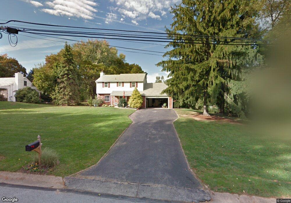
1007 Millstream Dr Malvern, PA 19355
Estimated Value: $620,000 - $716,000
4
Beds
3
Baths
2,020
Sq Ft
$329/Sq Ft
Est. Value
About This Home
This home is located at 1007 Millstream Dr, Malvern, PA 19355 and is currently estimated at $663,923, approximately $328 per square foot. 1007 Millstream Dr is a home located in Chester County with nearby schools including East Goshen Elementary School, J.R. Fugett Middle School, and West Chester East High School.
Ownership History
Date
Name
Owned For
Owner Type
Purchase Details
Closed on
Dec 10, 2012
Sold by
Hunt M Joseph and Hunt Mildred E
Bought by
Mcclemens David J and Mcclemens Carol Y
Current Estimated Value
Purchase Details
Closed on
Aug 28, 1998
Sold by
Miller Dorothy K
Bought by
Gothard Stephen R and Gothard Diane S
Home Financials for this Owner
Home Financials are based on the most recent Mortgage that was taken out on this home.
Original Mortgage
$178,600
Interest Rate
6.9%
Create a Home Valuation Report for This Property
The Home Valuation Report is an in-depth analysis detailing your home's value as well as a comparison with similar homes in the area
Home Values in the Area
Average Home Value in this Area
Purchase History
| Date | Buyer | Sale Price | Title Company |
|---|---|---|---|
| Mcclemens David J | $265,000 | None Available | |
| Gothard Stephen R | $188,000 | -- |
Source: Public Records
Mortgage History
| Date | Status | Borrower | Loan Amount |
|---|---|---|---|
| Previous Owner | Gothard Stephen R | $178,600 |
Source: Public Records
Tax History
| Year | Tax Paid | Tax Assessment Tax Assessment Total Assessment is a certain percentage of the fair market value that is determined by local assessors to be the total taxable value of land and additions on the property. | Land | Improvement |
|---|---|---|---|---|
| 2025 | $5,344 | $185,950 | $51,310 | $134,640 |
| 2024 | $5,344 | $185,950 | $51,310 | $134,640 |
| 2023 | $5,344 | $185,950 | $51,310 | $134,640 |
| 2022 | $5,181 | $185,950 | $51,310 | $134,640 |
| 2021 | $5,107 | $185,950 | $51,310 | $134,640 |
| 2020 | $5,073 | $185,950 | $51,310 | $134,640 |
| 2019 | $5,000 | $185,950 | $51,310 | $134,640 |
| 2018 | $4,891 | $185,950 | $51,310 | $134,640 |
| 2017 | $4,782 | $185,950 | $51,310 | $134,640 |
| 2016 | $4,245 | $185,950 | $51,310 | $134,640 |
| 2015 | $4,245 | $185,950 | $51,310 | $134,640 |
| 2014 | $4,245 | $185,950 | $51,310 | $134,640 |
Source: Public Records
Map
Nearby Homes
- THE PRESCOTT - (1010 Hershey Mill Rd) -*Millstone Cir
- THE DELCHESTER- Millstone Circle (Gps 1010 Hershey Mill Rd)
- THE GREENBRIAR - Cir
- THE WARREN - (1010 Hershey Mill Rd )- *Millstone Cir
- 1218 Candytuft Ln
- 1561 Tanglewood Dr
- 1204 Princeton Ln
- 1518 Greenhill Rd
- 6 Hersheys Dr
- 621 Glenwood Ln
- 1414 Morstein Rd
- 754 Inverness Dr
- 46 Ashton Way
- 1308 S Tulip Dr
- 4 Treemont Dr
- 445 Eaton Way
- 10 Glen Loch Way
- 497 Lancaster Ave
- 1653 Yardley Ct
- 318 Devon Ln Unit 318B
- 1005 Millstream Dr
- 1009 Millstream Dr
- 1004 Millstream Dr
- 1003 Millstream Dr
- 1011 Millstream Dr
- 1008 Millstream Dr
- 1000 Millstream Dr
- 1013 Millstream Dr
- 1001 Millstream Dr
- 1002 Millstream Dr
- 1010 Millstream Dr
- 1006 Millstream Dr
- 981 Hershey Mill Rd
- 1015 Millstream Dr
- 1012 Millstream Dr
- 1017 Millstream Dr
- 990 Hershey Mill Rd
- 1019 Millstream Dr
- 1511 Tanglewood Dr
- 1016 Millstream Dr
Your Personal Tour Guide
Ask me questions while you tour the home.