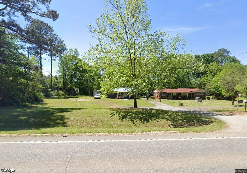
1008 Highway 36 E Barnesville, GA 30204
Barnesville AreaEstimated Value: $47,000 - $312,000
About This Home
This home is located at 1008 Highway 36 E, Barnesville, GA 30204 and is currently estimated at $129,062, approximately $132 per square foot. 1008 Highway 36 E is a home located in Lamar County with nearby schools including Lamar County Primary School, Lamar County Elementary School, and Lamar County Middle School.
Ownership History
We collect this data history from publicly available records. To have your information removed, we recommend requesting removal directly through your county’s website.
Purchase Details
Purchase Details
Purchase Details
Purchase History
We collect this data history from publicly available records. To have your information removed, we recommend requesting removal directly through your county’s website.
| Date | Buyer | Sale Price | Title Company |
|---|---|---|---|
| -- | -- | ||
| -- | -- | ||
| -- | -- |
Mortgage History
We collect this data history from publicly available records. To have your information removed, we recommend requesting removal directly through your county’s website.
| Date | Status | Borrower | Loan Amount |
|---|---|---|---|
| Previous Owner | $44,030 |
Tax History
We collect this data history from publicly available records. To have your information removed, we recommend requesting removal directly through your county’s website.
| Year | Tax Paid | Tax Assessment Tax Assessment Total Assessment is a certain percentage of the fair market value that is determined by local assessors to be the total taxable value of land and additions on the property. | Land | Improvement |
|---|---|---|---|---|
| 2025 | $808 | $33,324 | $3,410 | $29,914 |
| 2024 | $688 | $26,871 | $3,410 | $23,461 |
| 2023 | $730 | $26,460 | $3,410 | $23,050 |
| 2022 | $665 | $24,082 | $2,175 | $21,907 |
| 2021 | $554 | $18,415 | $1,615 | $16,800 |
| 2020 | $423 | $13,365 | $1,615 | $11,750 |
| 2019 | $424 | $13,365 | $1,615 | $11,750 |
| 2018 | $407 | $13,365 | $1,615 | $11,750 |
| 2017 | $405 | $13,365 | $1,615 | $11,750 |
| 2016 | $405 | $13,365 | $1,615 | $11,750 |
| 2015 | $405 | $13,365 | $1,615 | $11,750 |
| 2014 | $406 | $13,836 | $1,615 | $12,221 |
| 2013 | -- | $13,835 | $1,614 | $12,220 |
Map
- 154 Cole Forest Blvd
- 147 Evergreen S
- 119 Mylee Cove
- 218 City Pond Rd
- 206 Cole Forest Blvd
- 117 Masons Ridge
- 225 Cole Forest Blvd
- 168 Oak Haven Ln
- 478 Liberty Hill Rd
- 136 Craftsman Way
- V L Silver Dollar Rd
- 618 Liberty Hill Rd
- 366 Liberty Hill Rd Unit LOT 17
- 0 City Pond Rd Unit 10752966
- 787 Silver Dollar Rd
- 115 Brook Rd
- 654 Liberty Hill Rd
- 120 Mill Pond Ct
- 118 Meadowbrooke Dr
- 654, LOT 66, 67 Liberty Hill Rd
- 1012 Highway 36 E
- 1007 Highway 36 E
- 1015 Highway 36 E
- 315 Brinkley Rd
- 114 City Pond Rd
- 1029 Highway 36 E
- 1030 Highway 36 E
- 122 City Pond Rd
- 0 Highway 36 E Unit 8041538
- 0 Highway 36 E Unit 20029393
- 0 Highway 36 E Unit 7468258
- 0 Highway 36 E Unit 10391773
- 0 Highway 36 E Unit 7363956
- 0 Highway 36 E Unit 10276683
- 0 Highway 36 E Unit 10261785
- 0 Highway 36 E Unit 20014184
- 0 Highway 36 E Unit 9037728
- 0 Highway 36 E Unit 8993152
- 0 Highway 36 E Unit 8979820
- 0 Highway 36 E Unit 8946943
Ask me questions while you tour the home.