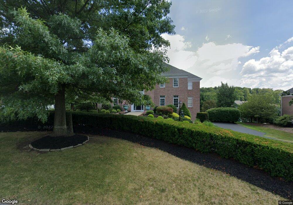
1009 Sheriff's Ct McMurray, PA 15317
Estimated Value: $895,000 - $1,182,000
4
Beds
5
Baths
4,790
Sq Ft
$221/Sq Ft
Est. Value
About This Home
This home is located at 1009 Sheriff's Ct, McMurray, PA 15317 and is currently estimated at $1,058,881, approximately $221 per square foot. 1009 Sheriff's Ct is a home located in Washington County with nearby schools including Pleasant Valley Elementary School and Kinder Care Learning Center.
Ownership History
Date
Name
Owned For
Owner Type
Purchase Details
Closed on
Sep 29, 2009
Sold by
White Patrick R
Bought by
Trombetta Robert J
Current Estimated Value
Home Financials for this Owner
Home Financials are based on the most recent Mortgage that was taken out on this home.
Original Mortgage
$325,000
Outstanding Balance
$212,653
Interest Rate
5.12%
Mortgage Type
New Conventional
Estimated Equity
$846,228
Purchase Details
Closed on
May 20, 2002
Sold by
Eddy Land Co
Bought by
White Patrick
Home Financials for this Owner
Home Financials are based on the most recent Mortgage that was taken out on this home.
Original Mortgage
$472,000
Interest Rate
7.01%
Mortgage Type
New Conventional
Create a Home Valuation Report for This Property
The Home Valuation Report is an in-depth analysis detailing your home's value as well as a comparison with similar homes in the area
Home Values in the Area
Average Home Value in this Area
Purchase History
| Date | Buyer | Sale Price | Title Company |
|---|---|---|---|
| Trombetta Robert J | $580,000 | -- | |
| White Patrick | $590,000 | -- |
Source: Public Records
Mortgage History
| Date | Status | Borrower | Loan Amount |
|---|---|---|---|
| Open | Trombetta Robert J | $325,000 | |
| Previous Owner | White Patrick | $472,000 |
Source: Public Records
Tax History
| Year | Tax Paid | Tax Assessment Tax Assessment Total Assessment is a certain percentage of the fair market value that is determined by local assessors to be the total taxable value of land and additions on the property. | Land | Improvement |
|---|---|---|---|---|
| 2025 | $13,848 | $678,500 | $152,100 | $526,400 |
| 2024 | $13,027 | $678,500 | $152,100 | $526,400 |
| 2023 | $13,027 | $678,500 | $152,100 | $526,400 |
| 2022 | $12,695 | $678,500 | $152,100 | $526,400 |
| 2021 | $12,357 | $678,500 | $152,100 | $526,400 |
| 2020 | $12,119 | $678,500 | $152,100 | $526,400 |
| 2019 | $11,909 | $678,500 | $152,100 | $526,400 |
| 2018 | $11,699 | $678,500 | $152,100 | $526,400 |
| 2017 | $2,126 | $678,500 | $152,100 | $526,400 |
| 2016 | $2,126 | $85,381 | $13,750 | $71,631 |
| 2015 | -- | $85,381 | $13,750 | $71,631 |
| 2014 | $2,657 | $85,381 | $13,750 | $71,631 |
| 2013 | $2,657 | $85,381 | $13,750 | $71,631 |
Source: Public Records
Map
Nearby Homes
- 709 Crosswinds Dr
- 804 Sheriffs Ct
- 413 Crossbow Ct
- 803 Sheriffs Ct
- 208 Waterside Dr
- 243 King Richard Dr
- 171 Fawn Valley Dr
- 128 Fawn Valley Dr
- Lot 1 Canterbury Ln
- 150 Roscommon Place
- 210 Marion Dr
- 196 Marion Dr
- 120 Canterbury Ln
- 199 Roscommon Place
- 207 Spruce Ln
- 401 Spruce Ln
- 409 Spruce Ln
- 233 Roscommon Place
- 133 Heather Dr
- 606 Spruce Ln
- 1009 Sheriffs Ct
- 1011 Sheriffs Ct
- 1011 Sheriffs Ct
- 1007 Sheriffs Ct
- 1013 Sheriffs Ct
- 1013 Sheriffs Ct
- 1013 Sheriffs Ct
- 1013 Sheriffs Ct
- 1013 Sheriffs Ct
- 327 Maid Marion Ln
- 237 Maid Marion Ln
- 1005 Sheriffs Ct
- 1010 Sheriffs Ct
- 1010 Sheriffs Ct
- 1010 Sheriffs Ct
- 1012 Sheriffs Ct
- 328 Maid Marion Ln
- 329 Marion Dr
- 1016 Sheriffs Ct
- 1015 Sheriff's Ct
Your Personal Tour Guide
Ask me questions while you tour the home.