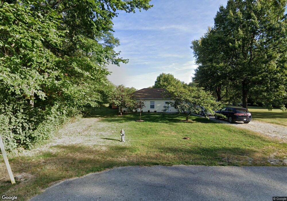
101 Dawson St Fulton, MO 65251
Estimated Value: $218,000 - $233,000
3
Beds
2
Baths
1,465
Sq Ft
$152/Sq Ft
Est. Value
About This Home
This home is located at 101 Dawson St, Fulton, MO 65251 and is currently estimated at $223,268, approximately $152 per square foot. 101 Dawson St is a home located in Callaway County with nearby schools including Fulton Senior High School, St. Peter Catholic School, and Kingdom Christian Academy.
Ownership History
Date
Name
Owned For
Owner Type
Purchase Details
Closed on
Dec 17, 2025
Sold by
Shawley David James
Bought by
Shawley Joy
Current Estimated Value
Home Financials for this Owner
Home Financials are based on the most recent Mortgage that was taken out on this home.
Original Mortgage
$85,398
Outstanding Balance
$85,235
Interest Rate
6.22%
Mortgage Type
New Conventional
Estimated Equity
$138,033
Purchase Details
Closed on
Sep 29, 2021
Sold by
Kennan Ronald M and Kennan Laura N
Bought by
Shawley David and Shawley Joy
Home Financials for this Owner
Home Financials are based on the most recent Mortgage that was taken out on this home.
Original Mortgage
$8,000
Interest Rate
2.5%
Mortgage Type
Purchase Money Mortgage
Purchase Details
Closed on
Sep 1, 2006
Sold by
Carpenter Lisa and 101 Dawson Street Land Trust
Bought by
Kennon Ronald M and Kennon Laura Nell
Home Financials for this Owner
Home Financials are based on the most recent Mortgage that was taken out on this home.
Original Mortgage
$77,960
Interest Rate
6.79%
Mortgage Type
Purchase Money Mortgage
Create a Home Valuation Report for This Property
The Home Valuation Report is an in-depth analysis detailing your home's value as well as a comparison with similar homes in the area
Home Values in the Area
Average Home Value in this Area
Purchase History
| Date | Buyer | Sale Price | Title Company |
|---|---|---|---|
| Shawley Joy | -- | None Listed On Document | |
| Shawley David | -- | None Available | |
| Shawley David | -- | None Available | |
| Kennon Ronald M | -- | None Available |
Source: Public Records
Mortgage History
| Date | Status | Borrower | Loan Amount |
|---|---|---|---|
| Open | Shawley Joy | $85,398 | |
| Previous Owner | Shawley David | $8,000 | |
| Previous Owner | Kennon Ronald M | $77,960 |
Source: Public Records
Tax History
| Year | Tax Paid | Tax Assessment Tax Assessment Total Assessment is a certain percentage of the fair market value that is determined by local assessors to be the total taxable value of land and additions on the property. | Land | Improvement |
|---|---|---|---|---|
| 2025 | $1,500 | $24,250 | $0 | $0 |
| 2024 | $1,500 | $24,250 | $0 | $0 |
| 2023 | $1,500 | $21,658 | $0 | $0 |
| 2022 | $1,333 | $21,658 | $2,223 | $19,435 |
| 2021 | $1,332 | $21,658 | $2,223 | $19,435 |
| 2020 | $1,350 | $21,658 | $2,223 | $19,435 |
| 2019 | $1,306 | $21,658 | $2,223 | $19,435 |
| 2018 | $1,351 | $21,658 | $2,223 | $19,435 |
| 2017 | $1,201 | $21,658 | $2,223 | $19,435 |
| 2016 | $1,017 | $17,570 | $0 | $0 |
| 2015 | $994 | $17,570 | $0 | $0 |
| 2014 | -- | $18,400 | $0 | $0 |
Source: Public Records
Map
Nearby Homes
- 103 Glover St
- 0 Sabre Cir
- TBD Sabre Cir
- 3212 Nicklaus Ct
- 3411 Richland Heights Rd
- 3302 Richland Heights Rd
- LOT 15,24+ Fairway Dr
- LOT 27 Fairway Dr
- LOT 19 Fairway Dr
- LOT 18 Fairway Dr
- LOT 14 Fairway Dr
- LOT 28 Fairway Dr
- LOT 22 Fairway Dr
- LOT 20 Fairway Dr
- LOT 13 Fairway Dr
- LOT 12 Fairway Dr
- Lots 16-17 Fairway Dr
- 3500 Tanglewood Way
- 1202 Bluff St
- 1012 N Bluff St
Your Personal Tour Guide
Ask me questions while you tour the home.