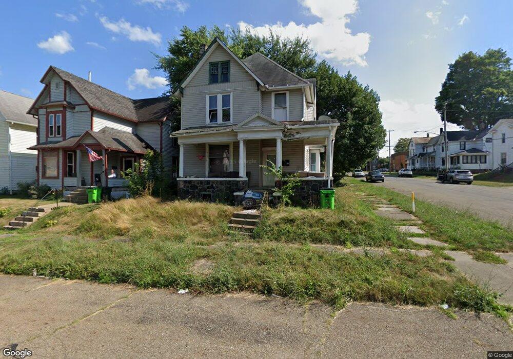
101 E Columbia St Alliance, OH 44601
Estimated Value: $72,000 - $91,000
4
Beds
2
Baths
2,354
Sq Ft
$33/Sq Ft
Est. Value
About This Home
This home is located at 101 E Columbia St, Alliance, OH 44601 and is currently estimated at $77,146, approximately $32 per square foot. 101 E Columbia St is a home located in Stark County with nearby schools including Alliance Intermediate School at Northside, Alliance Elementary School at Rockhill, and Alliance Middle School.
Ownership History
Date
Name
Owned For
Owner Type
Purchase Details
Closed on
Mar 27, 2019
Sold by
Acorn Rentals Iii Ltd
Bought by
Nichols Jason David and Nichols Debra Sue
Current Estimated Value
Purchase Details
Closed on
Dec 30, 2005
Sold by
Warfel David T
Bought by
Acorn Rentals Iii Ltd
Purchase Details
Closed on
Sep 25, 2001
Sold by
Wells Fargo Bank Of Minnesota Na
Bought by
Superior Property Investments Ltd
Purchase Details
Closed on
Aug 2, 2001
Sold by
Weatherspoon Larry P and Weatherspoon Cynthia Marie
Bought by
Wells Fargo Bank Of Minnesota Na and Norwest Bank Minnesota Na
Purchase Details
Closed on
Sep 2, 1998
Sold by
Weatherspoon Larry P and Weatherspoon Cynthia M
Bought by
Cross Michael W and Brunk Renee E
Home Financials for this Owner
Home Financials are based on the most recent Mortgage that was taken out on this home.
Original Mortgage
$35,000
Interest Rate
9.5%
Mortgage Type
Seller Take Back
Create a Home Valuation Report for This Property
The Home Valuation Report is an in-depth analysis detailing your home's value as well as a comparison with similar homes in the area
Home Values in the Area
Average Home Value in this Area
Purchase History
We collect this data history from publicly available records. To have your information removed, we recommend requesting removal directly through your county’s website.
| Date | Buyer | Sale Price | Title Company |
|---|---|---|---|
| Nichols Jason David | $20,000 | None Available | |
| Acorn Rentals Iii Ltd | $21,000 | -- | |
| Superior Property Investments Ltd | $11,000 | -- | |
| Wells Fargo Bank Of Minnesota Na | $24,000 | -- | |
| Cross Michael W | $35,000 | -- |
Source: Public Records
Mortgage History
We collect this data history from publicly available records. To have your information removed, we recommend requesting removal directly through your county’s website.
| Date | Status | Borrower | Loan Amount |
|---|---|---|---|
| Previous Owner | Cross Michael W | $35,000 |
Source: Public Records
Tax History
| Year | Tax Paid | Tax Assessment Tax Assessment Total Assessment is a certain percentage of the fair market value that is determined by local assessors to be the total taxable value of land and additions on the property. | Land | Improvement |
|---|---|---|---|---|
| 2025 | $2,549 | $16,070 | $3,190 | $12,880 |
| 2024 | $1,777 | $16,070 | $3,190 | $12,880 |
| 2023 | $1,731 | $11,520 | $1,750 | $9,770 |
| 2022 | $471 | $11,520 | $1,750 | $9,770 |
| 2021 | $472 | $11,520 | $1,750 | $9,770 |
| 2020 | $594 | $10,750 | $1,510 | $9,240 |
| 2019 | $472 | $13,060 | $1,510 | $11,550 |
| 2018 | $576 | $13,060 | $1,510 | $11,550 |
| 2017 | $522 | $11,620 | $1,260 | $10,360 |
| 2016 | $526 | $11,620 | $1,260 | $10,360 |
| 2015 | $530 | $11,620 | $1,260 | $10,360 |
| 2014 | $366 | $7,630 | $1,120 | $6,510 |
| 2013 | $183 | $7,630 | $1,120 | $6,510 |
Source: Public Records
Map
Nearby Homes
- 421 S Park Ave
- 427 S Union Ave
- 223 E Oxford St
- 244 N Park Ave
- 171 1/2 W Main St
- V/L S Freedom Ave
- 134 W Cambridge St
- 105 W Ely St
- 452 E Summit St
- 33 S Lincoln Ave
- 807 S Union Ave
- 442 S Liberty Ave
- 319 W Oxford St
- 260 W Washington St
- 456 W Broadway St
- 430 W Oxford St
- 479 W High St
- 847 E Patterson St
- 645 W Summit St
- 900 S Seneca Ave
- 111 E Columbia St
- 111 E Columbia St
- 222 S Park Ave
- 121 E Columbia St
- 67 E Columbia St
- 131 E Columbia St
- 219 S Park Ave
- 146 S Park Ave
- 61 E Columbia St
- 116 E Columbia St
- 227 S Park Ave
- 114 E Broadway St
- 126 E Columbia St
- 141 E Columbia St
- 130 E Broadway St
- 134 E Columbia St
- 72 E Broadway St
- 62 E Columbia St
- 62 E Broadway St
- 142 E Columbia St
Your Personal Tour Guide
Ask me questions while you tour the home.