101 Lindy Ct Hampstead, NC 28443
Estimated Value: $572,905 - $692,000
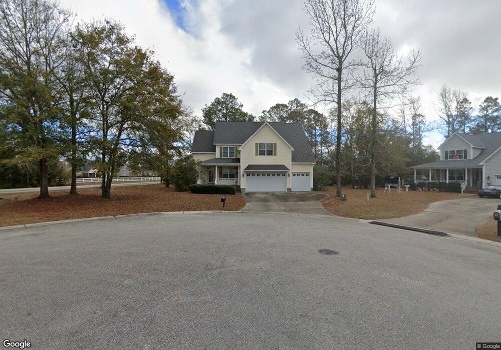
About This Home
This home is located at 101 Lindy Ct, Hampstead, NC 28443 and is currently estimated at $610,976, approximately $185 per square foot. 101 Lindy Ct is a home located in Pender County with nearby schools including North Topsail Elementary School, Topsail Middle School, and Topsail High School.
Ownership History
We collect this data history from publicly available records. To have your information removed, we recommend requesting removal directly through your county’s website.
Purchase Details
Purchase Details
Home Financials for this Owner
Home Financials are based on the most recent Mortgage that was taken out on this home.Purchase Details
Home Values in the Area
Average Home Value in this Area
Purchase History
We collect this data history from publicly available records. To have your information removed, we recommend requesting removal directly through your county’s website.
| Date | Buyer | Sale Price | Title Company |
|---|---|---|---|
| -- | -- | ||
| $69,000 | -- | ||
| $50,000 | -- |
Mortgage History
We collect this data history from publicly available records. To have your information removed, we recommend requesting removal directly through your county’s website.
| Date | Status | Borrower | Loan Amount |
|---|---|---|---|
| Open | $294,000 |
Tax History
We collect this data history from publicly available records. To have your information removed, we recommend requesting removal directly through your county’s website.
| Year | Tax Paid | Tax Assessment Tax Assessment Total Assessment is a certain percentage of the fair market value that is determined by local assessors to be the total taxable value of land and additions on the property. | Land | Improvement |
|---|---|---|---|---|
| 2025 | $3,510 | $564,638 | $57,698 | $506,940 |
| 2024 | $3,510 | $357,881 | $61,539 | $296,342 |
| 2023 | $3,199 | $357,881 | $61,539 | $296,342 |
| 2022 | $3,199 | $357,881 | $61,539 | $296,342 |
| 2021 | $3,199 | $357,881 | $61,539 | $296,342 |
| 2020 | $3,199 | $357,881 | $61,539 | $296,342 |
| 2019 | $3,199 | $357,881 | $61,539 | $296,342 |
| 2018 | $3,056 | $325,058 | $63,000 | $262,058 |
| 2017 | $3,056 | $325,058 | $63,000 | $262,058 |
| 2016 | $3,024 | $325,058 | $63,000 | $262,058 |
| 2015 | $2,989 | $325,058 | $63,000 | $262,058 |
| 2014 | $2,349 | $325,058 | $63,000 | $262,058 |
| 2013 | -- | $325,058 | $63,000 | $262,058 |
| 2012 | -- | $325,058 | $63,000 | $262,058 |
Map
- 981 Sloop Point Loop Rd
- 0000 Sloop Point Loop Rd
- 90 W Bailey Ln
- 73 J E Batson Rd
- 11 E Bailey Ln
- 93 J E Batson Rd
- 205 Doral Dr
- Lot 2 Doral Dr
- 134 Wild Berry Ln
- 122 Yacht Basin Landing
- 585 W Craftsman Way
- 166 N Passerine Path
- 46 E Cloverfield Ln
- 63 Evergreen Ln
- 704 W Craftsman Way
- 105 N Lamplighters Walk
- 410 Compass Point
- 143 Red Bird Ln
- 406 Compass Point
- 88 S Lamplighters Walk
Ask me questions while you tour the home.