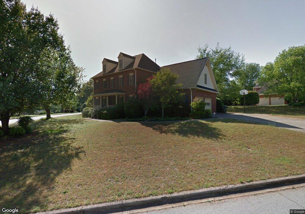
101 River Point Ct Simpsonville, SC 29681
Estimated Value: $617,000 - $747,000
About This Home
This home is located at 101 River Point Ct, Simpsonville, SC 29681 and is currently estimated at $695,628, approximately $234 per square foot. 101 River Point Ct is a home located in Greenville County with nearby schools including Monarch Elementary, Mauldin Middle School, and Mauldin High School.
Ownership History
We collect this data history from publicly available records. To have your information removed, we recommend requesting removal directly through your county’s website.
Purchase Details
Purchase Details
Purchase Details
Purchase Details
Home Values in the Area
Average Home Value in this Area
Purchase History
We collect this data history from publicly available records. To have your information removed, we recommend requesting removal directly through your county’s website.
| Date | Buyer | Sale Price | Title Company |
|---|---|---|---|
| -- | None Available | ||
| -- | None Available | ||
| -- | -- | ||
| -- | -- |
Tax History
We collect this data history from publicly available records. To have your information removed, we recommend requesting removal directly through your county’s website.
| Year | Tax Paid | Tax Assessment Tax Assessment Total Assessment is a certain percentage of the fair market value that is determined by local assessors to be the total taxable value of land and additions on the property. | Land | Improvement |
|---|---|---|---|---|
| 2025 | $2,237 | $17,760 | $3,670 | $14,090 |
| 2024 | $2,237 | $15,440 | $2,800 | $12,640 |
| 2023 | $2,112 | $15,440 | $2,800 | $12,640 |
| 2022 | $2,058 | $15,440 | $2,800 | $12,640 |
| 2021 | $2,059 | $15,440 | $2,800 | $12,640 |
| 2020 | $2,043 | $14,730 | $2,300 | $12,430 |
| 2019 | $2,044 | $14,730 | $2,300 | $12,430 |
| 2018 | $2,104 | $14,730 | $2,300 | $12,430 |
| 2017 | $2,106 | $14,730 | $2,300 | $12,430 |
| 2016 | $2,035 | $368,210 | $57,500 | $310,710 |
| 2015 | $2,039 | $368,210 | $57,500 | $310,710 |
| 2014 | $1,659 | $320,190 | $50,000 | $270,190 |
Map
- 501 River Walk Dr
- 1202 Plantation Dr
- 1300 Plantation Dr
- 906 Plantation Dr
- 105 Gleneagles Ct
- 120 Laurel Oak Trail
- 221 River Walk Dr
- 620 Heathercrest Ct
- 7 Gilderview Dr
- 208 Yellow Poplar Ct
- 207 Poplar Ridge Rd
- 204 Parkside Dr
- 51 Staffordshire Way
- 401 Belcross Dr
- 117 Summerwalk Place
- 218 Lovelace Ct
- 205 Ansley Dr
- 226 Lovelace Ct
- 113 Waters Run Ln
- 205 Moncton Place
- 601 River Walk Dr
- 103 River Point Ct
- 100 River Point Ct
- 604 River Walk Dr
- 700 River Walk Dr
- 102 River Point Ct
- 509 River Walk Dr
- 201 Greenside Ct
- 104 River Point Ct
- 105 River Point Ct
- 703 River Walk Dr
- 702 River Walk Dr
- 106 River Point Ct
- 507 River Walk Dr
- 206 River Walk Ct
- 108 River Point Ct
- 203 Greenside Ct
- 801 River Walk Dr
- 107 River Point Ct
- 102 River Walk Terrace
Ask me questions while you tour the home.