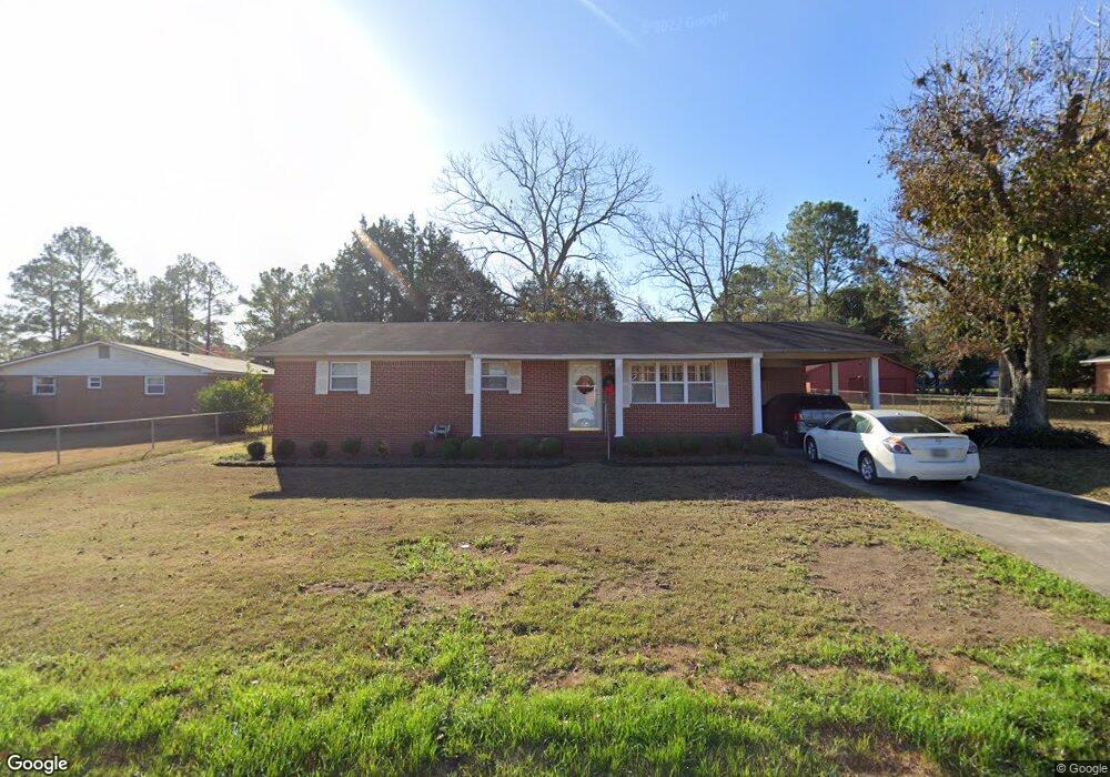
1010 22nd St E Tifton, GA 31794
Estimated Value: $170,000 - $197,000
3
Beds
2
Baths
1,269
Sq Ft
$143/Sq Ft
Est. Value
About This Home
This home is located at 1010 22nd St E, Tifton, GA 31794 and is currently estimated at $181,879, approximately $143 per square foot. 1010 22nd St E is a home located in Tift County with nearby schools including Northside Primary School, Charles Spencer Elementary School, and J.T. Reddick School.
Ownership History
Date
Name
Owned For
Owner Type
Purchase Details
Closed on
Mar 24, 2025
Sold by
Mclain Bryan Scott
Bought by
Mclain Bryan Scott and Mclain Carmen Perry
Current Estimated Value
Purchase Details
Closed on
Jan 6, 2025
Sold by
Mclain Sara S
Bought by
Mclain Bryan Scott
Purchase Details
Closed on
Feb 7, 2011
Sold by
Mcclain Sara S
Bought by
Mclain Sara S
Purchase Details
Closed on
May 31, 1972
Sold by
Strawder Charles H and Strawder Louice F
Bought by
Mclain William A
Create a Home Valuation Report for This Property
The Home Valuation Report is an in-depth analysis detailing your home's value as well as a comparison with similar homes in the area
Purchase History
| Date | Buyer | Sale Price | Title Company |
|---|---|---|---|
| Mclain Bryan Scott | -- | -- | |
| Mclain Bryan Scott | -- | -- | |
| Mclain Sara S | -- | -- | |
| Mclain William A | $16,600 | -- |
Source: Public Records
Tax History
| Year | Tax Paid | Tax Assessment Tax Assessment Total Assessment is a certain percentage of the fair market value that is determined by local assessors to be the total taxable value of land and additions on the property. | Land | Improvement |
|---|---|---|---|---|
| 2025 | $1,314 | $62,678 | $8,160 | $54,518 |
| 2024 | $1,314 | $62,678 | $8,160 | $54,518 |
| 2023 | $1,405 | $32,101 | $4,000 | $28,101 |
| 2022 | $698 | $32,101 | $4,000 | $28,101 |
| 2021 | $702 | $32,101 | $4,000 | $28,101 |
| 2020 | $716 | $32,101 | $4,000 | $28,101 |
| 2019 | $716 | $32,101 | $4,000 | $28,101 |
| 2018 | $717 | $32,101 | $4,000 | $28,101 |
| 2017 | $739 | $32,101 | $4,000 | $28,101 |
| 2016 | $739 | $32,101 | $4,000 | $28,101 |
| 2015 | $739 | $32,101 | $4,000 | $28,101 |
| 2014 | $739 | $32,101 | $4,000 | $28,101 |
| 2013 | -- | $32,101 | $4,000 | $28,101 |
Source: Public Records
Map
Nearby Homes
- 2014 Tyson Ave
- 2008 Lee Ave
- 2209 Meadowbrook Dr
- 2021 Davis Ave
- 2014 Davis Ave
- 2417 Belmont Ave
- 1809 Davis Ave
- 2612 Goff St
- 502 20th St E
- -0- Old Ocilla Rd
- 2811 Lullwater Rd
- 153 Ridgeland Ct
- 2214 Love Ave
- 0 Tift Ave
- 1611 Love Ave
- 1444 Madison Ave
- 319 Irwin St
- 1137 Oquinn Dr
- 109 Cypress Ridge Rd
- 225 Cypress Ridge Rd
- 1008 22nd St E
- 2020 Meadowbrook Dr
- 2018 Meadowbrook Dr
- 1009 22nd St E
- 2019 Tyson Ave
- 2013 Tyson Ave
- 2016 Meadowbrook Dr
- 2201 Tyson Ave
- 1101 22nd St E
- 2206 Lee Ave
- 2010 Lee Ave
- 1201 22nd St E
- 2009 Tyson Ave
- 2205 Tyson Ave
- 2205 Lee Ave
- 2010 Meadowbrook Dr
- 2201 Meadowbrook Dr
- 910 22nd St E
- 2018 Tyson Ave
- 2210 Lee Ave
Your Personal Tour Guide
Ask me questions while you tour the home.