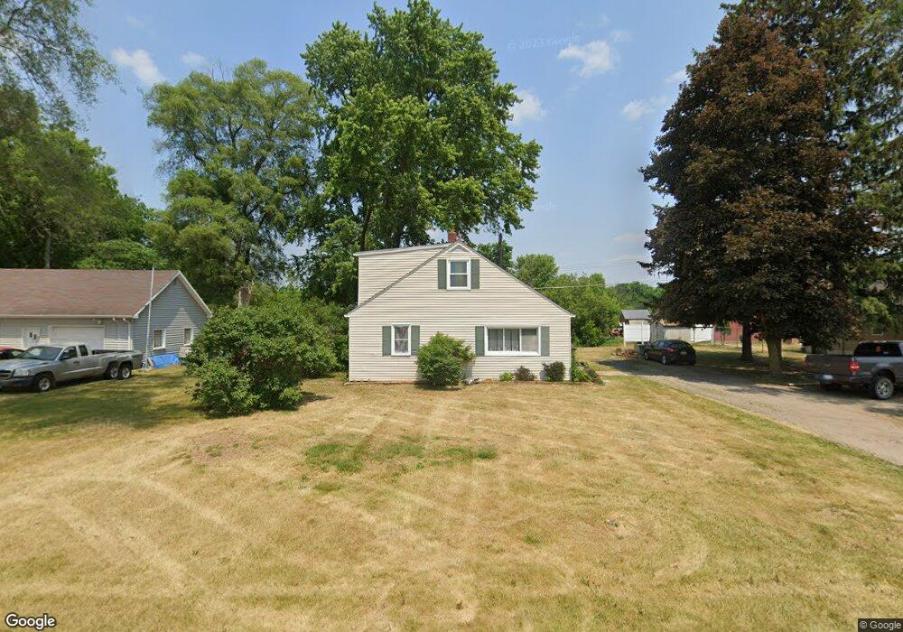
1010 Angle Rd Lapeer, MI 48446
Estimated Value: $183,474 - $264,000
2
Beds
1
Bath
1,890
Sq Ft
$121/Sq Ft
Est. Value
About This Home
This home is located at 1010 Angle Rd, Lapeer, MI 48446 and is currently estimated at $227,869, approximately $120 per square foot. 1010 Angle Rd is a home located in Lapeer County with nearby schools including Rolland-Warner Middle School, Lapeer High School, and Chatfield School.
Ownership History
Date
Name
Owned For
Owner Type
Purchase Details
Closed on
Aug 28, 2015
Sold by
Linn Pamela L
Bought by
Mckeon Celeste
Current Estimated Value
Home Financials for this Owner
Home Financials are based on the most recent Mortgage that was taken out on this home.
Original Mortgage
$68,000
Outstanding Balance
$53,445
Interest Rate
4.09%
Mortgage Type
New Conventional
Estimated Equity
$174,424
Purchase Details
Closed on
Aug 18, 2000
Sold by
Linn Pamela L
Bought by
Mckeon Celeste
Purchase Details
Closed on
Feb 18, 1994
Sold by
Linn Pamela L
Create a Home Valuation Report for This Property
The Home Valuation Report is an in-depth analysis detailing your home's value as well as a comparison with similar homes in the area
Home Values in the Area
Average Home Value in this Area
Purchase History
| Date | Buyer | Sale Price | Title Company |
|---|---|---|---|
| Mckeon Celeste | $96,500 | -- | |
| Mckeon Celeste | $96,500 | -- | |
| -- | $37,000 | -- | |
| -- | $37,000 | -- |
Source: Public Records
Mortgage History
| Date | Status | Borrower | Loan Amount |
|---|---|---|---|
| Open | Mckeon Celeste | $68,000 |
Source: Public Records
Tax History
| Year | Tax Paid | Tax Assessment Tax Assessment Total Assessment is a certain percentage of the fair market value that is determined by local assessors to be the total taxable value of land and additions on the property. | Land | Improvement |
|---|---|---|---|---|
| 2025 | $870 | $76,300 | $0 | $0 |
| 2024 | $401 | $75,700 | $0 | $0 |
| 2023 | $383 | $64,700 | $0 | $0 |
| 2022 | $786 | $58,100 | $0 | $0 |
| 2021 | $716 | $54,200 | $0 | $0 |
| 2020 | $709 | $49,900 | $0 | $0 |
| 2019 | $725 | $48,800 | $0 | $0 |
| 2018 | $708 | $47,300 | $47,300 | $0 |
| 2017 | $695 | $47,200 | $0 | $0 |
| 2016 | $329 | $44,800 | $44,800 | $0 |
| 2015 | -- | $40,700 | $0 | $0 |
| 2014 | -- | $36,100 | $36,100 | $0 |
| 2013 | -- | $32,200 | $32,200 | $0 |
Source: Public Records
Map
Nearby Homes
- 2198 Russell Ln
- 2681 Flint River Rd
- 2700 Flint River Rd
- 1452 Debi Ann Dr
- 1821 N Lapeer Rd
- 2222 Landmark Dr
- 2191 Stonesthrow Dr
- 1466 Luxington Dr
- 1468 Lincoln St
- 1470 Lincoln St
- 1437 Luxington Dr
- 1435 Luxington Dr
- 1747 Westbrooke Dr
- 1408 Lincoln St
- 3297 Reamer Rd
- 2854 Treymore St
- 1389 Luxington Dr
- 1441 Candace Dr
- 2824 Somerset St
- 2792 Somerset St
- 1020 Angle Rd
- 1000 Angle Rd
- 1038 Angle Rd
- 986 Angle Rd
- 1058 Angle Rd
- 1064 Angle Rd
- 1051 Angle Rd
- 1090 Angle Rd
- 1067 Angle Rd
- 1100 Angle Rd
- 920 Angle Rd
- 1115 Angle Rd
- 1121 Angle Rd
- 881 Angle Rd
- 0 Bronson Lake Rd Unit 217038065
- 0 Bronson Lake Rd
- 0 Bronson Lake Rd Unit R217107314
- 0 Bronson Lake Rd Unit G21417876
- 0 Bronson Lake Rd Unit R218095191
- 0 Bronson Lake Rd Unit R2200025055
Your Personal Tour Guide
Ask me questions while you tour the home.